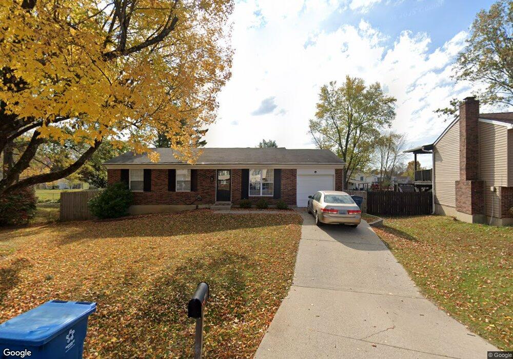
9806 Dea Dea Ct Louisville, KY 40291
Estimated Value: $239,000 - $276,000
3
Beds
1
Bath
2,100
Sq Ft
$122/Sq Ft
Est. Value
About This Home
This home is located at 9806 Dea Dea Ct, Louisville, KY 40291 and is currently estimated at $255,787, approximately $121 per square foot. 9806 Dea Dea Ct is a home located in Jefferson County with nearby schools including Wilt Elementary School, Wheeler Elementary School, and Fern Creek Elementary School.
Ownership History
Date
Name
Owned For
Owner Type
Purchase Details
Closed on
Apr 13, 2018
Sold by
Harnett Daniel James and Harnett Shaunna Elisa
Bought by
Johnson Jessica Lynn
Current Estimated Value
Home Financials for this Owner
Home Financials are based on the most recent Mortgage that was taken out on this home.
Original Mortgage
$174,600
Outstanding Balance
$150,223
Interest Rate
4.46%
Mortgage Type
New Conventional
Estimated Equity
$105,564
Purchase Details
Closed on
Sep 26, 2002
Sold by
Roden Michael T and Roden Billie J
Bought by
Mcintyre Steven
Create a Home Valuation Report for This Property
The Home Valuation Report is an in-depth analysis detailing your home's value as well as a comparison with similar homes in the area
Home Values in the Area
Average Home Value in this Area
Purchase History
| Date | Buyer | Sale Price | Title Company |
|---|---|---|---|
| Johnson Jessica Lynn | $180,000 | Premium Title Group Llc | |
| Mcintyre Steven | $97,068 | -- |
Source: Public Records
Mortgage History
| Date | Status | Borrower | Loan Amount |
|---|---|---|---|
| Open | Johnson Jessica Lynn | $174,600 |
Source: Public Records
Tax History Compared to Growth
Tax History
| Year | Tax Paid | Tax Assessment Tax Assessment Total Assessment is a certain percentage of the fair market value that is determined by local assessors to be the total taxable value of land and additions on the property. | Land | Improvement |
|---|---|---|---|---|
| 2024 | $2,187 | $191,030 | $45,000 | $146,030 |
| 2023 | $1,893 | $160,730 | $33,000 | $127,730 |
| 2022 | $1,900 | $160,730 | $33,000 | $127,730 |
| 2021 | $2,043 | $160,730 | $33,000 | $127,730 |
| 2020 | $2,119 | $180,000 | $26,000 | $154,000 |
| 2019 | $1,951 | $180,000 | $26,000 | $154,000 |
| 2018 | $1,463 | $136,690 | $26,000 | $110,690 |
| 2017 | $1,435 | $136,690 | $26,000 | $110,690 |
| 2013 | $1,185 | $118,500 | $25,000 | $93,500 |
Source: Public Records
Map
Nearby Homes
- 9720 Mary Dell Ln
- 9923 Chenoweth Vista Way Unit 9923
- 5502 Sprigwood Ln
- 10004 Chenoweth Vista Way Unit 10004
- 5610 Cynthia Dr
- 9911 Sprig Way
- 5210 Cynthia Dr
- 5206 Old Billtown Rd
- 9417 Plumwood Rd
- 9409 Doewood Ln
- 5501 Billtown Rd
- 5506 Tealeaf Ct
- 5206 Firwood Ln
- 5109 Billtown Rd
- 10011 Fern Creek Rd
- 10206 Easum Rd
- 9706 Fairground Rd
- 9615 Keeling Ridge Rd
- 10436 Monticello Forest Cir
- 11201 Arbor Wood Dr
- 9806 Dea Dea Ct
- 9804 Dea Dea Ct
- 9808 Dea Dea Ct
- 5602 Kasey Way
- 5600 Kasey Way
- 9802 Dea Dea Ct
- 9809 Dea Dea Ct
- 9807 Dea Dea Ct
- 5604 Kasey Way
- 9700 Rocky Trail
- 9803 Dea Dea Ct
- 5603 Dea Dea Dr
- 9800 Dea Dea Ct
- 9803 Dea Dea Ct
- 5603 Dea Dea Dr
- 5605 Dea Dea Dr
- 9801 Dea Dea Ct
- 9804 Dea Ct
- 9805 Dea Dea Ct
- 9701 Rocky Trail