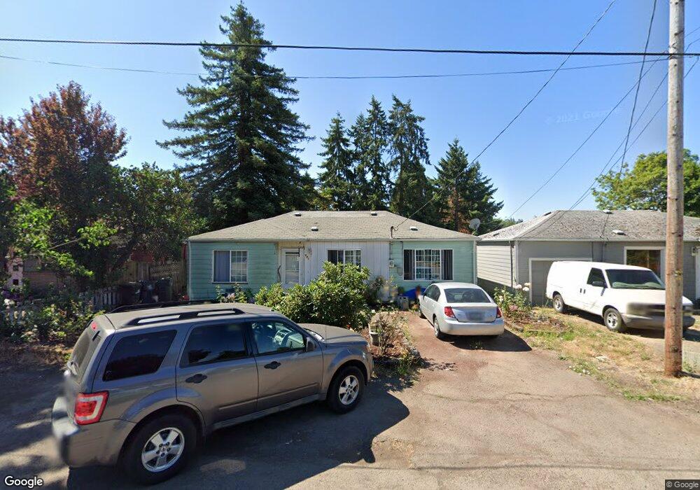
981 W N St Springfield, OR 97477
West Springfield NeighborhoodEstimated Value: $332,451 - $355,000
3
Beds
1
Bath
1,192
Sq Ft
$292/Sq Ft
Est. Value
About This Home
This home is located at 981 W N St, Springfield, OR 97477 and is currently estimated at $347,613, approximately $291 per square foot. 981 W N St is a home located in Lane County with nearby schools including Centennial Elementary School, Hamlin Middle School, and Springfield High School.
Create a Home Valuation Report for This Property
The Home Valuation Report is an in-depth analysis detailing your home's value as well as a comparison with similar homes in the area
Home Values in the Area
Average Home Value in this Area
Tax History Compared to Growth
Tax History
| Year | Tax Paid | Tax Assessment Tax Assessment Total Assessment is a certain percentage of the fair market value that is determined by local assessors to be the total taxable value of land and additions on the property. | Land | Improvement |
|---|---|---|---|---|
| 2025 | $2,333 | $127,252 | -- | -- |
| 2024 | $2,296 | $123,546 | -- | -- |
| 2023 | $2,296 | $119,948 | $0 | $0 |
| 2022 | $2,126 | $116,455 | $0 | $0 |
| 2021 | $2,088 | $113,064 | $0 | $0 |
| 2020 | $2,027 | $109,771 | $0 | $0 |
| 2019 | $1,966 | $106,574 | $0 | $0 |
| 2018 | $1,853 | $100,456 | $0 | $0 |
| 2017 | $1,782 | $100,456 | $0 | $0 |
| 2016 | $1,745 | $97,530 | $0 | $0 |
| 2015 | $1,695 | $94,689 | $0 | $0 |
| 2014 | $1,669 | $91,931 | $0 | $0 |
Source: Public Records
Map
Nearby Homes
- 872 W N St
- 804 W N St
- 1120 W Fairview Dr Unit 3
- 1310 W Quinalt St
- 436 W M St
- 428 W Centennial Blvd
- 930 Prescott Ln
- 955 Oak Meadows Place
- 1770 Brandy Way
- 1632 Dotie Dr
- 952 Summit Blvd
- 1130 Anderson Ln
- 1723 Dotie Dr
- 0 Summit Blvd Unit 6305 24210629
- 484 Scotts Glen Dr
- 835 Anderson Ln
- 835 Willacade Ct
- 364 Scotts Glen Dr
- 633 Rowan Ave
- 1205 Mill St