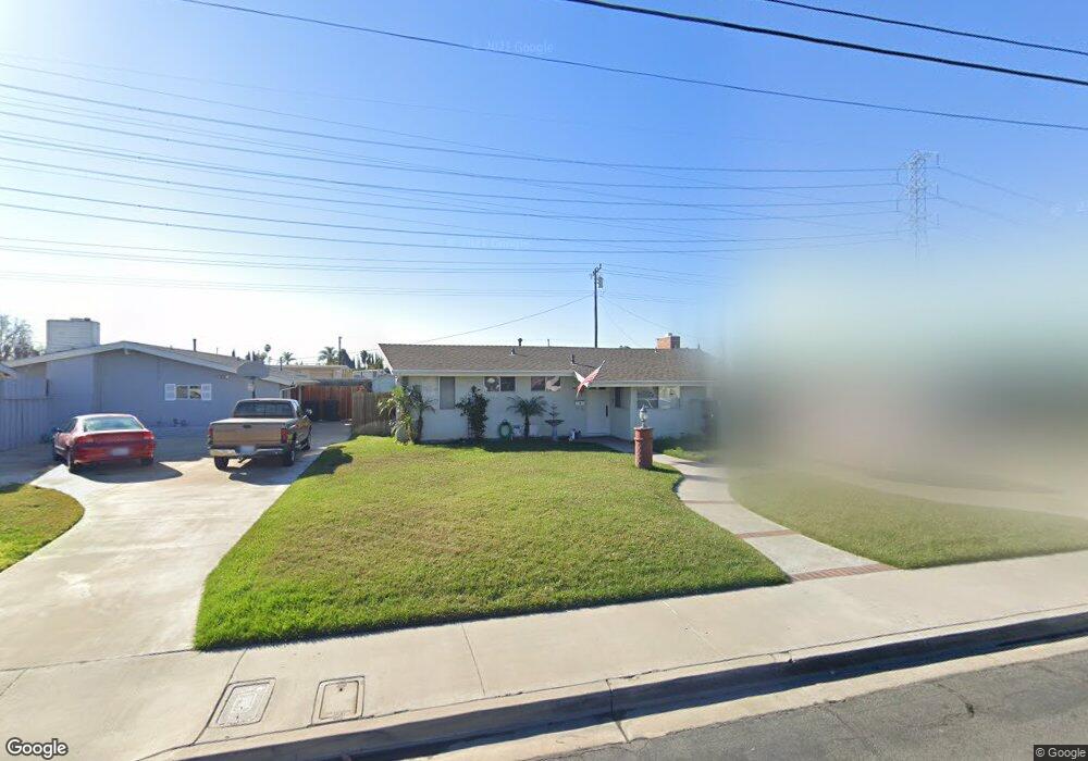
9822 Pacific Ave Anaheim, CA 92804
West Anaheim NeighborhoodEstimated Value: $871,927 - $910,000
2
Beds
2
Baths
1,226
Sq Ft
$723/Sq Ft
Est. Value
About This Home
This home is located at 9822 Pacific Ave, Anaheim, CA 92804 and is currently estimated at $886,982, approximately $723 per square foot. 9822 Pacific Ave is a home located in Orange County with nearby schools including Jonas E. Salk Elementary School, Dale Jr High School, and Magnolia High.
Ownership History
Date
Name
Owned For
Owner Type
Purchase Details
Closed on
Feb 19, 2004
Sold by
Webb Robert A
Bought by
Webb Robert A and Webb Stephanie A
Current Estimated Value
Home Financials for this Owner
Home Financials are based on the most recent Mortgage that was taken out on this home.
Original Mortgage
$169,900
Interest Rate
5.62%
Mortgage Type
New Conventional
Purchase Details
Closed on
Mar 24, 2003
Sold by
Webb Robert A and Nelson Linda
Bought by
Webb Robert A
Purchase Details
Closed on
May 15, 2002
Sold by
Webb Robert A and Nelson Linda
Bought by
Webb Robert A
Home Financials for this Owner
Home Financials are based on the most recent Mortgage that was taken out on this home.
Original Mortgage
$171,000
Interest Rate
5.72%
Create a Home Valuation Report for This Property
The Home Valuation Report is an in-depth analysis detailing your home's value as well as a comparison with similar homes in the area
Home Values in the Area
Average Home Value in this Area
Purchase History
| Date | Buyer | Sale Price | Title Company |
|---|---|---|---|
| Webb Robert A | -- | First American Title Ins Co | |
| Webb Robert A | -- | -- | |
| Webb Robert A | -- | Southland Title |
Source: Public Records
Mortgage History
| Date | Status | Borrower | Loan Amount |
|---|---|---|---|
| Closed | Webb Robert A | $169,900 | |
| Closed | Webb Robert A | $171,000 |
Source: Public Records
Tax History
| Year | Tax Paid | Tax Assessment Tax Assessment Total Assessment is a certain percentage of the fair market value that is determined by local assessors to be the total taxable value of land and additions on the property. | Land | Improvement |
|---|---|---|---|---|
| 2025 | $3,693 | $305,866 | $233,944 | $71,922 |
| 2024 | $3,693 | $299,869 | $229,357 | $70,512 |
| 2023 | $3,623 | $293,990 | $224,860 | $69,130 |
| 2022 | $3,575 | $288,226 | $220,451 | $67,775 |
| 2021 | $3,544 | $282,575 | $216,128 | $66,447 |
| 2020 | $3,480 | $279,678 | $213,912 | $65,766 |
| 2019 | $3,409 | $274,195 | $209,718 | $64,477 |
| 2018 | $3,368 | $268,819 | $205,606 | $63,213 |
| 2017 | $3,244 | $263,549 | $201,575 | $61,974 |
| 2016 | $3,268 | $258,382 | $197,623 | $60,759 |
| 2015 | $3,198 | $254,501 | $194,654 | $59,847 |
| 2014 | $3,041 | $249,516 | $190,841 | $58,675 |
Source: Public Records
Map
Nearby Homes
- 2161 W Harle Ave
- 10601 Patricia Dr
- 1765 S Biscayne Ct
- 10402 Patricia Dr
- 1762 S William Miller Dr
- 2011 W Katella Ave
- 2011 W Katella Ave Unit 3
- 11192 Biscayne Ct
- 1250 S Brookhurst St Unit 2050
- 1250 S Brookhurst St Unit 1109
- 1250 S Brookhurst St Unit 2028
- 1250 S Brookhurst St Unit 2080
- 1250 S Brookhurst St Unit 2033
- 1250 S Brookhurst St Unit 2014
- 9652 Dewey Dr
- 10031 Burgundy Place
- 9155 Pacific Ave Unit 265
- 90093 Stacie Ln
- 2157 W Essex Cir
- 904 S Cornwall Dr
- 9812 Pacific Ave
- 9832 Pacific Ave
- 9802 Pacific Ave
- 9842 Pacific Ave
- 10662 Dixie Dr
- 9811 Pacific Ave
- 9792 Pacific Ave
- 9852 Pacific Ave
- 10651 Dixie Dr
- 10652 Dixie Dr
- 9772 Pacific Ave
- 9862 Pacific Ave
- 9771 Pacific Ave
- 9861 Pacific Ave
- 10632 Dixie Dr
- 10631 Dixie Dr
- 10652 Crew Dr
- 10651 Chamberlain Ave
- 9762 Pacific Ave
- 9872 Pacific Ave
Your Personal Tour Guide
Ask me questions while you tour the home.