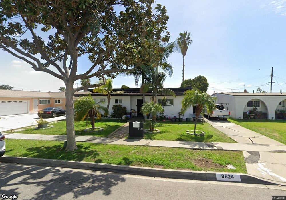
9824 Firebird Ave Whittier, CA 90605
South Whittier NeighborhoodEstimated Value: $743,091 - $825,000
3
Beds
1
Bath
1,103
Sq Ft
$700/Sq Ft
Est. Value
About This Home
This home is located at 9824 Firebird Ave, Whittier, CA 90605 and is currently estimated at $771,773, approximately $699 per square foot. 9824 Firebird Ave is a home located in Los Angeles County with nearby schools including Laurel Elementary School, Hillview Middle School, and Pioneer High School.
Ownership History
Date
Name
Owned For
Owner Type
Purchase Details
Closed on
Jan 15, 2003
Sold by
Sandoval Jose A and Sandoval Martina Imelda
Bought by
Sandoval Martina Imelda
Current Estimated Value
Purchase Details
Closed on
Apr 25, 1995
Sold by
Texas Commerce Bank Na
Bought by
Sandoval Jose A
Home Financials for this Owner
Home Financials are based on the most recent Mortgage that was taken out on this home.
Original Mortgage
$129,105
Interest Rate
6.87%
Purchase Details
Closed on
Jan 19, 1995
Sold by
Abuhakmeh Mahmoud and Abuhakmeh Maria I
Bought by
Texas Commerce Bank Na
Create a Home Valuation Report for This Property
The Home Valuation Report is an in-depth analysis detailing your home's value as well as a comparison with similar homes in the area
Home Values in the Area
Average Home Value in this Area
Purchase History
| Date | Buyer | Sale Price | Title Company |
|---|---|---|---|
| Sandoval Martina Imelda | -- | -- | |
| Sandoval Jose A | $136,000 | Stewart Title | |
| Texas Commerce Bank Na | $154,499 | First Southwestern Title |
Source: Public Records
Mortgage History
| Date | Status | Borrower | Loan Amount |
|---|---|---|---|
| Previous Owner | Sandoval Jose A | $129,105 |
Source: Public Records
Tax History Compared to Growth
Tax History
| Year | Tax Paid | Tax Assessment Tax Assessment Total Assessment is a certain percentage of the fair market value that is determined by local assessors to be the total taxable value of land and additions on the property. | Land | Improvement |
|---|---|---|---|---|
| 2025 | $3,171 | $228,239 | $154,013 | $74,226 |
| 2024 | $3,171 | $223,765 | $150,994 | $72,771 |
| 2023 | $3,080 | $219,379 | $148,034 | $71,345 |
| 2022 | $3,094 | $215,079 | $145,132 | $69,947 |
| 2021 | $3,031 | $210,863 | $142,287 | $68,576 |
| 2019 | $2,979 | $204,611 | $138,068 | $66,543 |
| 2018 | $2,815 | $200,600 | $135,361 | $65,239 |
| 2016 | $2,674 | $192,811 | $130,105 | $62,706 |
| 2015 | $2,609 | $189,916 | $128,151 | $61,765 |
| 2014 | $2,590 | $186,197 | $125,641 | $60,556 |
Source: Public Records
Map
Nearby Homes
- 13426 Anola St
- 10123 Lanett Ave
- 13649 Reis St
- 13317 Allegan St
- 9551 Barkerville Ave
- 10246 Parkinson Ave
- 9545 Barkerville Ave
- 9534 Painter Ave
- 13856 Mulberry Dr
- 10541 Mills Ave
- 13752 Bentongrove Dr
- 14042 Hawes St
- 14026 Light St
- 13535 Dunton Dr
- 10035 Ben Hur Ave
- 13762 Danbrook Dr
- 14052 Reis St
- 14033 Oval Dr
- 9009 Bluford Ave
- 9127 Greenleaf Ave
- 9830 Firebird Ave
- 9812 Firebird Ave
- 9840 Firebird Ave
- 13439 Reis St
- 13445 Reis St
- 13433 Reis St
- 13451 Reis St
- 13457 Reis St
- 9827 Firebird Ave
- 9821 Firebird Ave
- 9803 Greening Ave
- 9854 Firebird Ave
- 9809 Greening Ave
- 9833 Firebird Ave
- 9815 Firebird Ave
- 13461 Reis St
- 9815 Greening Ave
- 9839 Firebird Ave
- 9803 Firebird Ave
- 9821 Greening Ave