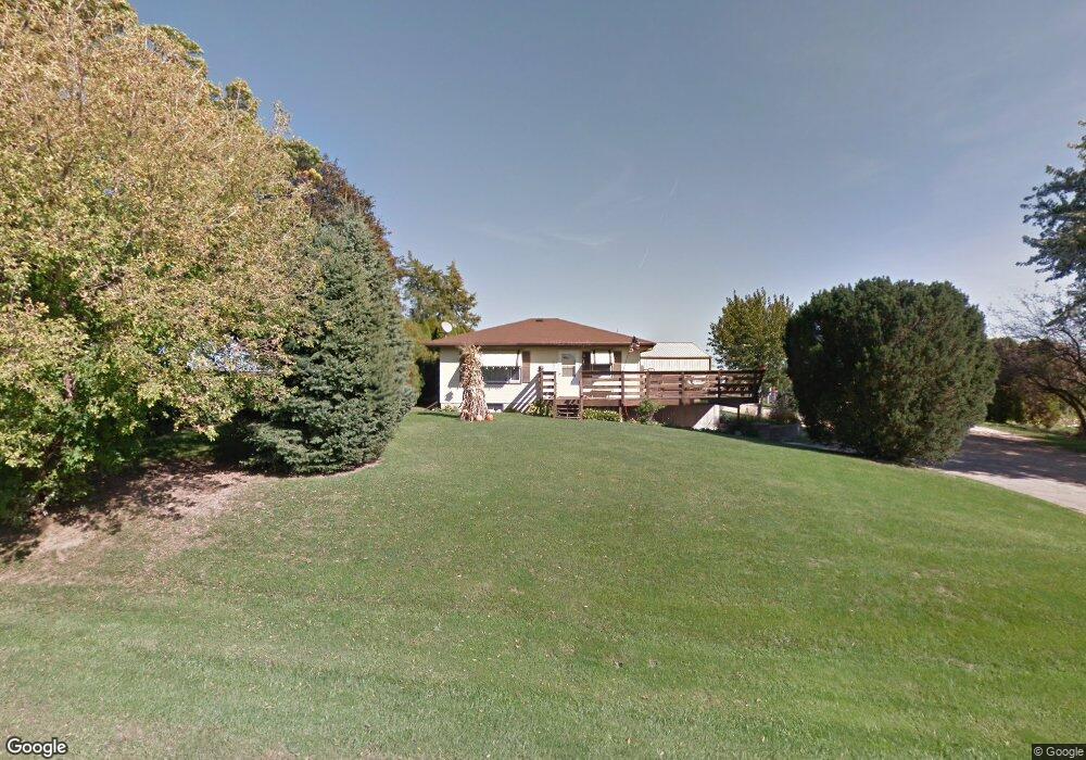
9828 Key West Dr Dubuque, IA 52003
Estimated Value: $226,000 - $247,000
2
Beds
2
Baths
780
Sq Ft
$299/Sq Ft
Est. Value
About This Home
This home is located at 9828 Key West Dr, Dubuque, IA 52003 and is currently estimated at $233,567, approximately $299 per square foot. 9828 Key West Dr is a home located in Dubuque County with nearby schools including Table Mound Elementary School, Eleanor Roosevelt Middle School, and Dubuque Senior High School.
Ownership History
Date
Name
Owned For
Owner Type
Purchase Details
Closed on
Nov 6, 2024
Sold by
Hilkin Jean Ann M and Boyes Kevin D
Bought by
Neuses Tommy F
Current Estimated Value
Home Financials for this Owner
Home Financials are based on the most recent Mortgage that was taken out on this home.
Original Mortgage
$178,600
Outstanding Balance
$176,712
Interest Rate
6.32%
Mortgage Type
New Conventional
Estimated Equity
$56,855
Create a Home Valuation Report for This Property
The Home Valuation Report is an in-depth analysis detailing your home's value as well as a comparison with similar homes in the area
Home Values in the Area
Average Home Value in this Area
Purchase History
| Date | Buyer | Sale Price | Title Company |
|---|---|---|---|
| Neuses Tommy F | $223,500 | None Listed On Document |
Source: Public Records
Mortgage History
| Date | Status | Borrower | Loan Amount |
|---|---|---|---|
| Open | Neuses Tommy F | $178,600 |
Source: Public Records
Tax History Compared to Growth
Tax History
| Year | Tax Paid | Tax Assessment Tax Assessment Total Assessment is a certain percentage of the fair market value that is determined by local assessors to be the total taxable value of land and additions on the property. | Land | Improvement |
|---|---|---|---|---|
| 2025 | $1,942 | $184,400 | $56,100 | $128,300 |
| 2024 | $1,942 | $176,300 | $53,500 | $122,800 |
| 2023 | $1,876 | $176,300 | $53,500 | $122,800 |
| 2022 | $1,702 | $134,220 | $49,500 | $84,720 |
| 2021 | $1,702 | $134,220 | $49,500 | $84,720 |
| 2020 | $1,816 | $133,400 | $47,500 | $85,900 |
| 2019 | $1,730 | $133,400 | $47,500 | $85,900 |
| 2018 | $1,684 | $122,590 | $39,300 | $83,290 |
| 2017 | $1,686 | $122,590 | $39,300 | $83,290 |
| 2016 | $1,686 | $116,870 | $36,300 | $80,570 |
| 2015 | $1,638 | $116,870 | $36,300 | $80,570 |
| 2014 | $1,612 | $118,900 | $33,800 | $85,100 |
Source: Public Records
Map
Nearby Homes
- 0 Digital Dr
- 00 S Hwy 61 151
- 10533 Cedar Point Ct
- 8109 Elmwood Dr
- 8328 Elmwood Dr
- 8123 Elmwood Dr
- 8151 Elmwood Dr
- 8137 Elmwood Dr
- 8163 Elmwood Dr
- 8177 Elmwood Dr
- 8189 Elmwood Dr
- 8203 Elmwood Dr
- 8223 Elmwood Dr
- 8235 Elmwood Dr
- 8247 Elmwood Dr
- 8255 Elmwood Dr
- 8267 Elmwood Dr
- 8275 Elmwood Dr
- 8293 Elmwood Dr
- 8278 Elmwood Dr
- 9824 Key West Dr
- 9854 Key West Dr
- 9868 Williams Ln
- 9952 Key West Dr
- 10006 Timothy St
- 10024 Timothy St
- 10030 Timothy St
- 10047 Timothy St
- 10054 Timothy St
- 10061 Timothy St
- 10080 Timothy St
- 10096 Timothy St
- 10086 Key West Dr
- 6689 Boulder Brook Ct Unit Suites 3 and 4
- 6689 Boulder Brook Ct Unit Suite 3
- 6689 Boulder Brook Ct Unit Suite 4
- 6689 Boulder Brook Ct Unit Suites 3 & 4
- 6689 Boulder Brook Ct
- 6689 Boulder Brook Ct
- 10138 Timothy St