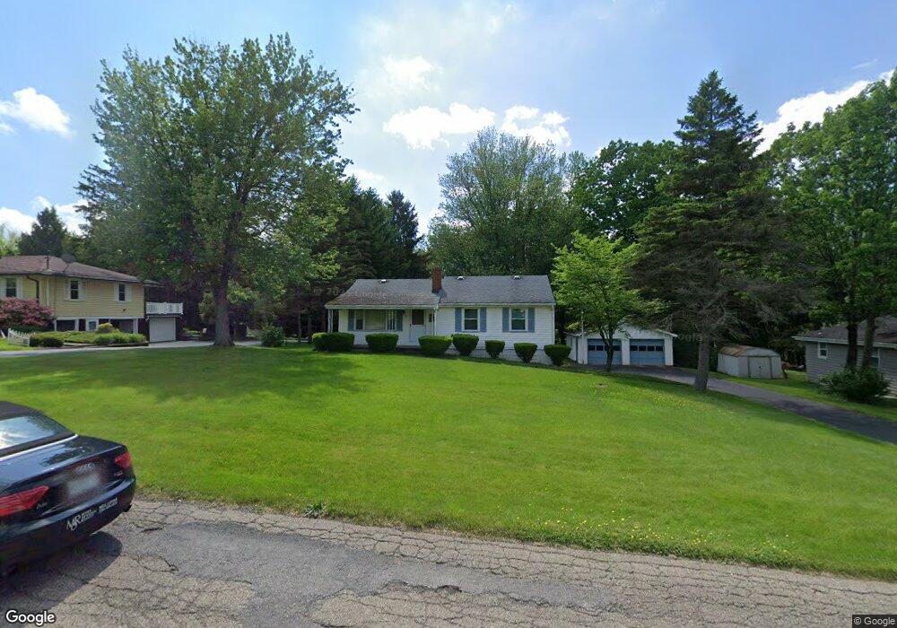
9830 Unity Rd Youngstown, OH 44514
Estimated Value: $182,000 - $214,000
3
Beds
2
Baths
1,332
Sq Ft
$150/Sq Ft
Est. Value
About This Home
This home is located at 9830 Unity Rd, Youngstown, OH 44514 and is currently estimated at $199,496, approximately $149 per square foot. 9830 Unity Rd is a home located in Mahoning County with nearby schools including Springfield Elementary School, Springfield Intermediate Middle School, and Springfield High School.
Ownership History
Date
Name
Owned For
Owner Type
Purchase Details
Closed on
Jun 6, 1994
Sold by
Donofrio John
Bought by
Barth Philip H
Current Estimated Value
Home Financials for this Owner
Home Financials are based on the most recent Mortgage that was taken out on this home.
Original Mortgage
$76,620
Interest Rate
7.95%
Mortgage Type
New Conventional
Purchase Details
Closed on
May 30, 1989
Bought by
Donofrio John
Create a Home Valuation Report for This Property
The Home Valuation Report is an in-depth analysis detailing your home's value as well as a comparison with similar homes in the area
Purchase History
| Date | Buyer | Sale Price | Title Company |
|---|---|---|---|
| Barth Philip H | $88,100 | -- | |
| Donofrio John | $58,000 | -- |
Source: Public Records
Mortgage History
| Date | Status | Borrower | Loan Amount |
|---|---|---|---|
| Closed | Barth Philip H | $76,620 |
Source: Public Records
Tax History
| Year | Tax Paid | Tax Assessment Tax Assessment Total Assessment is a certain percentage of the fair market value that is determined by local assessors to be the total taxable value of land and additions on the property. | Land | Improvement |
|---|---|---|---|---|
| 2025 | $2,109 | $48,080 | $4,620 | $43,460 |
| 2024 | $1,940 | $48,080 | $4,620 | $43,460 |
| 2023 | $1,907 | $48,080 | $4,620 | $43,460 |
| 2022 | $1,614 | $36,500 | $4,620 | $31,880 |
| 2021 | $1,627 | $36,500 | $4,620 | $31,880 |
| 2020 | $1,636 | $36,500 | $4,620 | $31,880 |
| 2019 | $1,515 | $32,590 | $4,620 | $27,970 |
| 2018 | $1,496 | $32,590 | $4,620 | $27,970 |
| 2017 | $1,459 | $32,590 | $4,620 | $27,970 |
| 2016 | $1,425 | $30,750 | $3,620 | $27,130 |
| 2015 | $1,386 | $30,750 | $3,620 | $27,130 |
| 2014 | $1,392 | $30,750 | $3,620 | $27,130 |
| 2013 | $1,379 | $30,750 | $3,620 | $27,130 |
Source: Public Records
Map
Nearby Homes
- 9868 Unity Rd
- 4035 Shelly Lynn Dr
- 4025 Shelly Lynn Dr
- 10115 Carrie Ct
- 10105 Carrie Ct
- 170 Sandy Ct Unit 11
- 170 Sandy Ct Unit 7
- 56 Jeffrey Ln
- 46 Ohlin Dr
- 4940 E Calla Rd
- 4957 E Calla Rd
- 93 Woodland Dr
- 8736 Harvest Glenn Trail Unit 10
- 8740 Harvest Glenn Trail Unit 11
- 8748 Harvest Glenn Trail Unit 13
- 8744 Harvest Glenn Trail Unit 12
- 9825 Struthers Rd
- 8732 Harvest Glenn Trail Unit 9
- 8745 Harvest Glenn Trail Unit 14
- 9663 Youngstown - Pittsburgh Rd
Your Personal Tour Guide
Ask me questions while you tour the home.