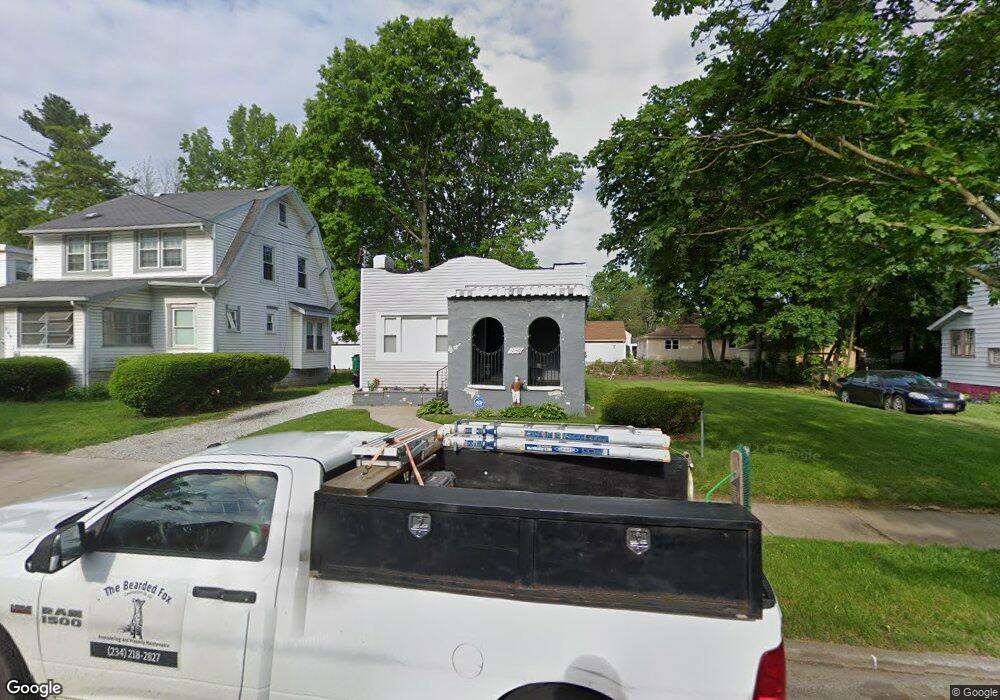
984 Peerless Ave Akron, OH 44320
West Akron NeighborhoodEstimated Value: $80,818 - $122,000
2
Beds
1
Bath
913
Sq Ft
$104/Sq Ft
Est. Value
About This Home
This home is located at 984 Peerless Ave, Akron, OH 44320 and is currently estimated at $94,705, approximately $103 per square foot. 984 Peerless Ave is a home located in Summit County with nearby schools including Emmanuel Christian Academy.
Ownership History
Date
Name
Owned For
Owner Type
Purchase Details
Closed on
Jan 16, 2023
Sold by
Heflin Nolan J
Bought by
Carter Dercell M
Current Estimated Value
Purchase Details
Closed on
Aug 3, 2022
Sold by
Sanders Rowland
Bought by
Heflin Nolan J
Purchase Details
Closed on
Feb 24, 2017
Sold by
Andrews Julius
Bought by
Sanders Bennett and Sanders Rouland
Purchase Details
Closed on
Jan 1, 2007
Sold by
Andrews Julius
Bought by
Sanders Bennett and Sanders Rowland D
Purchase Details
Closed on
May 19, 1999
Sold by
Andrews Melvin
Bought by
Andrews Julius
Create a Home Valuation Report for This Property
The Home Valuation Report is an in-depth analysis detailing your home's value as well as a comparison with similar homes in the area
Home Values in the Area
Average Home Value in this Area
Purchase History
| Date | Buyer | Sale Price | Title Company |
|---|---|---|---|
| Carter Dercell M | $36,000 | -- | |
| Heflin Nolan J | $5,000 | Cutler Jay L | |
| Sanders Bennett | $18,000 | None Available | |
| Sanders Bennett | -- | None Available | |
| Andrews Julius | $27,000 | Tri County Title |
Source: Public Records
Tax History
| Year | Tax Paid | Tax Assessment Tax Assessment Total Assessment is a certain percentage of the fair market value that is determined by local assessors to be the total taxable value of land and additions on the property. | Land | Improvement |
|---|---|---|---|---|
| 2025 | $1,221 | $21,253 | $5,653 | $15,600 |
| 2024 | $1,163 | $21,253 | $5,653 | $15,600 |
| 2023 | $1,221 | $21,253 | $5,653 | $15,600 |
| 2022 | $937 | $12,881 | $3,427 | $9,454 |
| 2021 | $938 | $12,881 | $3,427 | $9,454 |
| 2020 | $924 | $12,880 | $3,430 | $9,450 |
| 2019 | $882 | $11,110 | $4,450 | $6,660 |
| 2018 | $849 | $11,110 | $4,450 | $6,660 |
| 2017 | $945 | $11,110 | $4,450 | $6,660 |
| 2016 | $945 | $11,260 | $4,450 | $6,810 |
| 2015 | $945 | $11,260 | $4,450 | $6,810 |
| 2014 | $938 | $11,260 | $4,450 | $6,810 |
| 2013 | $1,135 | $14,290 | $4,450 | $9,840 |
Source: Public Records
Map
Nearby Homes
- 970 Mercer Ave
- 957 Mercer Ave
- 892-894 Storer Ave
- 1063 Packard Dr
- 1040 Mercer Ave
- 881 Stoner St
- 852 Storer Ave
- 1088 Packard Dr
- 1067 Mercer Ave
- 926 Winton Ave
- 849 Glenn St
- 801 Storer Ave
- VL Mercer Ave
- 1153 Packard Dr
- 615 Noah Ave
- 1074 Hartford Ave
- 1206 Diagonal Rd
- 1041 Diagonal Rd
- 1188 Hardesty Blvd
- 575 Noble Ave
- 988 Peerless Ave
- 982 Peerless Ave
- 994 Peerless Ave
- 978 Peerless Ave
- 993 Packard Dr
- 999 Packard Dr
- 987 Packard Dr
- 1003 Packard Dr
- 998 Peerless Ave
- 989 Peerless Ave
- 970 Peerless Ave
- 985 Peerless Ave
- 981 Peerless Ave
- 1011 Packard Dr
- 977 Peerless Ave
- 1008 Peerless Ave
- 997 Peerless Ave
- 973 Peerless Ave
- 977 Packard Dr
- 977 Packard Dr
Your Personal Tour Guide
Ask me questions while you tour the home.