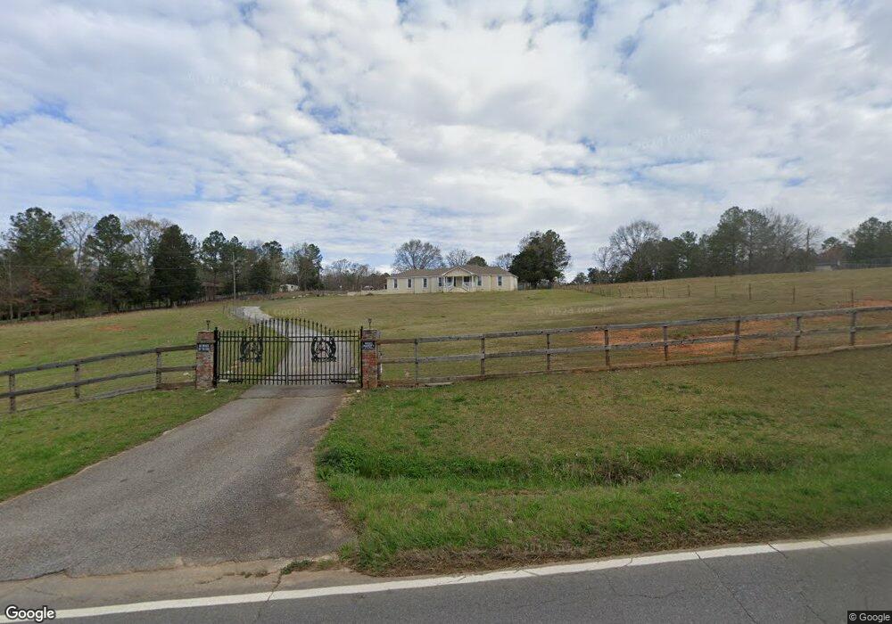
985 Youngs Farm Rd Cedartown, GA 30125
Estimated Value: $298,000 - $411,000
3
Beds
2
Baths
2,290
Sq Ft
$155/Sq Ft
Est. Value
About This Home
This home is located at 985 Youngs Farm Rd, Cedartown, GA 30125 and is currently estimated at $355,571, approximately $155 per square foot. 985 Youngs Farm Rd is a home located in Polk County.
Ownership History
Date
Name
Owned For
Owner Type
Purchase Details
Closed on
Jul 17, 2013
Sold by
Federal Home Loan Mortgage Corporation
Bought by
Segura Juan
Current Estimated Value
Home Financials for this Owner
Home Financials are based on the most recent Mortgage that was taken out on this home.
Original Mortgage
$82,450
Interest Rate
3.96%
Mortgage Type
New Conventional
Purchase Details
Closed on
Nov 6, 2012
Sold by
Cenlar Fsb
Bought by
Federal Home Loan Mortgage Corporation
Purchase Details
Closed on
Dec 21, 2006
Sold by
Not Provided
Bought by
Lossick James D
Home Financials for this Owner
Home Financials are based on the most recent Mortgage that was taken out on this home.
Original Mortgage
$176,200
Interest Rate
6.1%
Mortgage Type
New Conventional
Purchase Details
Closed on
Sep 1, 2006
Sold by
Cog Management Inc
Bought by
Lossick James
Home Financials for this Owner
Home Financials are based on the most recent Mortgage that was taken out on this home.
Original Mortgage
$170,000
Interest Rate
6.58%
Mortgage Type
New Conventional
Purchase Details
Closed on
May 2, 2006
Sold by
A L L Properties
Bought by
Cog Management Inc
Purchase Details
Closed on
Jan 4, 2005
Sold by
Kelley John D
Bought by
A L L Properties & Management
Purchase Details
Closed on
Jan 3, 2005
Sold by
A L L Properties & Managem
Bought by
Kelley John D
Purchase Details
Closed on
Dec 17, 2004
Sold by
Washburne Theodore and Washburne Kathryn
Bought by
All Properties & Management Inc
Purchase Details
Closed on
May 15, 2000
Sold by
Holder Janie
Bought by
Washburne Theodore and Washburne Kathryn
Purchase Details
Closed on
Nov 6, 1997
Sold by
Mattox Beverly Ann
Bought by
Holder Janie
Purchase Details
Closed on
Aug 21, 1979
Sold by
Simpson Don H and Simpson Mary
Bought by
Mattox Kenneth W
Purchase Details
Closed on
Sep 29, 1972
Sold by
Hamby Terry
Bought by
Simpson Don H and Simpson Mary
Purchase Details
Closed on
Jun 1, 1971
Bought by
Hamby Terry
Create a Home Valuation Report for This Property
The Home Valuation Report is an in-depth analysis detailing your home's value as well as a comparison with similar homes in the area
Home Values in the Area
Average Home Value in this Area
Purchase History
| Date | Buyer | Sale Price | Title Company |
|---|---|---|---|
| Segura Juan | $97,000 | -- | |
| Federal Home Loan Mortgage Corporation | $114,000 | -- | |
| Cenlar Fsb | $114,000 | -- | |
| Lossick James D | -- | -- | |
| Lossick James | -- | -- | |
| Cog Management Inc | $11,000 | -- | |
| A L L Properties & Management | -- | -- | |
| Kelley John D | $160,000 | -- | |
| All Properties & Management Inc | $130,000 | -- | |
| A L L Properties & Management | $130,000 | -- | |
| Washburne Theodore | $151,000 | -- | |
| Holder Janie | $122,000 | -- | |
| Mattox Kenneth W | -- | -- | |
| Simpson Don H | -- | -- | |
| Hamby Terry | -- | -- |
Source: Public Records
Mortgage History
| Date | Status | Borrower | Loan Amount |
|---|---|---|---|
| Closed | Segura Juan | $82,450 | |
| Previous Owner | Lossick James D | $176,200 | |
| Previous Owner | Lossick James | $170,000 |
Source: Public Records
Tax History Compared to Growth
Tax History
| Year | Tax Paid | Tax Assessment Tax Assessment Total Assessment is a certain percentage of the fair market value that is determined by local assessors to be the total taxable value of land and additions on the property. | Land | Improvement |
|---|---|---|---|---|
| 2024 | $2,080 | $101,502 | $22,538 | $78,964 |
| 2023 | $1,651 | $71,554 | $22,538 | $49,016 |
| 2022 | $1,294 | $56,534 | $15,025 | $41,509 |
| 2021 | $1,311 | $56,534 | $15,025 | $41,509 |
| 2020 | $1,314 | $56,534 | $15,025 | $41,509 |
| 2019 | $1,468 | $56,664 | $15,025 | $41,639 |
| 2018 | $1,469 | $55,317 | $15,025 | $40,292 |
| 2017 | $1,451 | $55,317 | $15,025 | $40,292 |
| 2016 | $1,543 | $58,697 | $18,404 | $40,292 |
| 2015 | $1,549 | $58,750 | $18,404 | $40,345 |
| 2014 | $1,012 | $58,750 | $18,404 | $40,345 |
Source: Public Records
Map
Nearby Homes
- 0 Youngs Farm Rd Unit 24829378
- 0 Buchanan Hwy Unit 10558945
- 4550 Buchanan Hwy
- 4267 Buchanan Hwy
- 160 Tate Rd
- 00 Antioch Rd
- 525 Grogan Rd
- 539 Grogan Rd
- 557 Grogan Rd
- 95 Wieuca Way
- 0 Wieuca Way Unit 10614129
- 000 Wieuca Way
- 142 Acres On Judkin Mill Rd
- 766 Antioch Rd
- 00 Buchanan Hwy
- 1987 Buchanan Hwy
- 35 Old Mill Rd
- 497 Judkin Mill Rd
- 7474 Highway 27
- 0 Ten Oaks Rd
- 985 Youngs Farm Rd
- 985 Young Farms Rd
- 955 Youngs Farm Rd
- 1025 Youngs Farm Rd
- 1025 Youngs Farm Rd
- 1035 Young Farms Rd
- 964 Youngs Farm Rd
- 1035 Youngs Farm Rd
- 982 Youngs Farm Rd
- 1049 Youngs Farm Rd
- 954 Youngs Farm Rd
- 920 Youngs Farm Rd Unit 1046
- 920 Youngs Farm Rd
- 1081 Youngs Farm Rd
- 887 Youngs Farm Rd
- 890 Youngs Farm Rd
- 870 Youngs Farm Rd
- 844 Youngs Farm Rd
- 3583 Buchanan Hwy
- 1146 Youngs Farm Rd