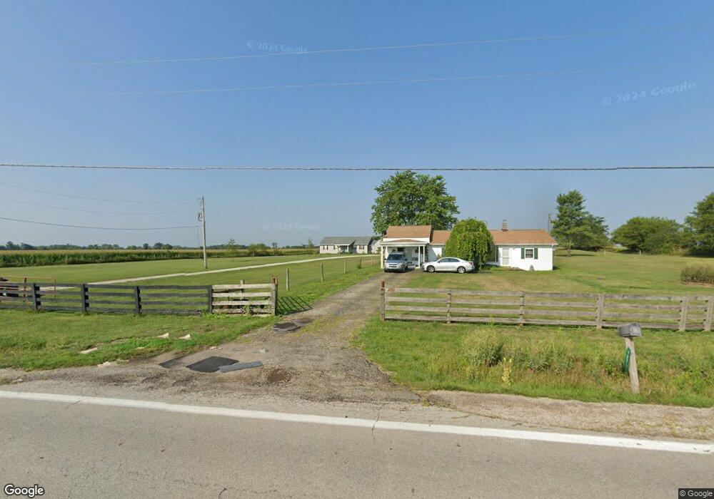
9871 State Route 762 Orient, OH 43146
Estimated Value: $198,000 - $325,000
3
Beds
2
Baths
1,680
Sq Ft
$166/Sq Ft
Est. Value
About This Home
This home is located at 9871 State Route 762, Orient, OH 43146 and is currently estimated at $279,029, approximately $166 per square foot. 9871 State Route 762 is a home located in Pickaway County.
Ownership History
Date
Name
Owned For
Owner Type
Purchase Details
Closed on
Feb 27, 2019
Sold by
Ott Jerry P and Ott Linda R
Bought by
Ott Jerald P and Ott Linda R
Current Estimated Value
Purchase Details
Closed on
Dec 10, 2002
Sold by
Ott Linda R
Bought by
Newsom Roger E and Newsom Connie D
Home Financials for this Owner
Home Financials are based on the most recent Mortgage that was taken out on this home.
Original Mortgage
$104,554
Interest Rate
6.38%
Mortgage Type
New Conventional
Create a Home Valuation Report for This Property
The Home Valuation Report is an in-depth analysis detailing your home's value as well as a comparison with similar homes in the area
Purchase History
| Date | Buyer | Sale Price | Title Company |
|---|---|---|---|
| Ott Jerald P | -- | None Available | |
| Newsom Roger E | $80,000 | -- |
Source: Public Records
Mortgage History
| Date | Status | Borrower | Loan Amount |
|---|---|---|---|
| Closed | Newsom Roger E | $104,554 |
Source: Public Records
Tax History
| Year | Tax Paid | Tax Assessment Tax Assessment Total Assessment is a certain percentage of the fair market value that is determined by local assessors to be the total taxable value of land and additions on the property. | Land | Improvement |
|---|---|---|---|---|
| 2024 | $3,413 | $66,130 | $21,000 | $45,130 |
| 2023 | $2,142 | $66,130 | $21,000 | $45,130 |
| 2022 | $1,546 | $46,500 | $14,000 | $32,500 |
| 2021 | $1,550 | $46,500 | $14,000 | $32,500 |
| 2020 | $1,551 | $46,500 | $14,000 | $32,500 |
| 2019 | $1,199 | $38,850 | $13,300 | $25,550 |
| 2018 | $1,173 | $38,850 | $13,300 | $25,550 |
| 2017 | $2,042 | $38,850 | $13,300 | $25,550 |
| 2016 | $1,125 | $36,810 | $11,550 | $25,260 |
| 2015 | $1,125 | $36,810 | $11,550 | $25,260 |
| 2014 | $1,192 | $36,810 | $11,550 | $25,260 |
| 2013 | $1,758 | $36,810 | $11,550 | $25,260 |
Source: Public Records
Map
Nearby Homes
- 0 Burgett Rd
- 7879 Railroad St
- 9148 Matville Rd
- 0 Scioto-Darby Rd Unit 226002982
- 190 Rosewood Loop SW
- 8835 Iroquois Way
- 6259 Cherokee Ln
- 6275 Cherokee Ln
- 182 Honey Locust Ln
- 0 Matville Rd Unit 225040474
- 0 Matville Rd Unit 225040477
- 0 Matville Rd Unit 225030661
- 161 Rosewood Loop SE
- 5326 Sandpiper Dr
- 160 Chestnut Commons Dr
- 8689 Larkspur Dr
- 8681 Larkspur Dr
- 161 Chestnut Estates Dr
- 0 Ridpath Rd
- 1063 Springlawn Ave
- 9861 State Route 762
- 9890 State Route 762
- 9641 State Route 762
- 10280 State Route 762
- 9220 Burgett Rd
- 9425 State Route 762
- 9403 State Route 762
- 9120 Burgett Rd
- 9419 State Route 762
- 9381 State Route 762
- 9056 Burgett Rd
- 10565 Thrailkill Rd
- 10521 Thrailkill Rd
- 8986 Burgett Rd
- 9311 State Route 762
- 10621 Thrailkill Rd
- 10643 Thrailkill Rd
- 10675 Thrailkill Rd
- 9291 State Route 762
- 10705 Thrailkill Rd
Your Personal Tour Guide
Ask me questions while you tour the home.