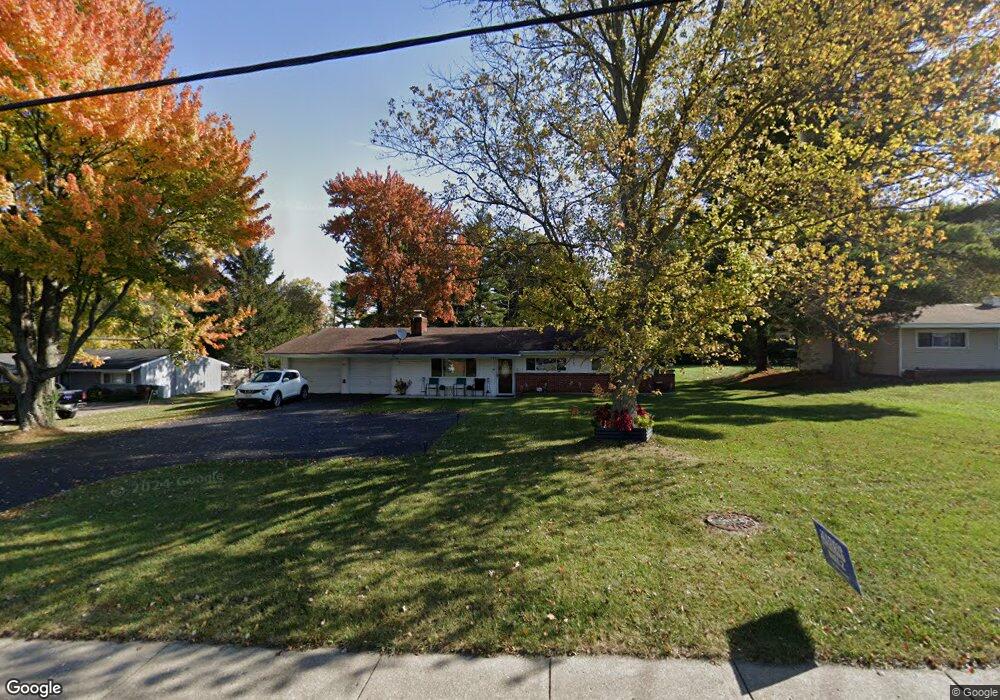
9888 Winton Rd Cincinnati, OH 45231
Winton Lake NeighborhoodEstimated Value: $214,592 - $256,000
3
Beds
2
Baths
1,260
Sq Ft
$185/Sq Ft
Est. Value
About This Home
This home is located at 9888 Winton Rd, Cincinnati, OH 45231 and is currently estimated at $233,648, approximately $185 per square foot. 9888 Winton Rd is a home located in Hamilton County with nearby schools including John Paul II Catholic School.
Ownership History
Date
Name
Owned For
Owner Type
Purchase Details
Closed on
Jun 16, 2003
Sold by
H & S Properties
Bought by
White Terry K and White Nancy L
Current Estimated Value
Home Financials for this Owner
Home Financials are based on the most recent Mortgage that was taken out on this home.
Original Mortgage
$111,934
Outstanding Balance
$46,397
Interest Rate
5.51%
Mortgage Type
FHA
Estimated Equity
$187,251
Purchase Details
Closed on
Dec 17, 2001
Sold by
Dolle Robert H
Bought by
H & S Properties
Purchase Details
Closed on
Oct 7, 1994
Sold by
Sacco Antoinetta
Bought by
Gleeson Ii F M and Gleeson Sunny T
Create a Home Valuation Report for This Property
The Home Valuation Report is an in-depth analysis detailing your home's value as well as a comparison with similar homes in the area
Home Values in the Area
Average Home Value in this Area
Purchase History
We collect this data history from publicly available records. To have your information removed, we recommend requesting removal directly through your county’s website.
| Date | Buyer | Sale Price | Title Company |
|---|---|---|---|
| White Terry K | $114,000 | -- | |
| H & S Properties | $73,000 | -- | |
| Gleeson Ii F M | -- | -- |
Source: Public Records
Mortgage History
We collect this data history from publicly available records. To have your information removed, we recommend requesting removal directly through your county’s website.
| Date | Status | Borrower | Loan Amount |
|---|---|---|---|
| Open | White Terry K | $111,934 |
Source: Public Records
Tax History
| Year | Tax Paid | Tax Assessment Tax Assessment Total Assessment is a certain percentage of the fair market value that is determined by local assessors to be the total taxable value of land and additions on the property. | Land | Improvement |
|---|---|---|---|---|
| 2025 | $3,034 | $44,976 | $10,959 | $34,017 |
| 2023 | $2,838 | $44,976 | $10,959 | $34,017 |
| 2022 | $2,665 | $31,637 | $10,350 | $21,287 |
| 2021 | $2,603 | $31,637 | $10,350 | $21,287 |
| 2020 | $2,640 | $31,637 | $10,350 | $21,287 |
| 2019 | $2,347 | $25,932 | $8,484 | $17,448 |
| 2018 | $2,353 | $25,932 | $8,484 | $17,448 |
| 2017 | $2,264 | $25,932 | $8,484 | $17,448 |
| 2016 | $2,678 | $30,101 | $8,397 | $21,704 |
| 2015 | $2,498 | $30,101 | $8,397 | $21,704 |
| 2014 | $2,489 | $30,101 | $8,397 | $21,704 |
| 2013 | $2,537 | $31,683 | $8,838 | $22,845 |
Source: Public Records
Map
Nearby Homes
- 9810 Lorelei Dr
- 9732 Woodmill Ln
- 911 Lakeside Dr
- 10022 Lakeside Dr
- 996 Mckelvey Rd
- 1065 Mckelvey Rd
- 1050 Garnoa Dr
- 9566 Galecrest Dr
- 9319 Winton Rd
- 9382 Stoneybrooke
- 9671 Wildbrook Ln
- 955 Crossing Pointe Unit 8E
- 9808 Daly Rd
- 1063 Newcastle Dr
- 9184 Millcliff Dr
- 9959 Thoroughbred Ln
- 9140 Millcliff Dr
- 9125 Millcliff Dr
- 9367 Sherborn Dr
- 1051 Flintlock Dr
- 9898 Winton Rd
- 9872 Winton Rd
- 9860 Winton Rd
- 9906 Winton Rd
- 9871 Lorelei Dr
- 9861 Lorelei Dr
- 9879 Lorelei Dr
- 9851 Lorelei Dr
- 9905 Winton Rd
- 9916 Winton Rd
- 9846 Winton Rd
- 9885 Lorelei Dr
- 9841 Lorelei Dr
- 9893 Winton Rd
- 9895 Lorelei Dr
- 9928 Winton Rd
- 9834 Winton Rd
- 9831 Lorelei Dr
- 9931 Winton Rd
- 9940 Winton Rd
Your Personal Tour Guide
Ask me questions while you tour the home.