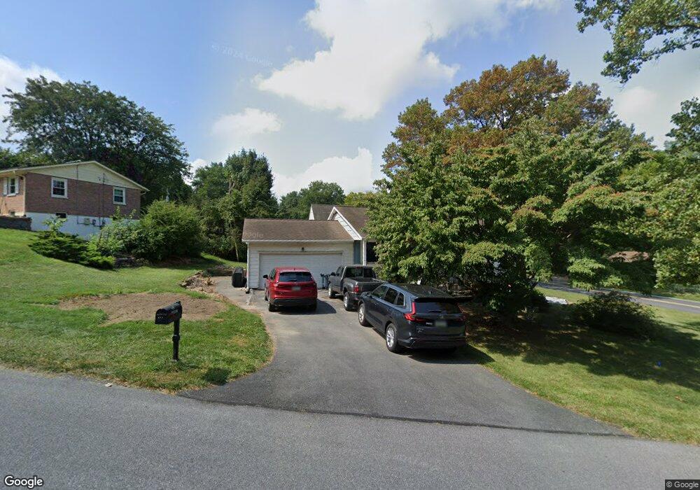
989 Cardinal Rd Lancaster, PA 17601
Oyster Point NeighborhoodEstimated Value: $311,000 - $352,000
3
Beds
1
Bath
988
Sq Ft
$332/Sq Ft
Est. Value
About This Home
This home is located at 989 Cardinal Rd, Lancaster, PA 17601 and is currently estimated at $327,735, approximately $331 per square foot. 989 Cardinal Rd is a home located in Lancaster County with nearby schools including Centerville Elementary School, Centerville Middle School, and Hempfield Senior High School.
Ownership History
Date
Name
Owned For
Owner Type
Purchase Details
Closed on
Jul 13, 2000
Sold by
Sten James L and Sten Norma L
Bought by
Schmidt Michael H and Schmidt Annette M
Current Estimated Value
Home Financials for this Owner
Home Financials are based on the most recent Mortgage that was taken out on this home.
Original Mortgage
$122,298
Outstanding Balance
$44,599
Interest Rate
8.5%
Mortgage Type
VA
Estimated Equity
$283,136
Create a Home Valuation Report for This Property
The Home Valuation Report is an in-depth analysis detailing your home's value as well as a comparison with similar homes in the area
Home Values in the Area
Average Home Value in this Area
Purchase History
| Date | Buyer | Sale Price | Title Company |
|---|---|---|---|
| Schmidt Michael H | $119,900 | -- |
Source: Public Records
Mortgage History
| Date | Status | Borrower | Loan Amount |
|---|---|---|---|
| Open | Schmidt Michael H | $122,298 |
Source: Public Records
Tax History Compared to Growth
Tax History
| Year | Tax Paid | Tax Assessment Tax Assessment Total Assessment is a certain percentage of the fair market value that is determined by local assessors to be the total taxable value of land and additions on the property. | Land | Improvement |
|---|---|---|---|---|
| 2025 | $3,248 | $150,300 | $55,400 | $94,900 |
| 2024 | $3,248 | $150,300 | $55,400 | $94,900 |
| 2023 | $3,183 | $150,300 | $55,400 | $94,900 |
| 2022 | $3,095 | $150,300 | $55,400 | $94,900 |
| 2021 | $3,046 | $150,300 | $55,400 | $94,900 |
| 2020 | $3,046 | $150,300 | $55,400 | $94,900 |
| 2019 | $2,995 | $150,300 | $55,400 | $94,900 |
| 2018 | $574 | $146,300 | $55,400 | $90,900 |
| 2017 | $3,435 | $136,400 | $38,500 | $97,900 |
| 2016 | $3,434 | $136,400 | $38,500 | $97,900 |
| 2015 | $690 | $136,400 | $38,500 | $97,900 |
| 2014 | $2,530 | $136,400 | $38,500 | $97,900 |
Source: Public Records
Map
Nearby Homes
- 880 Corvair Rd
- 695 Imperial Dr
- 854 Centerville Rd
- 916 Dorsea Rd
- 2940 Marietta Ave
- 660 Lawrence Blvd Unit DEVONSHIRE
- 660 Lawrence Blvd Unit MAGNOLIA
- 660 Lawrence Blvd Unit ADDISON
- 660 Lawrence Blvd Unit LACHLAN
- 660 Lawrence Blvd Unit COVINGTON
- 660 Lawrence Blvd Unit ARCADIA
- 660 Lawrence Blvd Unit PARKER
- 2827 Michener Dr
- Kipling Plan at Enclave at Independence Ridge
- Woodford Plan at Enclave at Independence Ridge
- Magnolia Plan at Enclave at Independence Ridge
- Sebastian Plan at Enclave at Independence Ridge
- Savannah Plan at Enclave at Independence Ridge
- Parker Plan at Enclave at Independence Ridge
- Nottingham Plan at Enclave at Independence Ridge
- 985 Cardinal Rd
- 998 Cardinal Rd
- 2901 Spring Valley Rd
- 2908 Spring Valley Rd
- 986 Cardinal Rd
- 981 Cardinal Rd
- 980 Cardinal Rd
- 2903 Spring Valley Rd
- 2879 Spring Valley Rd
- 2912 Spring Valley Rd
- 2880 Spring Valley Rd
- 971 Cardinal Rd
- 2905 Spring Valley Rd
- 901 Sherry Ln
- 2875 Spring Valley Rd
- 974 Cardinal Rd
- 961 Cardinal Rd
- 2916 Spring Valley Rd
- 2874 Spring Valley Rd
- 2911 Spring Valley Rd