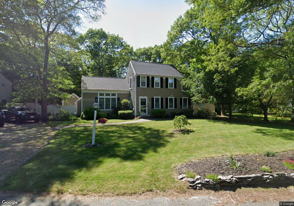
99 Capn Lijahs Rd Centerville, MA 02632
Centerville NeighborhoodEstimated Value: $588,000 - $624,000
2
Beds
2
Baths
1,394
Sq Ft
$435/Sq Ft
Est. Value
About This Home
This home is located at 99 Capn Lijahs Rd, Centerville, MA 02632 and is currently estimated at $606,078, approximately $434 per square foot. 99 Capn Lijahs Rd is a home located in Barnstable County with nearby schools including Centerville Elementary School, Barnstable United Elementary School, and Barnstable Intermediate School.
Ownership History
Date
Name
Owned For
Owner Type
Purchase Details
Closed on
Jan 26, 2018
Sold by
Shuman Jill M
Bought by
Huska Jeffrey D and Cole Hannah R
Current Estimated Value
Home Financials for this Owner
Home Financials are based on the most recent Mortgage that was taken out on this home.
Original Mortgage
$298,493
Outstanding Balance
$254,427
Interest Rate
4.25%
Mortgage Type
FHA
Estimated Equity
$351,651
Purchase Details
Closed on
Aug 30, 2005
Sold by
Fucillo Kevin M
Bought by
Shuman Jill M
Home Financials for this Owner
Home Financials are based on the most recent Mortgage that was taken out on this home.
Original Mortgage
$288,000
Interest Rate
5.68%
Mortgage Type
Purchase Money Mortgage
Purchase Details
Closed on
Aug 27, 1998
Sold by
Kitchen Lee E and Kitchen Janet F
Bought by
Fucillo Kevin M
Create a Home Valuation Report for This Property
The Home Valuation Report is an in-depth analysis detailing your home's value as well as a comparison with similar homes in the area
Home Values in the Area
Average Home Value in this Area
Purchase History
| Date | Buyer | Sale Price | Title Company |
|---|---|---|---|
| Huska Jeffrey D | $304,000 | -- | |
| Shuman Jill M | $360,000 | -- | |
| Fucillo Kevin M | $118,000 | -- |
Source: Public Records
Mortgage History
| Date | Status | Borrower | Loan Amount |
|---|---|---|---|
| Open | Huska Jeffrey D | $298,493 | |
| Previous Owner | Shuman Jill M | $288,000 | |
| Previous Owner | Shuman Jill M | $36,000 | |
| Previous Owner | Fucillo Kevin M | $145,000 | |
| Previous Owner | Fucillo Kevin M | $127,500 |
Source: Public Records
Tax History Compared to Growth
Tax History
| Year | Tax Paid | Tax Assessment Tax Assessment Total Assessment is a certain percentage of the fair market value that is determined by local assessors to be the total taxable value of land and additions on the property. | Land | Improvement |
|---|---|---|---|---|
| 2025 | $4,298 | $531,300 | $152,200 | $379,100 |
| 2024 | $3,756 | $480,900 | $152,200 | $328,700 |
| 2023 | $3,896 | $467,100 | $138,400 | $328,700 |
| 2022 | $3,699 | $383,700 | $102,500 | $281,200 |
| 2021 | $3,669 | $349,800 | $102,500 | $247,300 |
| 2020 | $3,407 | $310,900 | $102,500 | $208,400 |
| 2019 | $3,395 | $301,000 | $102,500 | $198,500 |
| 2018 | $3,146 | $280,400 | $107,900 | $172,500 |
| 2017 | $2,960 | $275,100 | $107,900 | $167,200 |
| 2016 | $3,007 | $275,900 | $108,700 | $167,200 |
| 2015 | $2,967 | $273,500 | $105,400 | $168,100 |
Source: Public Records
Map
Nearby Homes
- 900 Old Stage Rd
- 62 Three Ponds Dr
- 73 Tern Ln
- 66 Tern Ln
- 296 Buckskin Path
- 315 Prince Hinckley Rd
- 81 Monomoy Cir
- 87 Foxglove Rd
- 1044 Old Falmouth Rd
- 1028 Old Falmouth Rd
- 40 Appaloosa Way
- 21 Shannon Way
- 205 James Otis Rd
- 88 Joe Thompson Rd
- 74 Saddler Ln
- 80 Saddler Ln
- 16 Bridgets Path
- 50 Currycomb Cir
- 29 Summerwind Ln
- 149 Old Stage Rd
- 99 Capt Lijahs Rd
- 87 Capn Lijahs Rd
- 111 Capn Lijahs Rd
- 76 Patriot Way
- 98 Cap'N Lijah's Rd
- 98 Capn Lijahs Rd
- 98 Cap'N Lijahs Rd
- 108 Capn Lijahs Rd
- 108 Cap'N Lijah's Rd
- 64 Patriot Way
- 90 Patriot Way
- 121 Capn Lijahs Rd
- 77 Capn Lijahs Rd
- 118 Capn Lijahs Rd
- 118 Capt Lijahs
- 90 Capn Lijahs Rd
- 52 Patriot Way
- 73 Patriot Way
- 84 Capn Lijahs Rd
- 84 Captain Lijahs Rd