99 Clear Pond Dr Walpole, MA 02081
Estimated Value: $541,782 - $556,000
2
Beds
2
Baths
1,488
Sq Ft
$371/Sq Ft
Est. Value
About This Home
This home is located at 99 Clear Pond Dr, Walpole, MA 02081 and is currently estimated at $552,196, approximately $371 per square foot. 99 Clear Pond Dr is a home located in Norfolk County with nearby schools including Elm Street School, Eleanor N. Johnson Middle School, and Walpole High School.
Ownership History
Date
Name
Owned For
Owner Type
Purchase Details
Closed on
Nov 12, 2020
Sold by
Stephen & Susa Crump Ret
Bought by
Butler Tonya
Current Estimated Value
Home Financials for this Owner
Home Financials are based on the most recent Mortgage that was taken out on this home.
Original Mortgage
$375,250
Interest Rate
2.71%
Mortgage Type
Purchase Money Mortgage
Purchase Details
Closed on
May 21, 2018
Sold by
Crump Stephen W and Crump Susan T
Bought by
Stephen & S Crump Ret
Purchase Details
Closed on
Mar 25, 2016
Sold by
Affanato Theresa V Est
Bought by
Crump Stephen W and Crump Susan T
Purchase Details
Closed on
Oct 31, 1997
Sold by
Walpole Homes Lp
Bought by
Dobry Bradley M and Dobry Barbara M
Home Financials for this Owner
Home Financials are based on the most recent Mortgage that was taken out on this home.
Original Mortgage
$165,000
Interest Rate
7.31%
Mortgage Type
Purchase Money Mortgage
Create a Home Valuation Report for This Property
The Home Valuation Report is an in-depth analysis detailing your home's value as well as a comparison with similar homes in the area
Home Values in the Area
Average Home Value in this Area
Purchase History
| Date | Buyer | Sale Price | Title Company |
|---|---|---|---|
| Butler Tonya | $395,000 | None Available | |
| Stephen & S Crump Ret | -- | -- | |
| Crump Stephen W | $306,050 | -- | |
| Dobry Bradley M | $258,846 | -- |
Source: Public Records
Mortgage History
| Date | Status | Borrower | Loan Amount |
|---|---|---|---|
| Previous Owner | Butler Tonya | $375,250 | |
| Previous Owner | Dobry Barbara M | $156,000 | |
| Previous Owner | Dobry Bradley M | $165,000 |
Source: Public Records
Tax History Compared to Growth
Tax History
| Year | Tax Paid | Tax Assessment Tax Assessment Total Assessment is a certain percentage of the fair market value that is determined by local assessors to be the total taxable value of land and additions on the property. | Land | Improvement |
|---|---|---|---|---|
| 2025 | $6,223 | $485,000 | $0 | $485,000 |
| 2024 | $5,993 | $453,300 | $0 | $453,300 |
| 2023 | $5,502 | $396,100 | $0 | $396,100 |
| 2022 | $5,104 | $353,000 | $0 | $353,000 |
| 2021 | $5,354 | $360,800 | $0 | $360,800 |
| 2020 | $5,202 | $347,000 | $0 | $347,000 |
| 2019 | $4,889 | $323,800 | $0 | $323,800 |
| 2018 | $4,529 | $296,600 | $0 | $296,600 |
| 2017 | $4,414 | $287,900 | $0 | $287,900 |
| 2016 | $4,347 | $279,400 | $0 | $279,400 |
| 2015 | $4,093 | $260,700 | $0 | $260,700 |
| 2014 | $3,912 | $248,200 | $0 | $248,200 |
Source: Public Records
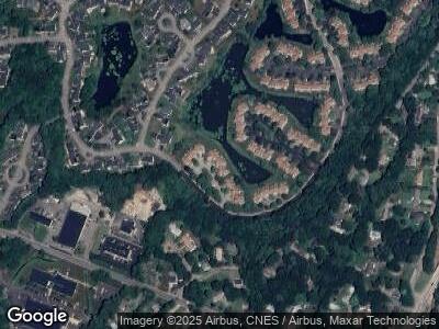
Map
Nearby Homes
- 30 Merganser Way
- 90 Allen St
- 11 Crane Rd
- 1188 Main St
- 66 Oak St
- 89 Lewis Ave
- 38 Riverside Place
- 11 South St
- 979 Main St Unit 6
- 979 Main St Unit 5
- 979 Main St Unit 4
- 979 Main St Unit 3
- 979 Main St Unit 2
- 979 Main St Unit 1
- 979 Main St Unit 8
- 224 School St Unit 4
- 115 Lincoln Rd
- 268 Common St
- 881 Main St Unit 4
- 57 Clapp St
- 95 Clear Pond Dr
- 97 Clear Pond Dr
- 99 Clear Pond Dr
- 101 Clear Pond Dr
- 103 Clear Pond Dr
- 99 Clear Pond Dr Unit 99
- 109 Clear Pond Dr
- 111 Clear Pond Dr
- 115 Clear Pond Dr
- 109 Clear Pond Dr Unit 6 31
- 85 Clear Pond Dr
- 87 Clear Pond Dr
- 89 Clear Pond Dr
- 91 Clear Pond Dr
- 87 Clear Pond Dr Unit 87
- 17 Merganser Way
- 18 Merganser Way
- 19 Merganser Way
- 20 Merganser Way
- 21 Merganser Way