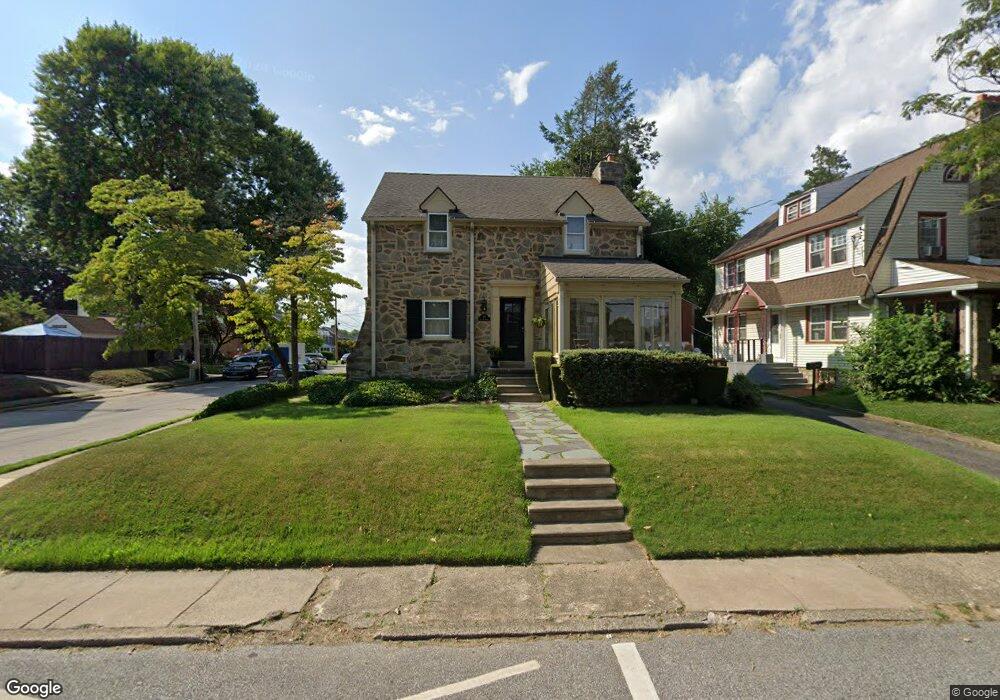
99 E Plumstead Ave Lansdowne, PA 19050
Estimated Value: $325,000 - $362,000
4
Beds
2
Baths
1,910
Sq Ft
$178/Sq Ft
Est. Value
About This Home
This home is located at 99 E Plumstead Ave, Lansdowne, PA 19050 and is currently estimated at $339,800, approximately $177 per square foot. 99 E Plumstead Ave is a home located in Delaware County with nearby schools including East Lansdowne Elementary School, Penn Wood Middle School, and Penn Wood High School - Cypress Street Campus.
Ownership History
Date
Name
Owned For
Owner Type
Purchase Details
Closed on
Sep 26, 2001
Sold by
Vitello Antonio S and Vitello Janet C
Bought by
Roeder Elizabeth G
Current Estimated Value
Home Financials for this Owner
Home Financials are based on the most recent Mortgage that was taken out on this home.
Original Mortgage
$124,200
Interest Rate
7.08%
Mortgage Type
Stand Alone First
Create a Home Valuation Report for This Property
The Home Valuation Report is an in-depth analysis detailing your home's value as well as a comparison with similar homes in the area
Home Values in the Area
Average Home Value in this Area
Purchase History
| Date | Buyer | Sale Price | Title Company |
|---|---|---|---|
| Roeder Elizabeth G | $138,000 | Fidelity National Title Ins |
Source: Public Records
Mortgage History
| Date | Status | Borrower | Loan Amount |
|---|---|---|---|
| Previous Owner | Roeder Elizabeth G | $124,200 |
Source: Public Records
Tax History Compared to Growth
Tax History
| Year | Tax Paid | Tax Assessment Tax Assessment Total Assessment is a certain percentage of the fair market value that is determined by local assessors to be the total taxable value of land and additions on the property. | Land | Improvement |
|---|---|---|---|---|
| 2025 | $7,784 | $189,060 | $44,330 | $144,730 |
| 2024 | $7,784 | $189,060 | $44,330 | $144,730 |
| 2023 | $7,421 | $189,060 | $44,330 | $144,730 |
| 2022 | $7,276 | $189,060 | $44,330 | $144,730 |
| 2021 | $10,925 | $189,060 | $44,330 | $144,730 |
| 2020 | $6,851 | $104,460 | $32,020 | $72,440 |
| 2019 | $6,736 | $104,460 | $32,020 | $72,440 |
| 2018 | $6,620 | $104,460 | $0 | $0 |
| 2017 | $6,474 | $104,460 | $0 | $0 |
| 2016 | $573 | $104,460 | $0 | $0 |
| 2015 | $585 | $104,460 | $0 | $0 |
| 2014 | $573 | $104,460 | $0 | $0 |
Source: Public Records
Map
Nearby Homes
- 53 E Essex Ave
- 88 E Essex Ave
- 15 E Albemarle Ave
- 239 N Maple Ave
- 164 Woodland Ave
- 291 N Wycombe Ave
- 341 Congress Ave
- 127 Sherbrook Blvd
- 345 Wayne Ave
- 351 Congress Ave
- 178 N Union Ave
- 243 Coverly Rd
- 1806 Garrett Rd
- 142 Springton Rd
- 339 Huntley Rd
- 149 Springton Rd
- 315 E Essex Ave
- 317 E Essex Ave
- 319 E Essex Ave
- 143 Springton Rd
- 107 E Plumstead Ave
- 85 E Plumstead Ave
- 251 Jackson Ave
- 111 E Plumstead Ave
- 81 E Plumstead Ave
- 292 Jackson Ave
- 286 Crawford Ave
- 291 Jackson Ave
- 247 Jackson Ave
- 86 E Plumstead Ave
- 254 Crawford Ave
- 290 Jackson Ave
- 79 E Plumstead Ave
- 293 Jackson Ave
- 290 Crawford Ave
- 250 Crawford Ave
- 82 E Plumstead Ave
- 294 Jackson Ave
- 289 Green Ave
- 243 Jackson Ave