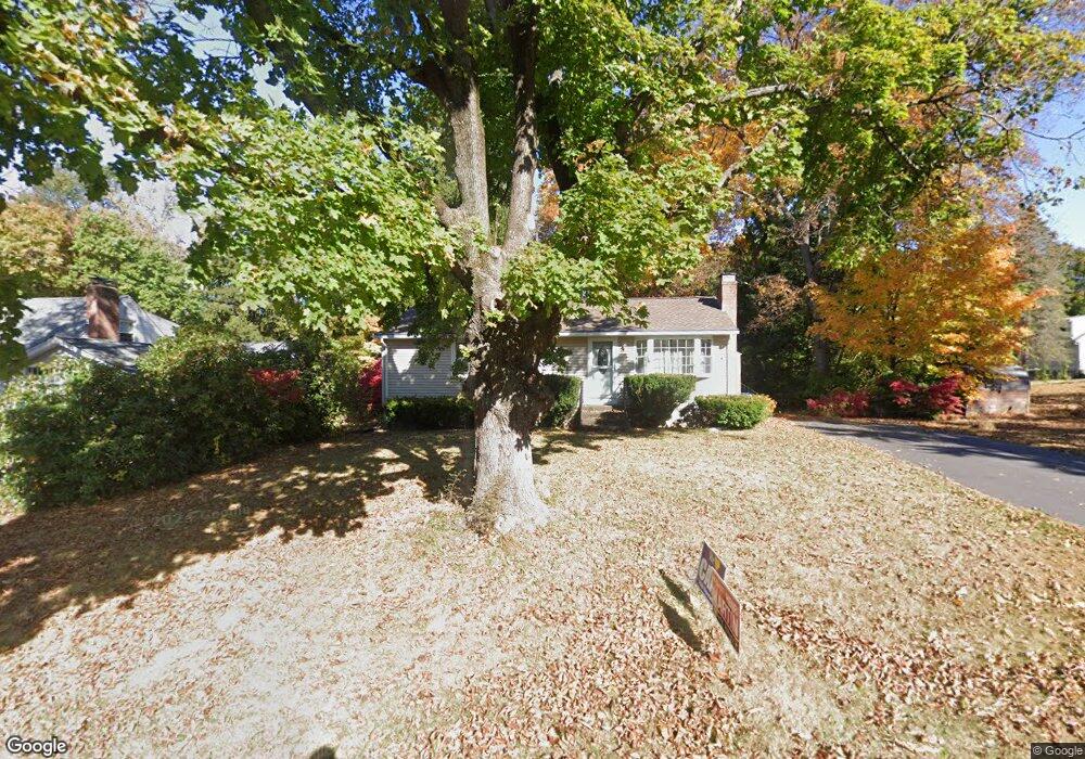
99 Gregory Rd Bristol, CT 06010
North Bristol NeighborhoodEstimated Value: $274,000 - $308,759
3
Beds
1
Bath
960
Sq Ft
$309/Sq Ft
Est. Value
About This Home
This home is located at 99 Gregory Rd, Bristol, CT 06010 and is currently estimated at $296,190, approximately $308 per square foot. 99 Gregory Rd is a home located in Hartford County with nearby schools including Ivy Drive School, Northeast Middle School, and Bristol Eastern High School.
Ownership History
Date
Name
Owned For
Owner Type
Purchase Details
Closed on
May 3, 2005
Sold by
Hennessey Stephen P and Hennessey Eleanor F
Bought by
Fitzgerald Jon P
Current Estimated Value
Home Financials for this Owner
Home Financials are based on the most recent Mortgage that was taken out on this home.
Original Mortgage
$142,300
Interest Rate
5.95%
Purchase Details
Closed on
Dec 19, 2000
Sold by
Dwinnells Altone E
Bought by
Hennessey Stephen P and Hennessey Eleanor F
Home Financials for this Owner
Home Financials are based on the most recent Mortgage that was taken out on this home.
Original Mortgage
$85,000
Interest Rate
7.7%
Create a Home Valuation Report for This Property
The Home Valuation Report is an in-depth analysis detailing your home's value as well as a comparison with similar homes in the area
Home Values in the Area
Average Home Value in this Area
Purchase History
| Date | Buyer | Sale Price | Title Company |
|---|---|---|---|
| Fitzgerald Jon P | $177,900 | -- | |
| Hennessey Stephen P | $115,000 | -- |
Source: Public Records
Mortgage History
| Date | Status | Borrower | Loan Amount |
|---|---|---|---|
| Open | Hennessey Stephen P | $117,000 | |
| Closed | Hennessey Stephen P | $142,300 | |
| Previous Owner | Hennessey Stephen P | $85,000 | |
| Previous Owner | Hennessey Stephen P | $85,000 |
Source: Public Records
Tax History
| Year | Tax Paid | Tax Assessment Tax Assessment Total Assessment is a certain percentage of the fair market value that is determined by local assessors to be the total taxable value of land and additions on the property. | Land | Improvement |
|---|---|---|---|---|
| 2025 | $5,105 | $151,270 | $48,160 | $103,110 |
| 2024 | $4,818 | $151,270 | $48,160 | $103,110 |
| 2023 | $4,591 | $151,270 | $48,160 | $103,110 |
| 2022 | $4,180 | $108,990 | $39,130 | $69,860 |
| 2021 | $4,180 | $108,990 | $39,130 | $69,860 |
| 2020 | $4,180 | $108,990 | $39,130 | $69,860 |
| 2019 | $4,147 | $108,990 | $39,130 | $69,860 |
| 2018 | $4,020 | $108,990 | $39,130 | $69,860 |
| 2017 | $3,980 | $110,460 | $44,730 | $65,730 |
| 2016 | $3,980 | $110,460 | $44,730 | $65,730 |
| 2015 | $3,823 | $110,460 | $44,730 | $65,730 |
| 2014 | $3,823 | $110,460 | $44,730 | $65,730 |
Source: Public Records
Map
Nearby Homes
- 97 Jacqueline Dr
- 162 Ben St
- 3 Sandra St
- 35 Jasmine St
- 1325 Farmington Ave Unit 52
- 1325 Farmington Ave Unit 54
- 14 Bridgeport Ave
- 1469 Farmington Ave Unit 56
- 1469 Farmington Ave Unit 40
- 55 Beths Ave Unit 77
- 941 Farmington Ave
- 131 Mountain View Ave
- 20 Westchester Dr
- 101 Vincent Rd
- 169 Morningside Dr E
- 25 Sheffield Ln
- 179 Mark St
- 186 Stevens St
- 64 Fanway Ave
- 206 Burton St
- 91 Gregory Rd
- 83 Gregory Rd
- 98 Gregory Rd
- 90 Gregory Rd
- 227 Shagbark Dr
- 235 Shagbark Dr
- 82 Gregory Rd
- 243 Shagbark Dr
- 75 Gregory Rd
- 219 Shagbark Dr
- 211 Shagbark Dr
- 253 Shagbark Dr
- 74 Gregory Rd
- 64 Rosemary Ln
- 80 Rosemary Ln
- 67 Gregory Rd
- 228 Shagbark Dr
- 72 Rosemary Ln
- 236 Shagbark Dr
- 203 Shagbark Dr
Your Personal Tour Guide
Ask me questions while you tour the home.