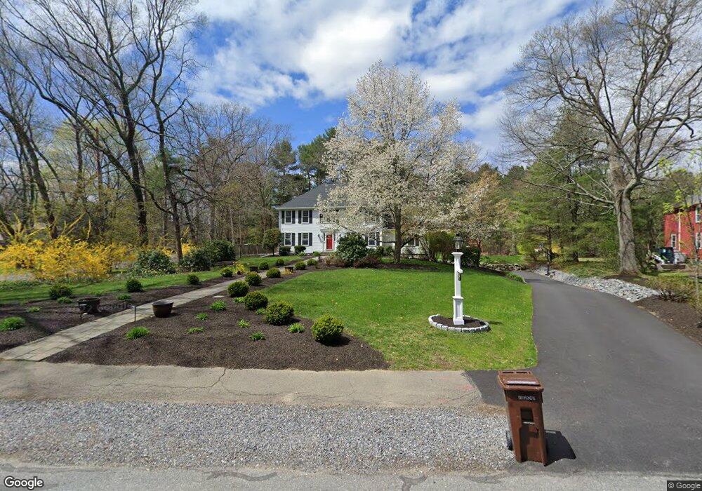
99 Shadow Oak Dr Sudbury, MA 01776
Estimated Value: $1,348,000 - $1,647,000
4
Beds
3
Baths
2,985
Sq Ft
$495/Sq Ft
Est. Value
About This Home
This home is located at 99 Shadow Oak Dr, Sudbury, MA 01776 and is currently estimated at $1,476,107, approximately $494 per square foot. 99 Shadow Oak Dr is a home located in Middlesex County with nearby schools including Israel Loring Elementary School, Ephraim Curtis Middle School, and Lincoln-Sudbury Regional High School.
Ownership History
Date
Name
Owned For
Owner Type
Purchase Details
Closed on
Feb 27, 2012
Sold by
Stern Leslie E
Bought by
Klappenbach Joel A and Klappenbach Rebecca
Current Estimated Value
Home Financials for this Owner
Home Financials are based on the most recent Mortgage that was taken out on this home.
Original Mortgage
$525,000
Outstanding Balance
$360,982
Interest Rate
3.89%
Mortgage Type
Purchase Money Mortgage
Estimated Equity
$1,115,125
Purchase Details
Closed on
Dec 1, 1989
Sold by
Albano Dennis A
Bought by
Freund Mitchell D
Create a Home Valuation Report for This Property
The Home Valuation Report is an in-depth analysis detailing your home's value as well as a comparison with similar homes in the area
Home Values in the Area
Average Home Value in this Area
Purchase History
| Date | Buyer | Sale Price | Title Company |
|---|---|---|---|
| Klappenbach Joel A | $772,000 | -- | |
| Freund Mitchell D | $472,500 | -- | |
| Freund Mitchell D | $472,500 | -- |
Source: Public Records
Mortgage History
| Date | Status | Borrower | Loan Amount |
|---|---|---|---|
| Open | Klappenbach Joel A | $525,000 | |
| Closed | Freund Mitchell D | $525,000 | |
| Previous Owner | Freund Mitchell D | $100,000 | |
| Previous Owner | Freund Mitchell D | $100,000 |
Source: Public Records
Tax History Compared to Growth
Tax History
| Year | Tax Paid | Tax Assessment Tax Assessment Total Assessment is a certain percentage of the fair market value that is determined by local assessors to be the total taxable value of land and additions on the property. | Land | Improvement |
|---|---|---|---|---|
| 2025 | $19,259 | $1,315,500 | $546,800 | $768,700 |
| 2024 | $18,561 | $1,270,400 | $530,800 | $739,600 |
| 2023 | $17,191 | $1,090,100 | $474,000 | $616,100 |
| 2022 | $16,990 | $941,300 | $434,800 | $506,500 |
| 2021 | $16,184 | $859,500 | $434,800 | $424,700 |
| 2020 | $15,858 | $859,500 | $434,800 | $424,700 |
| 2019 | $15,394 | $859,500 | $434,800 | $424,700 |
| 2018 | $15,241 | $850,000 | $462,400 | $387,600 |
| 2017 | $14,935 | $841,900 | $458,000 | $383,900 |
| 2016 | $14,473 | $813,100 | $440,400 | $372,700 |
| 2015 | $14,110 | $801,700 | $436,400 | $365,300 |
| 2014 | $14,110 | $782,600 | $424,800 | $357,800 |
Source: Public Records
Map
Nearby Homes
- 63 Landham Rd
- 0 Wagonwheel Rd
- 216 Landham Rd
- 84 Hopestill Brown Rd
- 6 Old County Rd Unit 16
- 30 Edith Rd
- 353 Old Connecticut Path
- 8 Clara Rd
- 94 Goodmans Hill Rd
- 23 Massasoit Ave
- 24 Pinewood Dr
- 29 Derby St
- 81 Nicholas Rd Unit B
- 71 Nicholas Rd Unit H
- 454 Old Connecticut Path
- 14 Francine Rd
- 36 Concord Rd
- 154 Danforth St
- 19 Park Ave
- 96 Lakeshore Dr
- 95 Shadow Oak Dr
- 79 Stock Farm Rd
- 88 Stock Farm Rd
- 87 Stock Farm Rd
- 71 Stock Farm Rd
- 89 Shadow Oak Dr
- 68 Stock Farm Rd
- 91 Stock Farm Rd
- 96 Stock Farm Rd
- 92 Shadow Oak Dr
- 54 Kay St
- 81 Shadow Oak Dr
- 63 Stock Farm Rd
- 62 Stock Farm Rd
- 7 Shadow Oak Dr
- 85 Brookdale Rd
- 80 Shadow Oak Dr
- 48 Kay St
- 15 Shadow Oak Dr
- 75 Shadow Oak Dr