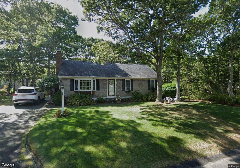
99 Whittier Dr Dennis, MA 02638
Dennis Village NeighborhoodEstimated Value: $667,000 - $708,000
3
Beds
2
Baths
1,144
Sq Ft
$604/Sq Ft
Est. Value
About This Home
This home is located at 99 Whittier Dr, Dennis, MA 02638 and is currently estimated at $691,270, approximately $604 per square foot. 99 Whittier Dr is a home located in Barnstable County with nearby schools including Dennis-Yarmouth Regional High School and St. Pius X. School.
Ownership History
Date
Name
Owned For
Owner Type
Purchase Details
Closed on
Nov 2, 2010
Sold by
Individual Lt and Hanks John N
Bought by
Mayo Amanda Jean and Drozell Stephan H
Current Estimated Value
Home Financials for this Owner
Home Financials are based on the most recent Mortgage that was taken out on this home.
Original Mortgage
$261,478
Outstanding Balance
$173,397
Interest Rate
4.37%
Mortgage Type
FHA
Estimated Equity
$517,873
Create a Home Valuation Report for This Property
The Home Valuation Report is an in-depth analysis detailing your home's value as well as a comparison with similar homes in the area
Home Values in the Area
Average Home Value in this Area
Purchase History
| Date | Buyer | Sale Price | Title Company |
|---|---|---|---|
| Mayo Amanda Jean | $265,000 | -- |
Source: Public Records
Mortgage History
| Date | Status | Borrower | Loan Amount |
|---|---|---|---|
| Open | Mayo Amanda Jean | $261,478 |
Source: Public Records
Tax History Compared to Growth
Tax History
| Year | Tax Paid | Tax Assessment Tax Assessment Total Assessment is a certain percentage of the fair market value that is determined by local assessors to be the total taxable value of land and additions on the property. | Land | Improvement |
|---|---|---|---|---|
| 2025 | $2,586 | $597,300 | $181,600 | $415,700 |
| 2024 | $2,509 | $571,500 | $183,000 | $388,500 |
| 2023 | $2,427 | $519,600 | $166,300 | $353,300 |
| 2022 | $2,230 | $398,200 | $136,200 | $262,000 |
| 2021 | $2,118 | $351,200 | $133,500 | $217,700 |
| 2020 | $2,020 | $331,100 | $133,500 | $197,600 |
| 2019 | $1,974 | $320,000 | $144,000 | $176,000 |
| 2018 | $1,808 | $285,100 | $124,600 | $160,500 |
| 2017 | $1,722 | $280,000 | $124,600 | $155,400 |
| 2016 | $1,884 | $288,500 | $155,800 | $132,700 |
| 2015 | $1,846 | $288,500 | $155,800 | $132,700 |
| 2014 | $1,634 | $257,300 | $124,600 | $132,700 |
Source: Public Records
Map
Nearby Homes
- 268 Main St
- 6 Thomas Ct
- 15 Signal Hill Dr
- 59 Main St Unit 19-2
- 59 Route 6a Unit 29-4
- 35 Crown Grant Dr
- 59 Massachusetts 6a Unit 19-2
- 51 Bray Farm Rd N
- 645 Main St Back Lot
- 6 Nimble Hill Dr
- 13 Covey Dr
- 19 Deacon Joseph Ln
- 831 Main St
- 19 Whig St
- 32 Captain Walsh Dr
- 59 Hope Ln
- 50 John Hall Cartway
- 50 John Hall Cartway Unit 50
- 64 Kates Path
- 4 Ebb Rd
- 66 Longfellow Dr
- 98 Whittier Dr
- 91 Whittier Dr
- 104 Whittier Dr
- 92 Whittier Dr
- 63 Longfellow Dr
- 58 Longfellow Dr
- 14 North St
- 16 Run Pond Rd
- 59 Longfellow Dr
- 39 Apple Ln
- 22 Run Pond Rd
- 86 Whittier Dr
- 6 Billingsgate Dr
- 6 Billingsgate Rd
- 81 Whittier Dr
- 66 Southwest Dr
- 62 S West Dr
- 12 Billingsgate Rd
- 42 Apple Ln