Estimated Value: $55,972 - $166,000
Studio
1
Bath
1,444
Sq Ft
$77/Sq Ft
Est. Value
About This Home
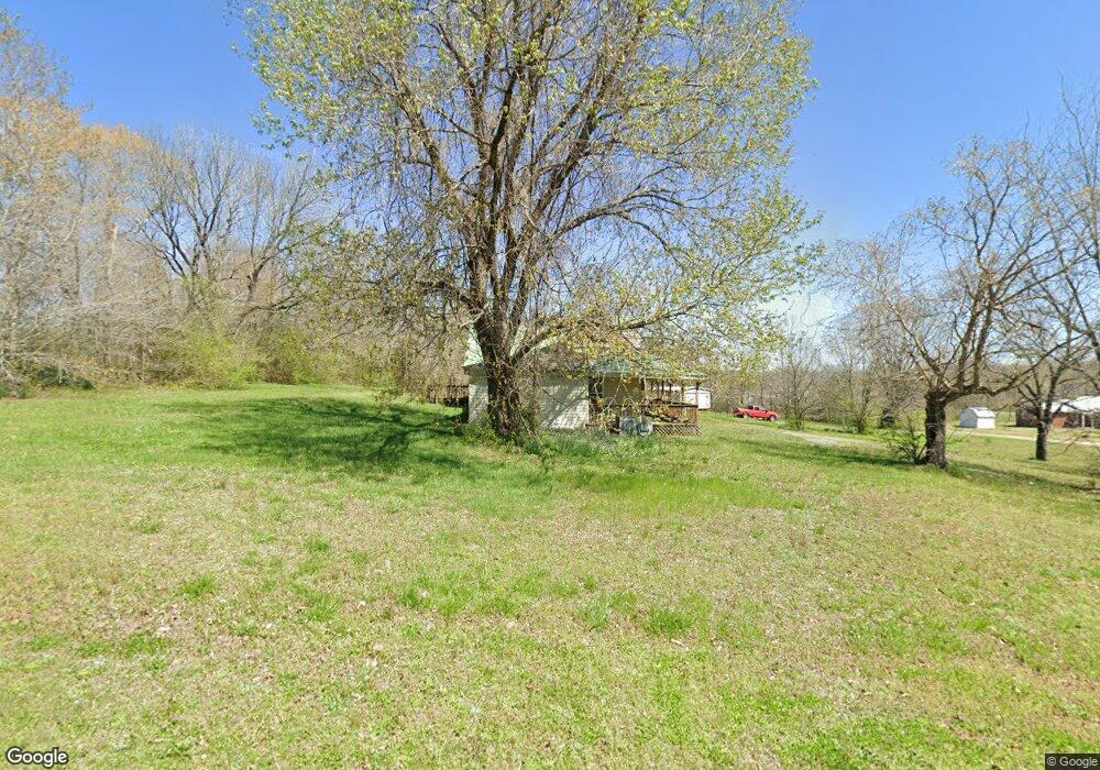
This home is located at 990 Huron Rd, Huron, TN 38345 and is currently estimated at $110,493, approximately $76 per square foot. 990 Huron Rd is a home located in Henderson County.
Ownership History
Date
Name
Owned For
Owner Type
Purchase Details
Closed on
Dec 29, 2003
Sold by
Conseco Finance Servicing
Bought by
Lipscomb Jonathan W
Current Estimated Value
Home Financials for this Owner
Home Financials are based on the most recent Mortgage that was taken out on this home.
Original Mortgage
$28,260
Interest Rate
5.82%
Purchase Details
Closed on
Jun 23, 2003
Bought by
Conseco Finance Servicing Corp
Purchase Details
Closed on
Sep 15, 1978
Bought by
Phillips Phillips J and Phillips Carrie M
Create a Home Valuation Report for This Property
The Home Valuation Report is an in-depth analysis detailing your home's value as well as a comparison with similar homes in the area
Purchase History
| Date | Buyer | Sale Price | Title Company |
|---|---|---|---|
| Lipscomb Jonathan W | $29,900 | -- | |
| Conseco Finance Servicing Corp | $61,900 | -- | |
| Phillips Phillips J | -- | -- |
Source: Public Records
Mortgage History
| Date | Status | Borrower | Loan Amount |
|---|---|---|---|
| Closed | Phillips Phillips J | $28,260 |
Source: Public Records
Tax History
| Year | Tax Paid | Tax Assessment Tax Assessment Total Assessment is a certain percentage of the fair market value that is determined by local assessors to be the total taxable value of land and additions on the property. | Land | Improvement |
|---|---|---|---|---|
| 2025 | $91 | $5,775 | $2,025 | $3,750 |
| 2024 | $91 | $5,775 | $2,025 | $3,750 |
| 2023 | $91 | $5,775 | $2,025 | $3,750 |
| 2022 | $87 | $3,675 | $1,500 | $2,175 |
| 2021 | $87 | $3,675 | $1,500 | $2,175 |
| 2020 | $87 | $3,675 | $1,500 | $2,175 |
| 2019 | $87 | $3,675 | $1,500 | $2,175 |
| 2018 | $84 | $3,675 | $1,500 | $2,175 |
| 2017 | $84 | $3,675 | $1,500 | $2,175 |
| 2016 | $238 | $10,000 | $2,375 | $7,625 |
| 2015 | $238 | $10,000 | $2,375 | $7,625 |
| 2014 | $238 | $10,005 | $0 | $0 |
Source: Public Records
Map
Nearby Homes
- Highway 200
- 0 Tennessee 200
- 0 Tennessee 200
- 3955 Tennessee 200
- 96 Tennessee 200
- 4295 Tennessee 200
- 0 Mills Darden Rd
- 235 Mallard Ln
- 5035 Tennessee 200
- 5407 Highway 200
- 000 Moonshine Loop
- 00 Moonshine Loop
- 00 Moonshine Loop
- 900 Hubberd Town Rd
- 00 Cider Way
- 000 Moonshine Rd
- 0 Cider Way
- 592 Hubberd Town Rd
- 715 Roundtree Ln
- 0 Sand Ridge Ln
Your Personal Tour Guide
Ask me questions while you tour the home.