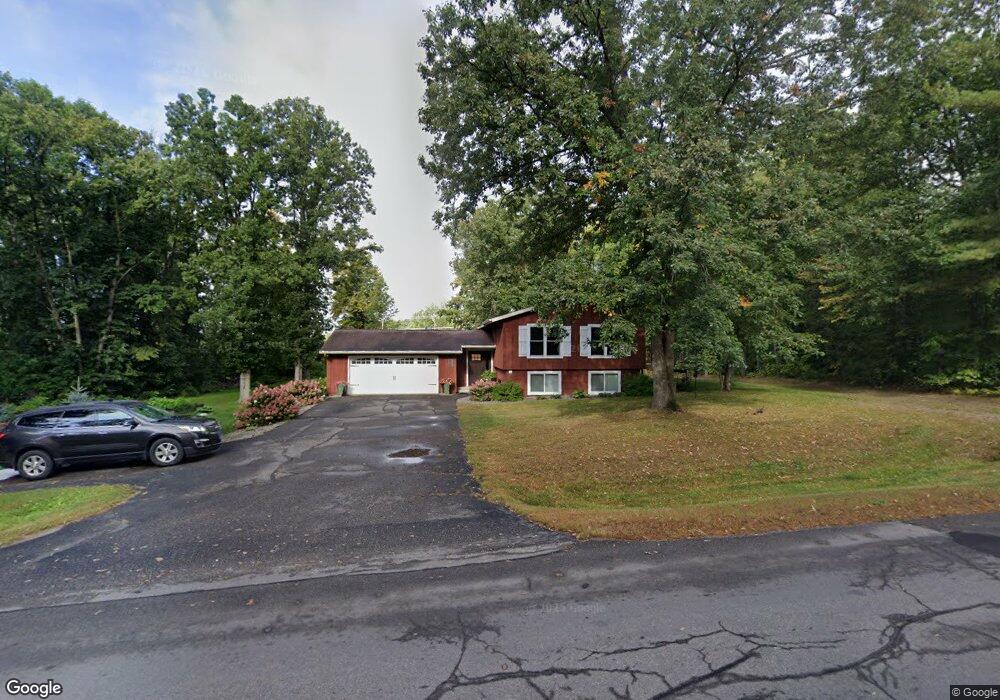
990 Range Line Rd Grand Rapids, MN 55744
Estimated Value: $272,000 - $322,000
2
Beds
1
Bath
1,079
Sq Ft
$278/Sq Ft
Est. Value
About This Home
This home is located at 990 Range Line Rd, Grand Rapids, MN 55744 and is currently estimated at $300,314, approximately $278 per square foot. 990 Range Line Rd is a home located in Itasca County with nearby schools including Forest Lake Elementary School, Robert J. Elkington Middle School, and Grand Rapids Senior High School.
Ownership History
Date
Name
Owned For
Owner Type
Purchase Details
Closed on
Aug 31, 2017
Sold by
Eichorn Mitchell D and Eichorn Debra K
Bought by
Rude Jay and Rude Shawnna
Current Estimated Value
Home Financials for this Owner
Home Financials are based on the most recent Mortgage that was taken out on this home.
Original Mortgage
$207,100
Outstanding Balance
$170,581
Interest Rate
3.93%
Mortgage Type
New Conventional
Estimated Equity
$129,733
Purchase Details
Closed on
Nov 10, 2016
Sold by
Affinity Plus Federal Credit Union
Bought by
Eichorn Mitchell D and Eichorn Debra K
Purchase Details
Closed on
Aug 4, 2011
Sold by
Cook Mark W and Cook Susan
Bought by
Cook David M and Cook Bobbi Jo
Home Financials for this Owner
Home Financials are based on the most recent Mortgage that was taken out on this home.
Original Mortgage
$115,200
Interest Rate
4.4%
Mortgage Type
New Conventional
Create a Home Valuation Report for This Property
The Home Valuation Report is an in-depth analysis detailing your home's value as well as a comparison with similar homes in the area
Home Values in the Area
Average Home Value in this Area
Purchase History
| Date | Buyer | Sale Price | Title Company |
|---|---|---|---|
| Rude Jay | $218,000 | None Available | |
| Eichorn Mitchell D | -- | None Available | |
| Cook David M | $128,000 | Affinity Plus Title Company |
Source: Public Records
Mortgage History
| Date | Status | Borrower | Loan Amount |
|---|---|---|---|
| Open | Rude Jay | $207,100 | |
| Previous Owner | Cook David M | $115,200 |
Source: Public Records
Tax History
| Year | Tax Paid | Tax Assessment Tax Assessment Total Assessment is a certain percentage of the fair market value that is determined by local assessors to be the total taxable value of land and additions on the property. | Land | Improvement |
|---|---|---|---|---|
| 2024 | $1,934 | $243,300 | $60,000 | $183,300 |
| 2023 | $1,934 | $243,000 | $59,700 | $183,300 |
| 2022 | $1,848 | $226,000 | $58,400 | $167,600 |
| 2021 | $1,740 | $176,700 | $52,400 | $124,300 |
| 2020 | $1,418 | $176,700 | $52,400 | $124,300 |
| 2019 | $1,294 | $143,800 | $57,000 | $86,800 |
| 2018 | $1,136 | $141,800 | $55,000 | $86,800 |
| 2017 | $1,560 | $0 | $0 | $0 |
| 2016 | $930 | $0 | $0 | $0 |
| 2015 | $906 | $0 | $0 | $0 |
| 2014 | -- | $0 | $0 | $0 |
Source: Public Records
Map
Nearby Homes
- 24673 County Road 76
- 35761 Lake St
- 901 NW 9th St
- 2XXX SW 8th St
- TBD SW 22nd Ave
- 2005 Knollwood Dr
- TBD Knollwood Dr
- 60 Polk St
- 523 NW 6th Ave
- 618 NW 5th Ave
- 729 NW 3rd Ave
- 1323 Golf Course Rd
- 100 NW 10th St
- 816 N Pokegama Ave
- 120 NE 14th St
- 1005 Horseshoe Lake Rd
- 318 SW 3rd Ave
- TBD County Road 60
- 209 NE 8th St
- TBD SW 8th St
- 990 990 Rangeline Rd
- TBD W Hwy 2
- 803 Range Line Rd
- 809 809 Rangeline-Road-
- 809 809 Rangeline Rd
- 809 Range Line Rd
- 2920 Deschepper Dr
- 3101 Alice St
- 1002 Range Line Rd
- 1001 Range Line Rd
- 3001 Elida Dr
- 2907 Alice St
- 2921 Deschepper Dr
- 2908 Deschepper Dr
- 1005 Range Line Rd
- 2907 Elida Dr
- 1007 Range Line Rd
- 2906 Alice St
- 2905 Alice St
- 2906 Deschepper Dr
Your Personal Tour Guide
Ask me questions while you tour the home.