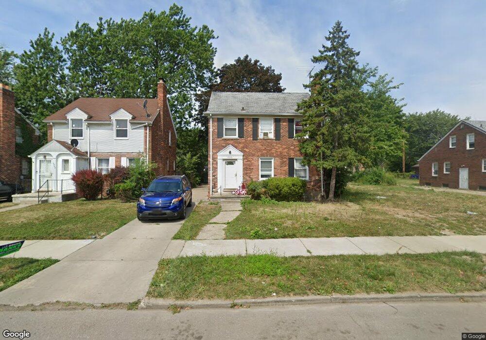
9905 Balfour Rd Detroit, MI 48224
Outer Drive-Hayes NeighborhoodEstimated Value: $78,076 - $118,000
3
Beds
1
Bath
1,597
Sq Ft
$60/Sq Ft
Est. Value
About This Home
This home is located at 9905 Balfour Rd, Detroit, MI 48224 and is currently estimated at $96,269, approximately $60 per square foot. 9905 Balfour Rd is a home located in Wayne County with nearby schools including Wayne Elementary School, Edward 'Duke' Ellington Conservatory of Music and Art, and Charles L. Spain Elementary-Middle School.
Ownership History
Date
Name
Owned For
Owner Type
Purchase Details
Closed on
Aug 8, 2023
Sold by
Orange Emerald Llc
Bought by
Lhg Real Estate Llc
Current Estimated Value
Purchase Details
Closed on
Sep 25, 2019
Sold by
Detroit Land Holdings Corp
Bought by
Orange Emerald Llc
Purchase Details
Closed on
Aug 16, 2019
Sold by
Johnson Ruthie M
Bought by
Detroit Land Holdings Corp
Purchase Details
Closed on
Aug 9, 2018
Sold by
Sturdivant Tanina M
Bought by
Anthony Marcus
Create a Home Valuation Report for This Property
The Home Valuation Report is an in-depth analysis detailing your home's value as well as a comparison with similar homes in the area
Home Values in the Area
Average Home Value in this Area
Purchase History
| Date | Buyer | Sale Price | Title Company |
|---|---|---|---|
| Lhg Real Estate Llc | $60,000 | None Listed On Document | |
| Orange Emerald Llc | $67,200 | Embassy Title Agency | |
| Detroit Land Holdings Corp | $28,000 | None Available | |
| Anthony Marcus | $16,160 | None Available |
Source: Public Records
Tax History Compared to Growth
Tax History
| Year | Tax Paid | Tax Assessment Tax Assessment Total Assessment is a certain percentage of the fair market value that is determined by local assessors to be the total taxable value of land and additions on the property. | Land | Improvement |
|---|---|---|---|---|
| 2025 | $2,954 | $42,600 | $0 | $0 |
| 2024 | $2,954 | $35,900 | $0 | $0 |
| 2023 | $1,806 | $28,600 | $0 | $0 |
| 2022 | $1,934 | $23,700 | $0 | $0 |
| 2021 | $1,878 | $19,500 | $0 | $0 |
| 2020 | $1,877 | $18,500 | $0 | $0 |
| 2019 | $1,144 | $15,600 | $0 | $0 |
| 2018 | $979 | $13,200 | $0 | $0 |
| 2017 | $233 | $12,300 | $0 | $0 |
| 2016 | $1,344 | $18,400 | $0 | $0 |
| 2015 | $1,840 | $18,400 | $0 | $0 |
| 2013 | $2,549 | $25,488 | $0 | $0 |
| 2010 | -- | $37,369 | $1,293 | $36,076 |
Source: Public Records
Map
Nearby Homes
- 9899 Balfour Rd
- 9910 Somerset Ave
- 10029 Balfour Rd
- 9265 Bedford St
- 9316 Mckinney St
- 10172 Somerset Ave
- 9300 Mckinney St
- 10326 Beaconsfield St
- 9344 Courville St
- 15925 Evanston St
- 15837 Evanston St
- 9200 King Richard St
- 9210 King Richard St
- 10345 Greensboro St
- 9205 Mckinney St
- 9610 Whittier St
- 9803 Nottingham Rd
- 10366 Roxbury St
- 10336 Roxbury St
- 10415 Roxbury St
- 9913 Balfour Rd
- 9919 Balfour Rd
- 9891 Balfour Rd
- 9881 Balfour Rd
- 9931 Balfour Rd
- 10000 Somerset Ave
- 9996 Somerset Ave
- 9875 Balfour Rd
- 10010 Somerset Ave
- 10020 Somerset Ave
- 10016 Somerset Ave
- 9900 Balfour Rd
- 9908 Balfour Rd
- 9980 Somerset Ave
- 9894 Balfour Rd
- 9916 Balfour Rd
- 9888 Balfour Rd
- 9945 Balfour Rd
- 10026 Somerset Ave
- 9920 Balfour Rd