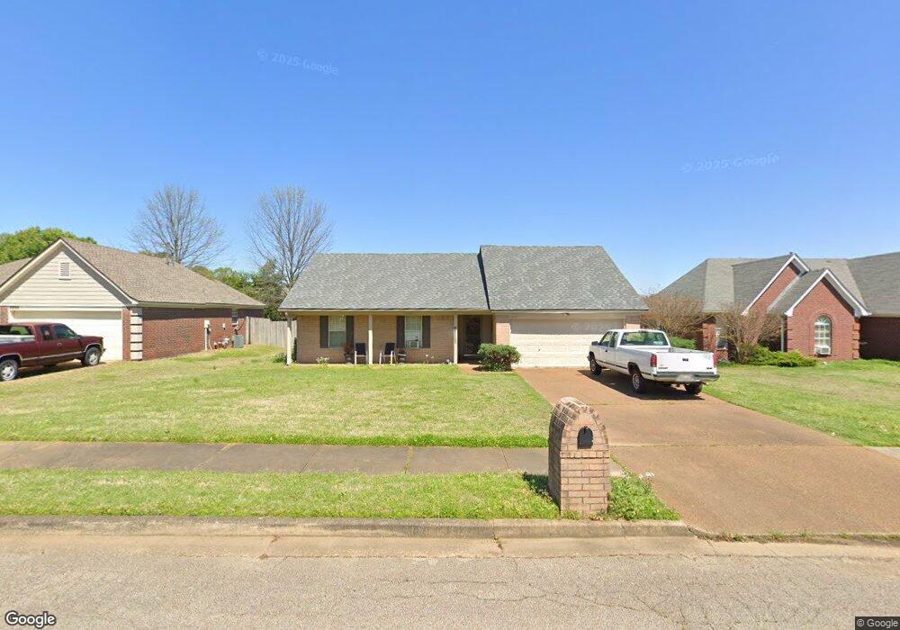
9910 Allen Pkwy S Olive Branch, MS 38654
Estimated Value: $232,000 - $250,000
3
Beds
2
Baths
1,288
Sq Ft
$187/Sq Ft
Est. Value
About This Home
This home is located at 9910 Allen Pkwy S, Olive Branch, MS 38654 and is currently estimated at $240,303, approximately $186 per square foot. 9910 Allen Pkwy S is a home located in DeSoto County with nearby schools including Olive Branch Elementary School, Chickasaw Elementary School, and Olive Branch Middle School.
Ownership History
Date
Name
Owned For
Owner Type
Purchase Details
Closed on
May 27, 2010
Sold by
Adams Scarlett C and Edwards Scarlett C
Bought by
Hamblin James W
Current Estimated Value
Home Financials for this Owner
Home Financials are based on the most recent Mortgage that was taken out on this home.
Original Mortgage
$122,878
Outstanding Balance
$82,595
Interest Rate
5.03%
Mortgage Type
FHA
Estimated Equity
$157,708
Create a Home Valuation Report for This Property
The Home Valuation Report is an in-depth analysis detailing your home's value as well as a comparison with similar homes in the area
Home Values in the Area
Average Home Value in this Area
Purchase History
| Date | Buyer | Sale Price | Title Company |
|---|---|---|---|
| Hamblin James W | -- | Realty Title |
Source: Public Records
Mortgage History
| Date | Status | Borrower | Loan Amount |
|---|---|---|---|
| Open | Hamblin James W | $122,878 |
Source: Public Records
Tax History Compared to Growth
Tax History
| Year | Tax Paid | Tax Assessment Tax Assessment Total Assessment is a certain percentage of the fair market value that is determined by local assessors to be the total taxable value of land and additions on the property. | Land | Improvement |
|---|---|---|---|---|
| 2024 | $1,436 | $10,523 | $2,500 | $8,023 |
| 2023 | $1,436 | $10,523 | $0 | $0 |
| 2022 | $1,436 | $10,518 | $2,500 | $8,018 |
| 2021 | $1,436 | $10,518 | $2,500 | $8,018 |
| 2020 | $1,348 | $9,877 | $2,500 | $7,377 |
| 2019 | $1,348 | $9,877 | $2,500 | $7,377 |
| 2017 | $1,332 | $16,920 | $9,710 | $7,210 |
| 2016 | $1,332 | $9,710 | $2,500 | $7,210 |
| 2015 | $1,332 | $16,920 | $9,710 | $7,210 |
| 2014 | $1,378 | $10,047 | $0 | $0 |
| 2013 | $1,338 | $10,047 | $0 | $0 |
Source: Public Records
Map
Nearby Homes
- 6041 Allen Pkwy W
- 9821 Morgan Manor Dr
- 9800 Cherokee Dr
- 9919 Adina Cove
- 9759 Pigeon Roost Park Cir
- 5676 Southbend Ln
- 10227 Williford Dr
- 10082 Lacey Dr
- 10475 Courtney Cove
- 10155 Riggan Dr
- 5619 Eagleston Dr
- 9745 Riggan Dr
- 5295 Blocker St
- 10101 Stephenson Ln
- 5648 Blocker St
- 5841 Blocker St
- 6825 Charlotte Dr
- 9270 College St
- 10335 Yates Dr
- 10625 Kristen Dr
- 9922 Allen Pkwy S
- 9903 Allen Pkwy N
- 9934 Allen Pkwy S
- 9886 Allen Pkwy S
- 9891 Allen Pkwy N
- 6034 Oak Ridge Dr
- 9927 Allen Pkwy N
- 9915 Allen Pkwy N
- 6031 Robby Cove
- 9946 Allen Pkwy S
- 9874 Allen Pkwy S
- 9879 Allen Pkwy N
- 6073 Allen Pkwy E
- 6033 Oak Ridge Dr
- 6020 Oak Ridge Dr
- 9906 Allen Pkwy N
- 9867 Allen Pkwy N
- 9918 Allen Pkwy N
- 9935 Highway Unit 178
- 9862 Allen Pkwy S