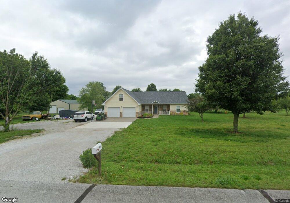
9915 County Lane 116 Carthage, MO 64836
Estimated Value: $298,000 - $383,000
4
Beds
3
Baths
2,166
Sq Ft
$157/Sq Ft
Est. Value
About This Home
This home is located at 9915 County Lane 116, Carthage, MO 64836 and is currently estimated at $339,276, approximately $156 per square foot. 9915 County Lane 116 is a home located in Jasper County with nearby schools including Carthage High School, Victory Academy, and St. Ann's Catholic School.
Ownership History
Date
Name
Owned For
Owner Type
Purchase Details
Closed on
Aug 15, 2016
Sold by
Long Brandon and Long Akeshia
Bought by
Mcguire Kelby and Mcguire Petra
Current Estimated Value
Purchase Details
Closed on
May 18, 2005
Sold by
Mccormick Dorman D and Mccormick Georgia M
Bought by
Long Brandon and Long Akeshia
Home Financials for this Owner
Home Financials are based on the most recent Mortgage that was taken out on this home.
Original Mortgage
$10,800
Interest Rate
5.92%
Mortgage Type
Unknown
Create a Home Valuation Report for This Property
The Home Valuation Report is an in-depth analysis detailing your home's value as well as a comparison with similar homes in the area
Home Values in the Area
Average Home Value in this Area
Purchase History
| Date | Buyer | Sale Price | Title Company |
|---|---|---|---|
| Mcguire Kelby | -- | None Available | |
| Long Brandon | -- | -- |
Source: Public Records
Mortgage History
| Date | Status | Borrower | Loan Amount |
|---|---|---|---|
| Previous Owner | Long Brandon | $10,800 |
Source: Public Records
Tax History Compared to Growth
Tax History
| Year | Tax Paid | Tax Assessment Tax Assessment Total Assessment is a certain percentage of the fair market value that is determined by local assessors to be the total taxable value of land and additions on the property. | Land | Improvement |
|---|---|---|---|---|
| 2024 | $1,527 | $32,640 | $3,780 | $28,860 |
| 2023 | $1,527 | $32,640 | $3,780 | $28,860 |
| 2022 | $1,519 | $32,590 | $3,780 | $28,810 |
| 2021 | $1,501 | $32,590 | $3,780 | $28,810 |
| 2020 | $1,440 | $30,050 | $3,780 | $26,270 |
| 2019 | $1,443 | $30,050 | $3,780 | $26,270 |
| 2018 | $1,370 | $28,570 | $0 | $0 |
| 2017 | $1,374 | $28,570 | $0 | $0 |
| 2016 | $1,434 | $29,910 | $0 | $0 |
| 2015 | $1,282 | $29,910 | $0 | $0 |
| 2014 | $1,282 | $29,170 | $0 | $0 |
Source: Public Records
Map
Nearby Homes
- 9670 County Lane 116
- 9671 County Road 118
- 9599 County Road 118
- 9404 County Lane 121
- Tbd Highway Hh S 25
- 10191 County Road 100
- 13825 Jasmine Loop
- 13341 Knoll Rd
- 1977 Hammer Ln
- TBD County Road 110
- 10203 County Road 96
- 935 S Paint Ln
- 11279 County Road 130
- 10350 Indian Ridge Ln
- 1604 E Chestnut St
- Lot 6 & 7 Indian Ridge Ln
- 9895 County Lane 93
- 9237 County Road 90
- 9997 Harmony Rd
- 1244 Glenwood Place
- 9879 County Lane 116
- 9984 County Lane 116
- 9791 County Lane 116
- 9973 County Lane 115
- 9991 County Lane 115
- 11416 State Highway 96
- 11537 State Highway 96
- 9950 County Road 118
- 9874 County Road 118 Unit 1
- 9874 County Road 118
- 11595 State Highway 96
- 11414 State Highway 96
- 11669 State Highway 96
- 9871 County Road 118
- 9745 County Lane 116
- 11709 State Highway 96
- 9853 County Road 118
- 9853 County Road 118 Unit 1
- 9953 County Road 118
- 9776 County Road 118