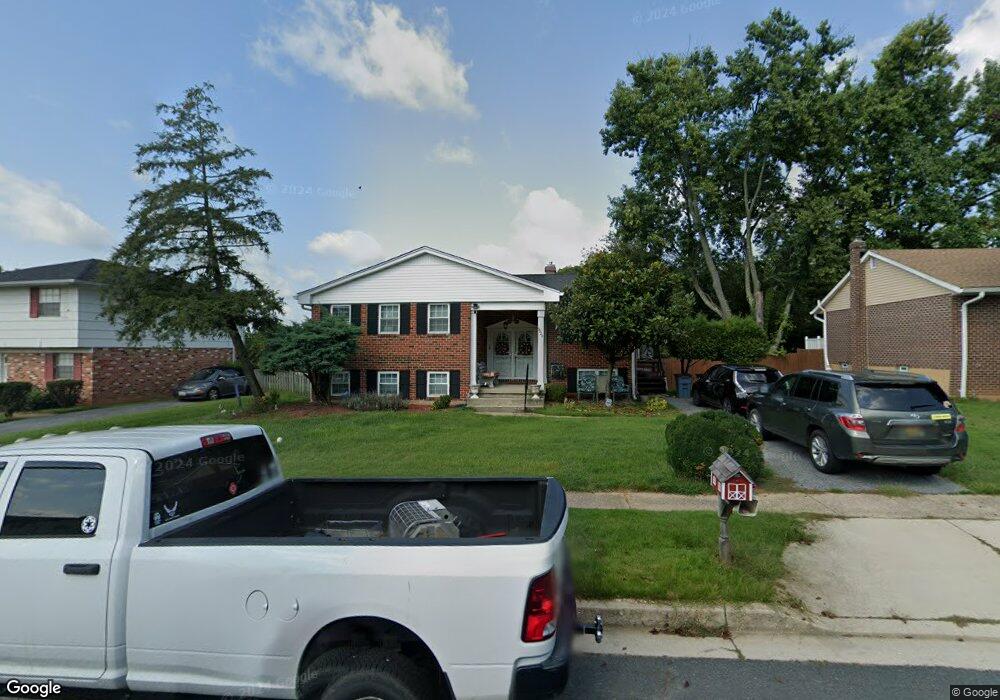
9928 Hoyt Cir Randallstown, MD 21133
Estimated Value: $325,000 - $442,000
--
Bed
3
Baths
1,646
Sq Ft
$227/Sq Ft
Est. Value
About This Home
This home is located at 9928 Hoyt Cir, Randallstown, MD 21133 and is currently estimated at $373,945, approximately $227 per square foot. 9928 Hoyt Cir is a home located in Baltimore County with nearby schools including Hernwood Elementary School, Deer Park Middle Magnet School, and New Town High.
Ownership History
Date
Name
Owned For
Owner Type
Purchase Details
Closed on
Mar 27, 2023
Sold by
Coles Yvette M
Bought by
Cunningham Donovan E
Current Estimated Value
Home Financials for this Owner
Home Financials are based on the most recent Mortgage that was taken out on this home.
Original Mortgage
$240,000
Outstanding Balance
$233,391
Interest Rate
6.65%
Mortgage Type
New Conventional
Estimated Equity
$140,554
Purchase Details
Closed on
Dec 9, 2012
Sold by
Coles Johnetta
Bought by
Coles Johnetta and Coles Yvette M
Purchase Details
Closed on
May 31, 1977
Sold by
Maslowe Harvey
Bought by
Coles Frank L
Create a Home Valuation Report for This Property
The Home Valuation Report is an in-depth analysis detailing your home's value as well as a comparison with similar homes in the area
Home Values in the Area
Average Home Value in this Area
Purchase History
| Date | Buyer | Sale Price | Title Company |
|---|---|---|---|
| Cunningham Donovan E | $300,000 | Greenwood Title | |
| Cunningham Donovan E | $300,000 | Greenwood Title | |
| Coles Johnetta | -- | None Available | |
| Coles Frank L | $60,000 | -- |
Source: Public Records
Mortgage History
| Date | Status | Borrower | Loan Amount |
|---|---|---|---|
| Open | Cunningham Donovan E | $240,000 | |
| Closed | Cunningham Donovan E | $240,000 |
Source: Public Records
Tax History Compared to Growth
Tax History
| Year | Tax Paid | Tax Assessment Tax Assessment Total Assessment is a certain percentage of the fair market value that is determined by local assessors to be the total taxable value of land and additions on the property. | Land | Improvement |
|---|---|---|---|---|
| 2025 | $3,771 | $295,500 | -- | -- |
| 2024 | $3,771 | $273,800 | $82,100 | $191,700 |
| 2023 | $3,780 | $263,567 | $0 | $0 |
| 2022 | $3,436 | $253,333 | $0 | $0 |
| 2021 | $3,276 | $243,100 | $82,100 | $161,000 |
| 2020 | $3,276 | $227,067 | $0 | $0 |
| 2019 | $2,977 | $211,033 | $0 | $0 |
| 2018 | $2,824 | $195,000 | $68,100 | $126,900 |
| 2017 | $2,689 | $186,800 | $0 | $0 |
| 2016 | $2,859 | $178,600 | $0 | $0 |
| 2015 | $2,859 | $170,400 | $0 | $0 |
| 2014 | $2,859 | $170,400 | $0 | $0 |
Source: Public Records
Map
Nearby Homes
- 3517 Kings Point Rd
- 3525 Cabot Rd
- 9804 Marriottsville Rd
- 3618 Granite Rd
- 30 Sheraton Rd
- 9605 Mendoza Rd
- 3803 Marriottsville Rd
- 3538 Corn Stream Rd
- 3518 Orchard Shade Rd
- 3827 Rayton Rd
- 3903 Innerdale Ct
- 10520 Marriottsville Rd
- 3903 Red Deer Cir
- 9931 Tuscarora Rd
- 3200 Peddicoat Ct
- 9302 Silver Charm Dr
- 9401 Summer Squal Dr
- 9 Bannock Ct
- 9311 Colorado Ave
- 4264 Cayuga Rd
- 9930 Hoyt Cir
- 9926 Hoyt Cir
- 9924 Hoyt Cir
- 9932 Hoyt Cir
- 9925 Hoyt Cir
- 9931 Hoyt Cir
- 9922 Hoyt Cir
- 9934 Hoyt Cir
- 9923 Hoyt Cir
- 9933 Hoyt Cir
- 9902 Gunstock Rd
- 9921 Hoyt Cir
- 9936 Hoyt Cir
- 9903 Gunstock Rd
- 9935 Hoyt Cir
- 9919 Hoyt Cir
- 9918 Hoyt Cir
- 3600 Kings Point Rd
- 3602 Kings Point Rd
- 3534 Kings Point Rd