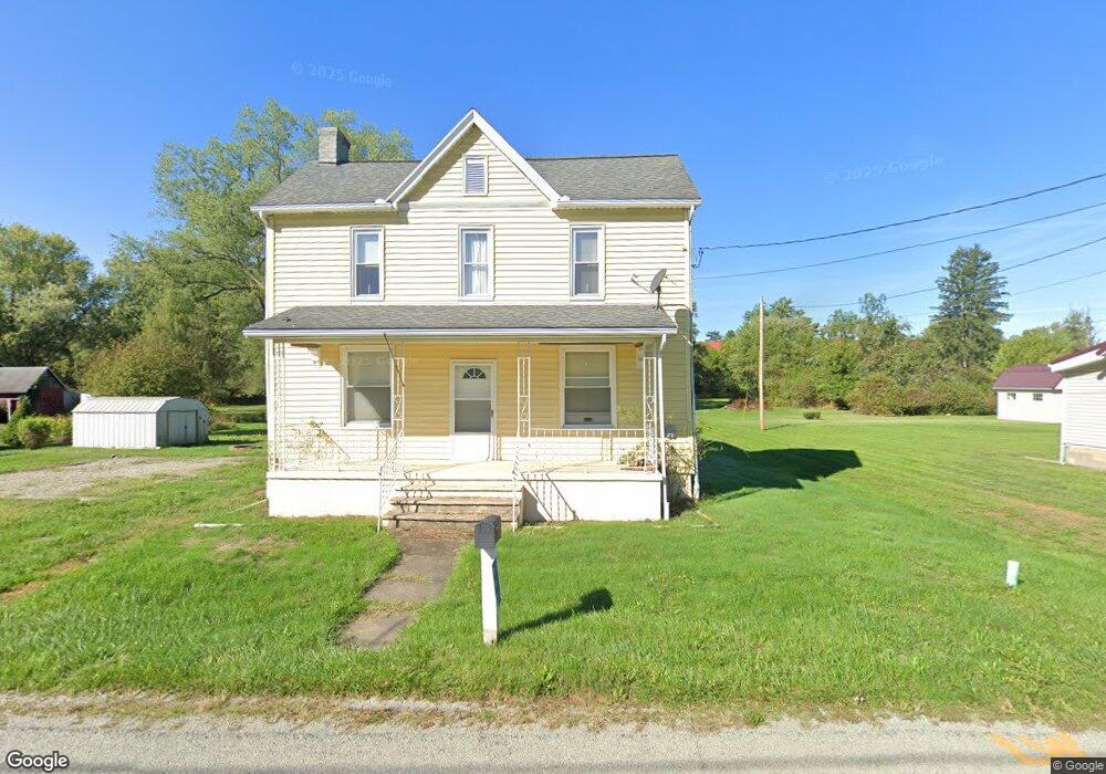
993 Broadford Rd Connellsville, PA 15425
Upper Tyrone Township NeighborhoodEstimated Value: $87,000 - $131,603
3
Beds
1
Bath
1,408
Sq Ft
$75/Sq Ft
Est. Value
About This Home
This home is located at 993 Broadford Rd, Connellsville, PA 15425 and is currently estimated at $105,401, approximately $74 per square foot. 993 Broadford Rd is a home located in Fayette County with nearby schools including Southmoreland Elementary School, Southmoreland Primary Center, and Southmoreland Senior High School.
Ownership History
Date
Name
Owned For
Owner Type
Purchase Details
Closed on
Mar 18, 2020
Sold by
Barnhart Brenda and Estate Of Raymond Scott Barnha
Bought by
Barnhart Brenda and Barnhart Shera L
Current Estimated Value
Purchase Details
Closed on
Dec 4, 2014
Sold by
Fayette County Tax Claim Bureau
Bought by
Barnhart Raymond S
Purchase Details
Closed on
Jan 1, 1968
Bought by
Sladky Theresa P and Sladky John R
Create a Home Valuation Report for This Property
The Home Valuation Report is an in-depth analysis detailing your home's value as well as a comparison with similar homes in the area
Home Values in the Area
Average Home Value in this Area
Purchase History
| Date | Buyer | Sale Price | Title Company |
|---|---|---|---|
| Barnhart Brenda | -- | None Available | |
| Barnhart Raymond S | $4,000 | None Available | |
| Sladky Theresa P | -- | -- |
Source: Public Records
Tax History Compared to Growth
Tax History
| Year | Tax Paid | Tax Assessment Tax Assessment Total Assessment is a certain percentage of the fair market value that is determined by local assessors to be the total taxable value of land and additions on the property. | Land | Improvement |
|---|---|---|---|---|
| 2025 | $761 | $30,465 | $10,800 | $19,665 |
| 2024 | $767 | $30,465 | $10,800 | $19,665 |
| 2023 | $1,459 | $30,465 | $10,800 | $19,665 |
| 2022 | $1,514 | $30,465 | $10,800 | $19,665 |
| 2021 | $1,440 | $30,465 | $10,800 | $19,665 |
| 2020 | $1,383 | $30,465 | $10,800 | $19,665 |
| 2019 | $1,256 | $30,465 | $10,800 | $19,665 |
| 2018 | $1,289 | $30,465 | $10,800 | $19,665 |
| 2017 | $1,289 | $30,465 | $10,800 | $19,665 |
| 2016 | -- | $30,465 | $10,800 | $19,665 |
| 2015 | -- | $30,465 | $10,800 | $19,665 |
| 2014 | -- | $60,930 | $21,600 | $39,330 |
Source: Public Records
Map
Nearby Homes
- 112 Wall St
- 420 Brown St
- 23 3rd Ave
- 5 Moyer Ave
- 631 Garfield Ave
- 242 Brown St
- 130 Chestnut St
- 322 S Broadway St
- 510 S Chestnut St
- 302 Eleanor Ave
- 401 S Grant St Unit 403
- 306 S Grant St
- 505 S Grove St
- 2236 Loucks Rd
- 717 George St
- 716 George St
- 318 Hunter Dr
- 22 N Grant St
- 723 Broadford Rd
- 1008 Pittsburgh St
- 989 Broadford Rd
- 997 Broadford Rd
- 115 Wall St
- 101 Wall St
- 109 Wall St
- 984 Broadford Rd
- 113 Wall St
- 1001 Broadford Rd
- 1003 Broadford Rd
- 986 Broadford Rd
- 990 Broadford Rd
- 979 Broadford Rd
- 1000 Broadford Rd
- 1005 Broadford Rd
- 980 Broadford Rd
- 977 Broadford Rd
- 998 Broadford Rd
- 1002 Broadford Rd
- 1007 Broadford Rd
- 1004 Broadford Rd