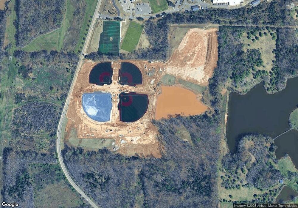
9933 Paul Jones Eads, TN 38028
Gray's Creek NeighborhoodEstimated Value: $668,500
6
Beds
4
Baths
5,964
Sq Ft
$112/Sq Ft
Est. Value
About This Home
This home is located at 9933 Paul Jones, Eads, TN 38028 and is currently priced at $668,500, approximately $112 per square foot. 9933 Paul Jones is a home located in Shelby County with nearby schools including Macon-Hall Elementary School, Mt. Pisgah Middle School, and Germantown High School.
Ownership History
Date
Name
Owned For
Owner Type
Purchase Details
Closed on
Jul 12, 2021
Sold by
Griffin William N and Paul Jones Wind River Revocabl
Bought by
Acquisition And Leasing Co Of Tn Llc
Current Estimated Value
Purchase Details
Closed on
Feb 14, 2008
Sold by
Griffin William N
Bought by
County Of Shelby
Purchase Details
Closed on
Oct 11, 2005
Sold by
Bates Robert C
Bought by
Griffin William N and Paul Jones/Wind River Revocable Trust
Purchase Details
Closed on
May 12, 1998
Sold by
Childress Elizabeth Boone Bates and Bates Elizabeth B
Bought by
Bates Robert C
Home Financials for this Owner
Home Financials are based on the most recent Mortgage that was taken out on this home.
Original Mortgage
$1,508,000
Interest Rate
7.1%
Mortgage Type
Seller Take Back
Create a Home Valuation Report for This Property
The Home Valuation Report is an in-depth analysis detailing your home's value as well as a comparison with similar homes in the area
Home Values in the Area
Average Home Value in this Area
Purchase History
| Date | Buyer | Sale Price | Title Company |
|---|---|---|---|
| Acquisition And Leasing Co Of Tn Llc | $300,000 | None Available | |
| County Of Shelby | $81,000 | Chicago Title Insurance Co | |
| Griffin William N | $1,500,000 | -- | |
| Bates Robert C | -- | -- | |
| Bates Robert C | -- | -- |
Source: Public Records
Mortgage History
| Date | Status | Borrower | Loan Amount |
|---|---|---|---|
| Previous Owner | Bates Robert C | $1,508,000 |
Source: Public Records
Tax History Compared to Growth
Tax History
| Year | Tax Paid | Tax Assessment Tax Assessment Total Assessment is a certain percentage of the fair market value that is determined by local assessors to be the total taxable value of land and additions on the property. | Land | Improvement |
|---|---|---|---|---|
| 2025 | $6,731 | $199,175 | $199,175 | -- |
| 2024 | $6,731 | $198,550 | $198,550 | -- |
| 2023 | $6,731 | $198,550 | $198,550 | $0 |
| 2022 | $607 | $198,550 | $198,550 | $0 |
| 2021 | $7,460 | $362,975 | $202,650 | $160,325 |
| 2020 | $6,274 | $325,950 | $191,175 | $134,775 |
| 2019 | $6,274 | $325,950 | $191,175 | $134,775 |
| 2018 | $13,201 | $325,950 | $191,175 | $134,775 |
| 2017 | $13,397 | $325,950 | $191,175 | $134,775 |
| 2016 | $6,255 | $314,175 | $0 | $0 |
| 2014 | $6,255 | $314,175 | $0 | $0 |
Source: Public Records
Map
Nearby Homes
- 9600 Grays Hollow Dr S
- 9568 Grays Hollow Dr
- 9574 Grays Hollow Dr
- 9562 Grays Hollow Dr
- 9589 Grays Valley Cove
- 9543 Grays Hollow Dr
- 9565 Grays Song Dr
- 9635 Grays Lake Cove
- 9605 Grays Meadow Dr
- 9636 Grays Meadow Dr
- 179 Bitter Branch Rd
- 173 Bitter Branch Rd
- 9951 Kemrock Dr S
- 185 Bitter Branch Rd
- 9593 Green Heights Rd
- 189 Bitter Branch Rd
- 9325 Beaver Valley Ln
- 10485 Raleigh Lagrange Rd E
- 9939 Kemrock Dr S
- 9947 Kemrock Dr S
- 0 Paul Jones Rd Unit 3130346
- 0 Paul Jones Rd Unit 3130344
- 0 Paul Jones Rd Unit 3282386
- 0 Paul Jones Rd Unit 10183638
- 563 Houston Hill Rd
- 0 Houston Levee Rd Unit 3150008
- 0 Houston Levee Rd Unit 3149971
- 0 Houston Levee Rd Unit 3276329
- 0 Houston Levee Rd Unit 9959934
- 0 Houston Levee Rd Unit 9972844
- 581 Houston Hill Rd
- 567 Houston Hill Rd
- 10065 Paul Jones
- 10046 Paul Jones
- 501 Houston Hill Rd
- 10087 Paul Jones
- 10064 Paul Jones
- 525 Houston Hill Rd
- 10105 Raleigh Lagrange Rd E
- 10109 Raleigh Lagrange Rd E
