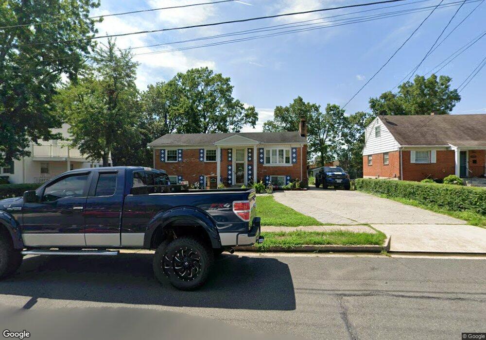
9937 Portsmouth Rd Manassas, VA 20109
Estimated Value: $499,241 - $561,000
4
Beds
3
Baths
1,170
Sq Ft
$453/Sq Ft
Est. Value
About This Home
This home is located at 9937 Portsmouth Rd, Manassas, VA 20109 and is currently estimated at $530,560, approximately $453 per square foot. 9937 Portsmouth Rd is a home located in Prince William County with nearby schools including West Gate Elementary School, Unity Braxton Middle School, and Unity Reed High School.
Ownership History
Date
Name
Owned For
Owner Type
Purchase Details
Closed on
Mar 3, 1997
Sold by
Short Thomas L and Short Mary L
Bought by
Stickel Salome S S
Current Estimated Value
Home Financials for this Owner
Home Financials are based on the most recent Mortgage that was taken out on this home.
Original Mortgage
$20,000
Outstanding Balance
$2,434
Interest Rate
7.78%
Mortgage Type
New Conventional
Estimated Equity
$528,126
Create a Home Valuation Report for This Property
The Home Valuation Report is an in-depth analysis detailing your home's value as well as a comparison with similar homes in the area
Home Values in the Area
Average Home Value in this Area
Purchase History
| Date | Buyer | Sale Price | Title Company |
|---|---|---|---|
| Stickel Salome S S | $135,000 | -- |
Source: Public Records
Mortgage History
| Date | Status | Borrower | Loan Amount |
|---|---|---|---|
| Open | Stickel Salome S S | $20,000 |
Source: Public Records
Tax History Compared to Growth
Tax History
| Year | Tax Paid | Tax Assessment Tax Assessment Total Assessment is a certain percentage of the fair market value that is determined by local assessors to be the total taxable value of land and additions on the property. | Land | Improvement |
|---|---|---|---|---|
| 2025 | $4,484 | $468,900 | $140,900 | $328,000 |
| 2024 | $4,484 | $450,900 | $129,900 | $321,000 |
| 2023 | $4,310 | $414,200 | $111,800 | $302,400 |
| 2022 | $4,562 | $411,900 | $111,800 | $300,100 |
| 2021 | $4,532 | $369,300 | $101,600 | $267,700 |
| 2020 | $5,448 | $351,500 | $101,600 | $249,900 |
| 2019 | $5,270 | $340,000 | $101,600 | $238,400 |
| 2018 | $3,746 | $310,200 | $101,600 | $208,600 |
| 2017 | $3,740 | $300,900 | $91,700 | $209,200 |
| 2016 | $3,735 | $303,400 | $91,700 | $211,700 |
| 2015 | $2,932 | $274,300 | $83,200 | $191,100 |
| 2014 | $2,932 | $231,200 | $70,400 | $160,800 |
Source: Public Records
Map
Nearby Homes
- 9929 Loudoun Ave
- 8355 Irongate Way
- 7823 Brookview Ct
- 8393 Scotland Loop
- 7832 Brookview Ct
- Matisse Plan at Lomond Village - Condos
- Picasso Plan at Lomond Village - Condos
- Strauss End Unit Plan at Lomond Village
- 9920 Whitemoss Dr
- 7608 Bland Dr
- 9724 Copeland Dr
- 8429 Girvan Ct
- 8555 Fortrose Dr
- 9613 King George Dr
- 9732 Copeland Dr
- 7530 Campbell Ct
- 7905 Brighton Way
- 8323 Rolling Rd
- 7518 Quail Run Ln
- 9405 Blackstone Rd
- 9935 Portsmouth Rd
- 9939 Portsmouth Rd
- 9933 Portsmouth Rd
- 9941 Portsmouth Rd
- 9938 Portsmouth Rd
- 9940 Portsmouth Rd
- 9936 Portsmouth Rd
- 9931 Portsmouth Rd
- 9931 Portsmouth Rd Unit (UPPER LEVEL ONLY)
- 9943 Portsmouth Rd
- 9942 Portsmouth Rd
- 9934 Portsmouth Rd
- 8008 Clifton St
- 9929 Portsmouth Rd
- 9945 Portsmouth Rd
- 9944 Portsmouth Rd
- 9932 Portsmouth Rd
- 8006 Clifton St
- 9919 Henrico St
- 9946 Portsmouth Rd