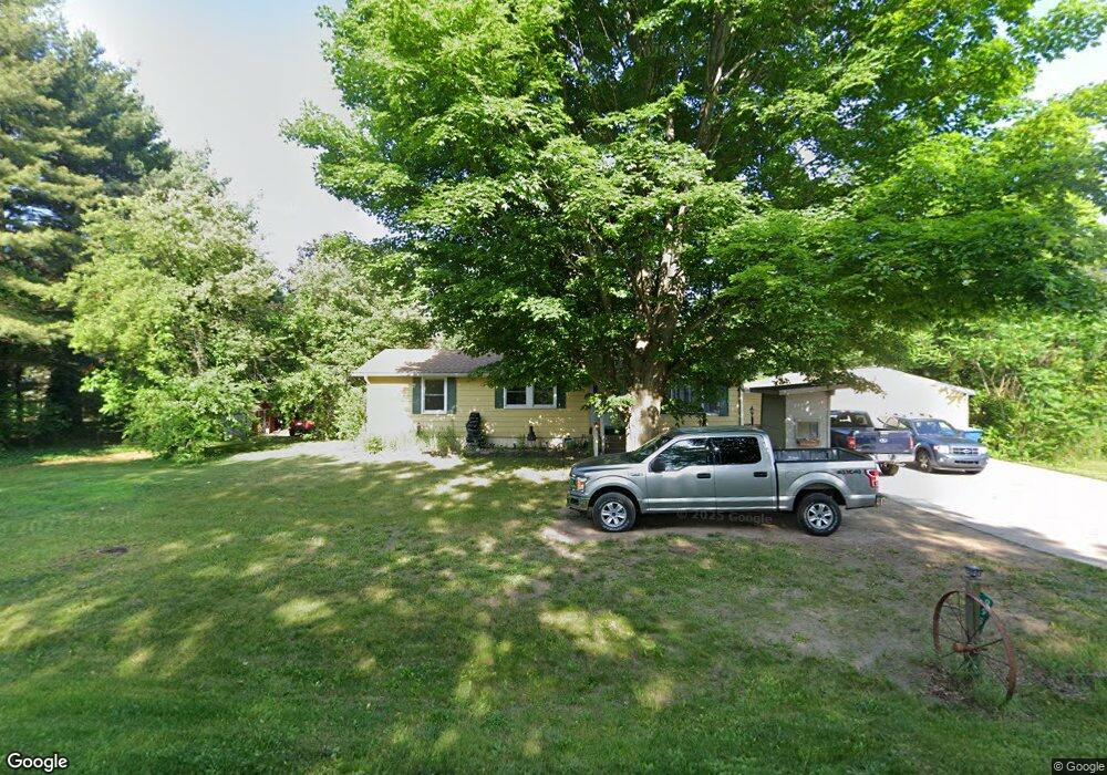
9955 N 12th St Kalamazoo, MI 49009
Estimated Value: $261,000 - $362,000
3
Beds
2
Baths
1,116
Sq Ft
$267/Sq Ft
Est. Value
About This Home
This home is located at 9955 N 12th St, Kalamazoo, MI 49009 and is currently estimated at $297,861, approximately $266 per square foot. 9955 N 12th St is a home located in Kalamazoo County with nearby schools including Plainwell High School.
Ownership History
Date
Name
Owned For
Owner Type
Purchase Details
Closed on
Jun 25, 2014
Sold by
Meyers Larry G and Meyers Dawn M
Bought by
Schlotterback Troy and Schlotterback Kimberly
Current Estimated Value
Home Financials for this Owner
Home Financials are based on the most recent Mortgage that was taken out on this home.
Original Mortgage
$119,000
Outstanding Balance
$94,703
Interest Rate
4.11%
Mortgage Type
USDA
Estimated Equity
$203,158
Purchase Details
Closed on
Nov 13, 2013
Sold by
Meyers Larry G and Meyers Dawn M
Bought by
Villarreal Chris and Villarreal Andrea
Create a Home Valuation Report for This Property
The Home Valuation Report is an in-depth analysis detailing your home's value as well as a comparison with similar homes in the area
Home Values in the Area
Average Home Value in this Area
Purchase History
| Date | Buyer | Sale Price | Title Company |
|---|---|---|---|
| Schlotterback Troy | $119,000 | Nations Title Agency | |
| Villarreal Chris | $16,200 | Devon Title | |
| Gauthier Ronald E | $19,800 | Devon Title |
Source: Public Records
Mortgage History
| Date | Status | Borrower | Loan Amount |
|---|---|---|---|
| Open | Schlotterback Troy | $119,000 |
Source: Public Records
Tax History Compared to Growth
Tax History
| Year | Tax Paid | Tax Assessment Tax Assessment Total Assessment is a certain percentage of the fair market value that is determined by local assessors to be the total taxable value of land and additions on the property. | Land | Improvement |
|---|---|---|---|---|
| 2025 | $2,030 | $100,900 | $0 | $0 |
| 2024 | $576 | $97,500 | $0 | $0 |
| 2023 | $576 | $81,900 | $0 | $0 |
| 2022 | $576 | $73,400 | $0 | $0 |
| 2021 | $576 | $71,400 | $0 | $0 |
| 2020 | $1,176 | $75,300 | $0 | $0 |
| 2019 | $1,509 | $55,000 | $0 | $0 |
| 2018 | $0 | $53,100 | $0 | $0 |
| 2017 | $0 | $53,100 | $0 | $0 |
| 2016 | -- | $51,100 | $0 | $0 |
| 2015 | -- | $49,000 | $0 | $0 |
| 2014 | -- | $42,100 | $0 | $0 |
Source: Public Records
Map
Nearby Homes
- 3455 W B Ave
- 8815 N 14th St
- VL Douglas Ave
- 2520 W C Ave
- 1050 Bronson Ave
- 1 Millberg Ridge
- 8060 Hunters Crossing
- 0 W D Ave W Unit VL 24060554
- 7131 W B Ave
- 1179 102nd Ave
- 1183 102nd Ave
- Parcel A D Ave W
- 110 Walnut Woods Ct
- 216 W Chart St
- 551 W Bridge St
- 426 W Bridge St
- 317 E Chart St
- 659 Benhoy St
- 1255 103rd Ave
- 1817 W D Ave
- 9955 N 12th St
- 0 W B Ave Unit 66019039483
- 0 W B Ave Unit 66019013599
- 0 W B Ave Unit 66002824471
- 0 W B Ave Unit M15025262
- 0 W B Ave Unit M19013599
- 0 W B Ave Unit M19039483
- 0 W B Ave Unit M20033540
- 0 W B Ave Unit 66015025262
- 0 W B Ave Unit 146 Acres
- 10 W B Ave
- 1 W B Ave
- 4500 W B Ave
- 0 W B Ave
- 5081 W B Ave
- 8801 N 12th St
- 9937 N 12th St
- 9937 N 12th St
- 10049 N 12th St
- 0 W B Ave Unit 71014027244