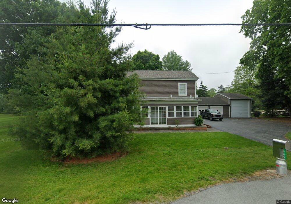
9965 W Us Route 224 Findlay, OH 45840
Estimated Value: $190,152 - $303,000
3
Beds
1
Bath
1,664
Sq Ft
$147/Sq Ft
Est. Value
About This Home
This home is located at 9965 W Us Route 224, Findlay, OH 45840 and is currently estimated at $245,038, approximately $147 per square foot. 9965 W Us Route 224 is a home located in Hancock County with nearby schools including Liberty-Benton Elementary School, Liberty-Benton Middle School, and Liberty-Benton High School.
Ownership History
Date
Name
Owned For
Owner Type
Purchase Details
Closed on
Jun 21, 2024
Sold by
Lennart Rosalie L
Bought by
Hug Dustin L and Hug Mackenzie L
Current Estimated Value
Home Financials for this Owner
Home Financials are based on the most recent Mortgage that was taken out on this home.
Original Mortgage
$150,000
Outstanding Balance
$148,086
Interest Rate
7.02%
Mortgage Type
New Conventional
Estimated Equity
$96,952
Purchase Details
Closed on
Oct 26, 1992
Bought by
Fox Hugh E and Fox Ilah L
Create a Home Valuation Report for This Property
The Home Valuation Report is an in-depth analysis detailing your home's value as well as a comparison with similar homes in the area
Home Values in the Area
Average Home Value in this Area
Purchase History
| Date | Buyer | Sale Price | Title Company |
|---|---|---|---|
| Hug Dustin L | $200,000 | Mid Am Title | |
| Fox Hugh E | -- | -- |
Source: Public Records
Mortgage History
| Date | Status | Borrower | Loan Amount |
|---|---|---|---|
| Open | Hug Dustin L | $150,000 |
Source: Public Records
Tax History Compared to Growth
Tax History
| Year | Tax Paid | Tax Assessment Tax Assessment Total Assessment is a certain percentage of the fair market value that is determined by local assessors to be the total taxable value of land and additions on the property. | Land | Improvement |
|---|---|---|---|---|
| 2024 | $2,018 | $53,100 | $7,250 | $45,850 |
| 2023 | $1,971 | $53,100 | $7,250 | $45,850 |
| 2022 | $1,952 | $53,100 | $7,250 | $45,850 |
| 2021 | $1,662 | $39,960 | $6,300 | $33,660 |
| 2020 | $1,676 | $39,960 | $6,300 | $33,660 |
| 2019 | $1,609 | $39,960 | $6,300 | $33,660 |
| 2018 | $1,328 | $36,250 | $5,250 | $31,000 |
| 2017 | $1,370 | $36,250 | $5,250 | $31,000 |
| 2016 | $1,341 | $36,250 | $5,250 | $31,000 |
| 2015 | $989 | $26,250 | $5,250 | $21,000 |
| 2014 | $998 | $26,250 | $5,250 | $21,000 |
| 2012 | $973 | $24,470 | $5,250 | $19,220 |
Source: Public Records
Map
Nearby Homes
- 9960 W Us Route 224
- 0 County Road 140
- 0 County Road 223
- 8179 Hazelwood Dr
- 8256 Silverwood Dr
- 0 County Road 95 Unit 6097574
- 6535 Silver Lake Dr
- 8922 Township Road 94
- 925 W Melrose Ave
- 905 W Melrose Ave
- 933 Laurel Ln
- 1405 Cypress Lake
- 2201 W Main Cross St
- 1005 Broad Ave
- 3106 Saddlebrook
- 3018 Gleneagle Dr
- 643 Edith Ave
- 425 Nevada Ln
- 636 W Melrose Ave
- 2014 W Sandusky St
- 9885 W Us Route 224
- 9934 U S 224
- 9934 W Us Route 224
- 10005 Us Route
- 9882 U S 224
- 9882 W Us Route 224
- 7474 County Road 140
- 7360 County Road 140
- 7369 County Road 140
- 7412 Congress Dr
- 7334 County Road 140
- 7380 Congress Dr
- 7310 County Road 140
- 9747 U S 224
- 9747 Us Route
- 9747 W Us Route 224
- 10157 U S 224
- 9780 W Us Route 224
- 10157 Us Route
- 9910 Independence Dr