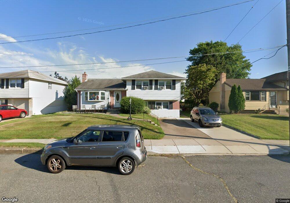
9969 Wistaria St Philadelphia, PA 19115
Bustleton NeighborhoodEstimated Value: $396,000 - $530,000
--
Bed
--
Bath
1,970
Sq Ft
$241/Sq Ft
Est. Value
About This Home
This home is located at 9969 Wistaria St, Philadelphia, PA 19115 and is currently estimated at $473,873, approximately $240 per square foot. 9969 Wistaria St is a home located in Philadelphia County with nearby schools including Frank Anne School, CCA Baldi Middle School, and George Washington High School.
Ownership History
Date
Name
Owned For
Owner Type
Purchase Details
Closed on
Oct 30, 2015
Sold by
Wasylenko Michael W and Wasylenko Carol A
Bought by
Bechtle Nicholas
Current Estimated Value
Home Financials for this Owner
Home Financials are based on the most recent Mortgage that was taken out on this home.
Original Mortgage
$152,000
Outstanding Balance
$120,081
Interest Rate
3.92%
Mortgage Type
New Conventional
Estimated Equity
$353,792
Purchase Details
Closed on
Apr 2, 1956
Bought by
Michael Michael W and Michael Yolanda D
Create a Home Valuation Report for This Property
The Home Valuation Report is an in-depth analysis detailing your home's value as well as a comparison with similar homes in the area
Home Values in the Area
Average Home Value in this Area
Purchase History
| Date | Buyer | Sale Price | Title Company |
|---|---|---|---|
| Bechtle Nicholas | $190,000 | None Available | |
| Michael Michael W | $15,000 | -- |
Source: Public Records
Mortgage History
| Date | Status | Borrower | Loan Amount |
|---|---|---|---|
| Open | Bechtle Nicholas | $152,000 |
Source: Public Records
Tax History Compared to Growth
Tax History
| Year | Tax Paid | Tax Assessment Tax Assessment Total Assessment is a certain percentage of the fair market value that is determined by local assessors to be the total taxable value of land and additions on the property. | Land | Improvement |
|---|---|---|---|---|
| 2025 | $5,046 | $434,700 | $86,940 | $347,760 |
| 2024 | $5,046 | $434,700 | $86,940 | $347,760 |
| 2023 | $5,046 | $360,500 | $72,100 | $288,400 |
| 2022 | $4,051 | $360,500 | $72,100 | $288,400 |
| 2021 | $4,051 | $0 | $0 | $0 |
| 2020 | $4,051 | $0 | $0 | $0 |
| 2019 | $3,879 | $0 | $0 | $0 |
| 2018 | $3,558 | $0 | $0 | $0 |
| 2017 | $3,558 | $0 | $0 | $0 |
| 2016 | $3,138 | $0 | $0 | $0 |
| 2015 | $3,004 | $0 | $0 | $0 |
| 2014 | -- | $254,200 | $193,648 | $60,552 |
| 2012 | -- | $34,464 | $10,428 | $24,036 |
Source: Public Records
Map
Nearby Homes
- 9987 Hardy Rd
- 9990 Sandy Rd
- 9983 Sandy Rd
- 9926 Haldeman Unit#133 Ave
- 9839 Haldeman Ave
- 9837 Haldeman Ave
- 10135 Haldeman Ave
- 9823 Bonner St
- 9926 Haldeman Ave
- 9815 Cowden St
- 9854 Clark St
- 2044 Gorman St
- 1863 Merlin Rd
- 9921 Bustleton Ave Unit P3
- 1961 President St
- 9782 Clark St
- 1861 Kentwood St
- 9759 Clark St
- 10103 Northeast Ave Unit 9
- 1912 Tomlinson Rd
- 9971 Wistaria St
- 9967 Wistaria St
- 9973 Wistaria St
- 9965 Wistaria St
- 9978 Dungan Rd
- 9976 Dungan Rd
- 9974 Dungan Rd
- 9975 Wistaria St
- 9968 Wistaria St
- 9972 Dungan Rd
- 9963 Wistaria St
- 2002 Montour St
- 9963 Montour St
- 9970 Wistaria St
- 9970 Dungan Rd
- 9966 Wistaria St
- 9972 Wistaria St
- 9968 Dungan Rd
- 9967 Haldeman Ave
- 2000 Montour St