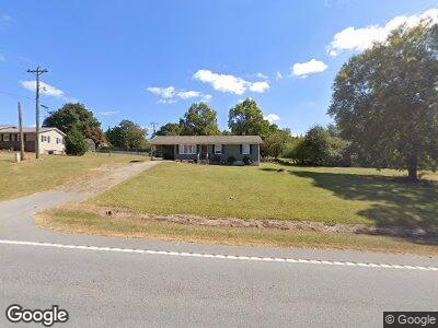
998 N Highway 11 West Union, SC 29696
Estimated Value: $182,000 - $233,000
3
Beds
1
Bath
1,080
Sq Ft
$192/Sq Ft
Est. Value
About This Home
This home is located at 998 N Highway 11, West Union, SC 29696 and is currently estimated at $207,147, approximately $191 per square foot. 998 N Highway 11 is a home with nearby schools including Walhalla Elementary School, Walhalla Middle School, and Faith Christian School.
Ownership History
Date
Name
Owned For
Owner Type
Purchase Details
Closed on
May 23, 2019
Sold by
Donald Eric
Bought by
Crenshaw Brittany Nicole
Current Estimated Value
Home Financials for this Owner
Home Financials are based on the most recent Mortgage that was taken out on this home.
Original Mortgage
$101,010
Outstanding Balance
$90,072
Interest Rate
4.2%
Mortgage Type
New Conventional
Estimated Equity
$126,013
Purchase Details
Closed on
Jun 19, 2012
Sold by
Donald Dennis Rayford and Donald Betty Jo
Bought by
Donald Eric
Create a Home Valuation Report for This Property
The Home Valuation Report is an in-depth analysis detailing your home's value as well as a comparison with similar homes in the area
Home Values in the Area
Average Home Value in this Area
Purchase History
| Date | Buyer | Sale Price | Title Company |
|---|---|---|---|
| Crenshaw Brittany Nicole | $100,000 | None Available | |
| Donald Eric | -- | -- |
Source: Public Records
Mortgage History
| Date | Status | Borrower | Loan Amount |
|---|---|---|---|
| Open | Crenshaw Brittany Nicole | $101,010 | |
| Previous Owner | Dinald Eric Franklin | $53,600 |
Source: Public Records
Tax History Compared to Growth
Tax History
| Year | Tax Paid | Tax Assessment Tax Assessment Total Assessment is a certain percentage of the fair market value that is determined by local assessors to be the total taxable value of land and additions on the property. | Land | Improvement |
|---|---|---|---|---|
| 2024 | $252 | $2,402 | $212 | $2,190 |
| 2023 | $255 | $2,402 | $212 | $2,190 |
| 2022 | $255 | $2,402 | $212 | $2,190 |
| 2021 | $270 | $2,398 | $327 | $2,071 |
| 2020 | $267 | $2,398 | $327 | $2,071 |
| 2019 | $267 | $0 | $0 | $0 |
| 2018 | $533 | $0 | $0 | $0 |
| 2017 | $270 | $0 | $0 | $0 |
| 2016 | $270 | $0 | $0 | $0 |
| 2015 | -- | $0 | $0 | $0 |
| 2014 | -- | $3,861 | $755 | $3,107 |
| 2013 | -- | $0 | $0 | $0 |
Source: Public Records
Map
Nearby Homes
- 1118 N Hwy 11
- 602 Walter Scott Ln
- 00 S Carolina 11
- 349 Winstead Rd
- 632 Revolutionary Dr
- 204 Friendship Dr
- 340 Bridgeport Dr
- 306 Bridgeport Dr
- 505 Waters Edge Ct
- 82A3 Getaway Ln Waters Edge Ct
- 82A2 Safety Harbor D Waters Edge Ct
- 00 S Carolina 11
- 205 Harrison Ave
- 2539 Blue Ridge Blvd Unit Highway 28
- 135 W Waters Edge Ln
- 98 Mountain View Dr
- 121 W Waters Edge Ln
- 111 Galleon Ct
- 117 W Waters Edge Ln
- 24 Joy Cir
- 998 N Highway 11
- 1022 N Highway 11
- 109 Colonial Ct
- 950 N Highway 11
- 950 N Hwy 11
- 101 Woodland Way
- 108 Colonial Ct
- 1060 N Highway 11
- 100 Colonial Ct
- 108 Lecroy Ct
- 967 N Highway 11
- 101 Lecroy Ct
- 1090 N Highway 11
- 108 Woodland Way
- 100 Lecroy Ct
- 100 Woodland Way
- 113 Woodland Way
- 116 Meadowbrook Dr
- 1118 N Highway 11
- 105 Meadowbrook Dr