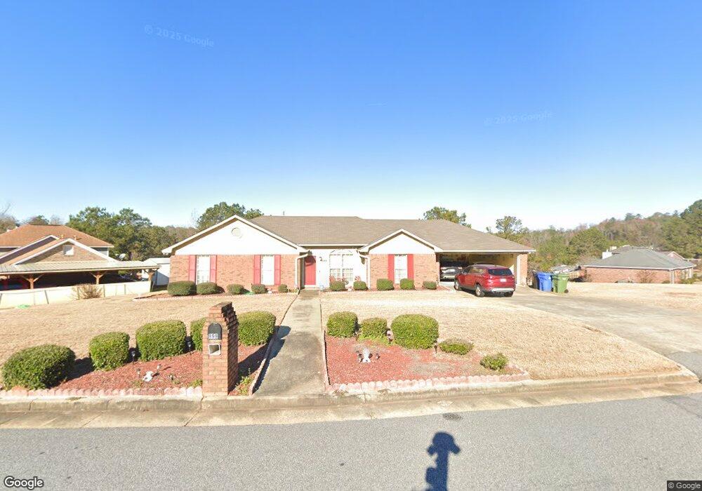
999 Sistrunk Ct Columbus, GA 31907
Eastern Columbus NeighborhoodEstimated Value: $183,000 - $215,000
3
Beds
3
Baths
1,524
Sq Ft
$128/Sq Ft
Est. Value
About This Home
This home is located at 999 Sistrunk Ct, Columbus, GA 31907 and is currently estimated at $194,662, approximately $127 per square foot. 999 Sistrunk Ct is a home located in Muscogee County with nearby schools including Dawson Elementary School, East Columbus Magnet Academy, and Spencer High School.
Ownership History
Date
Name
Owned For
Owner Type
Purchase Details
Closed on
Jun 12, 2025
Sold by
Johnson Charlie W
Bought by
Williams Gwendolyn D
Current Estimated Value
Home Financials for this Owner
Home Financials are based on the most recent Mortgage that was taken out on this home.
Original Mortgage
$178,000
Outstanding Balance
$177,539
Interest Rate
6.76%
Mortgage Type
VA
Estimated Equity
$17,123
Purchase Details
Closed on
Nov 18, 2024
Sold by
Williams Gwendolyn
Bought by
Johnson Charlie W
Create a Home Valuation Report for This Property
The Home Valuation Report is an in-depth analysis detailing your home's value as well as a comparison with similar homes in the area
Home Values in the Area
Average Home Value in this Area
Purchase History
| Date | Buyer | Sale Price | Title Company |
|---|---|---|---|
| Williams Gwendolyn D | $178,000 | None Listed On Document | |
| Williams Gwendolyn D | $178,000 | None Listed On Document | |
| Johnson Charlie W | -- | None Listed On Document | |
| Johnson Charlie W | -- | None Listed On Document |
Source: Public Records
Mortgage History
| Date | Status | Borrower | Loan Amount |
|---|---|---|---|
| Open | Williams Gwendolyn D | $178,000 | |
| Closed | Williams Gwendolyn D | $178,000 |
Source: Public Records
Tax History Compared to Growth
Tax History
| Year | Tax Paid | Tax Assessment Tax Assessment Total Assessment is a certain percentage of the fair market value that is determined by local assessors to be the total taxable value of land and additions on the property. | Land | Improvement |
|---|---|---|---|---|
| 2025 | $2,681 | $68,480 | $13,416 | $55,064 |
| 2024 | $848 | $68,480 | $13,416 | $55,064 |
| 2023 | $885 | $68,480 | $13,416 | $55,064 |
| 2022 | $885 | $50,672 | $13,416 | $37,256 |
| 2021 | $885 | $47,092 | $13,416 | $33,676 |
| 2020 | $885 | $47,092 | $13,416 | $33,676 |
| 2019 | $888 | $47,092 | $13,416 | $33,676 |
| 2018 | $888 | $47,092 | $13,416 | $33,676 |
| 2017 | $890 | $47,092 | $13,416 | $33,676 |
| 2016 | $1,233 | $58,518 | $7,745 | $50,773 |
| 2015 | $494 | $58,518 | $7,745 | $50,773 |
| 2014 | $496 | $58,518 | $7,745 | $50,773 |
| 2013 | -- | $58,518 | $7,745 | $50,773 |
Source: Public Records
Map
Nearby Homes
- 5219 Argonne Dr
- 4939 Aaron Dr
- 1025 Belmar St
- 849 Bunker Hill Rd
- 1210 Bunker Hill Rd
- 5336 Gettysburg Way
- 811 Pheasant Loop
- 5116 Magazine Ln
- 1238 Brandywine Dr
- 1225 Rowell St
- 4718 Velpoe Dr
- 1513 Alamo Dr
- 5109 Lexington Ln
- 5310 Stoney Point Rd
- 5090 Lexington Ln
- 780 Honey Do Ct
- 4201 Valley Crest Dr
- 4462 Walking Stick Way
- 4408 Walking Stick Way
- 4965 Brightstar Ln
- 989 Sistrunk Ct
- 990 Sistrunk Ct
- 1005 Sistrunk Ct
- 994 Sistrunk Ct
- 986 Sistrunk Ct
- 979 Sistrunk Ct
- 982 Sistrunk Ct
- 4980 Aaron Dr
- 978 Sistrunk Ct
- 4990 Aaron Dr
- 970 Sistrunk Ct
- 974 Sistrunk Ct
- 4994 Aaron Dr
- 4976 Aaron Dr
- 1025 Bunker Hill Rd
- 4987 Aaron Dr
- 4991 Aaron Dr
- 5000 Aaron Dr
- 4995 Aaron Dr
- 4972 Aaron Dr