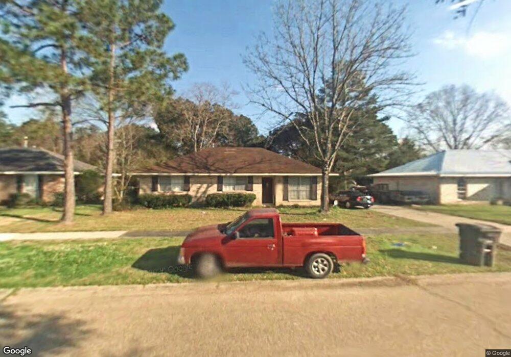
9990 Cloudland Dr Baton Rouge, LA 70818
Estimated Value: $190,302 - $278,000
3
Beds
2
Baths
1,415
Sq Ft
$162/Sq Ft
Est. Value
About This Home
This home is located at 9990 Cloudland Dr, Baton Rouge, LA 70818 and is currently estimated at $229,326, approximately $162 per square foot. 9990 Cloudland Dr is a home located in East Baton Rouge Parish with nearby schools including Bellingrath Hills Elementary School, Central Intermediate School, and Tanglewood Elementary School.
Ownership History
Date
Name
Owned For
Owner Type
Purchase Details
Closed on
Jun 8, 2006
Sold by
Hatfield Patricia H
Bought by
Broussard Leonard S
Current Estimated Value
Home Financials for this Owner
Home Financials are based on the most recent Mortgage that was taken out on this home.
Original Mortgage
$111,300
Outstanding Balance
$65,399
Interest Rate
6.56%
Mortgage Type
New Conventional
Estimated Equity
$163,927
Create a Home Valuation Report for This Property
The Home Valuation Report is an in-depth analysis detailing your home's value as well as a comparison with similar homes in the area
Home Values in the Area
Average Home Value in this Area
Purchase History
| Date | Buyer | Sale Price | Title Company |
|---|---|---|---|
| Broussard Leonard S | $111,300 | -- |
Source: Public Records
Mortgage History
| Date | Status | Borrower | Loan Amount |
|---|---|---|---|
| Open | Broussard Leonard S | $111,300 |
Source: Public Records
Tax History Compared to Growth
Tax History
| Year | Tax Paid | Tax Assessment Tax Assessment Total Assessment is a certain percentage of the fair market value that is determined by local assessors to be the total taxable value of land and additions on the property. | Land | Improvement |
|---|---|---|---|---|
| 2024 | $1,363 | $18,000 | $1,500 | $16,500 |
| 2023 | $1,363 | $14,400 | $1,500 | $12,900 |
| 2022 | $1,934 | $14,400 | $1,500 | $12,900 |
| 2021 | $1,934 | $14,400 | $1,500 | $12,900 |
| 2020 | $1,898 | $14,400 | $1,500 | $12,900 |
| 2019 | $1,914 | $14,100 | $1,500 | $12,600 |
| 2018 | $2,605 | $14,100 | $1,500 | $12,600 |
| 2017 | $3,035 | $14,100 | $1,500 | $12,600 |
| 2016 | $314 | $9,690 | $1,500 | $8,190 |
| 2015 | $901 | $14,100 | $1,500 | $12,600 |
| 2014 | $871 | $14,100 | $1,500 | $12,600 |
| 2013 | -- | $14,100 | $1,500 | $12,600 |
Source: Public Records
Map
Nearby Homes
- 9823 Banway Dr
- TBD Banway Dr
- 9512 Overwood Dr
- Lot A-1-E Wax Rd
- 17468 Wax Rd
- 17486 Wax Rd
- 14932 & 14934 Forest Grove Ave
- 14921 & 14923 Central Woods Ave
- 9532 Sullivan Rd
- 8135 Lavender Dr
- 8600 Sullivan Rd
- 10213 Alderman Dr
- 14045 Grand Settlement Blvd
- 13013 N Vieux Carre Cir
- 9976 Couret Dr
- 9986 Couret Dr
- 13952 Grand Settlement Blvd
- TBD Washington Ln
- 13985 Highgrove Ave
- 13975 Highgrove Ave
- 10010 Cloudland Dr
- 9976 Cloudland Dr
- 10024 Cloudland Dr
- 15432 Brighton Ave
- 10036 Cloudland Dr
- 10048 Cloudland Dr
- 15428 Brighton Ave
- 10052 Cloudland Dr
- 15416 Brighton Ave
- 10106 Cloudland Dr
- 15404 Brighton Ave
- 10114 Cloudland Dr
- 15358 Brighton Ave
- 10126 Cloudland Dr
- 10003 E Brookside Dr
- 10138 Cloudland Dr
- 10015 E Brookside Dr
- 9757 Overwood Dr
- 10027 E Brookside Dr
- 10142 Cloudland Dr