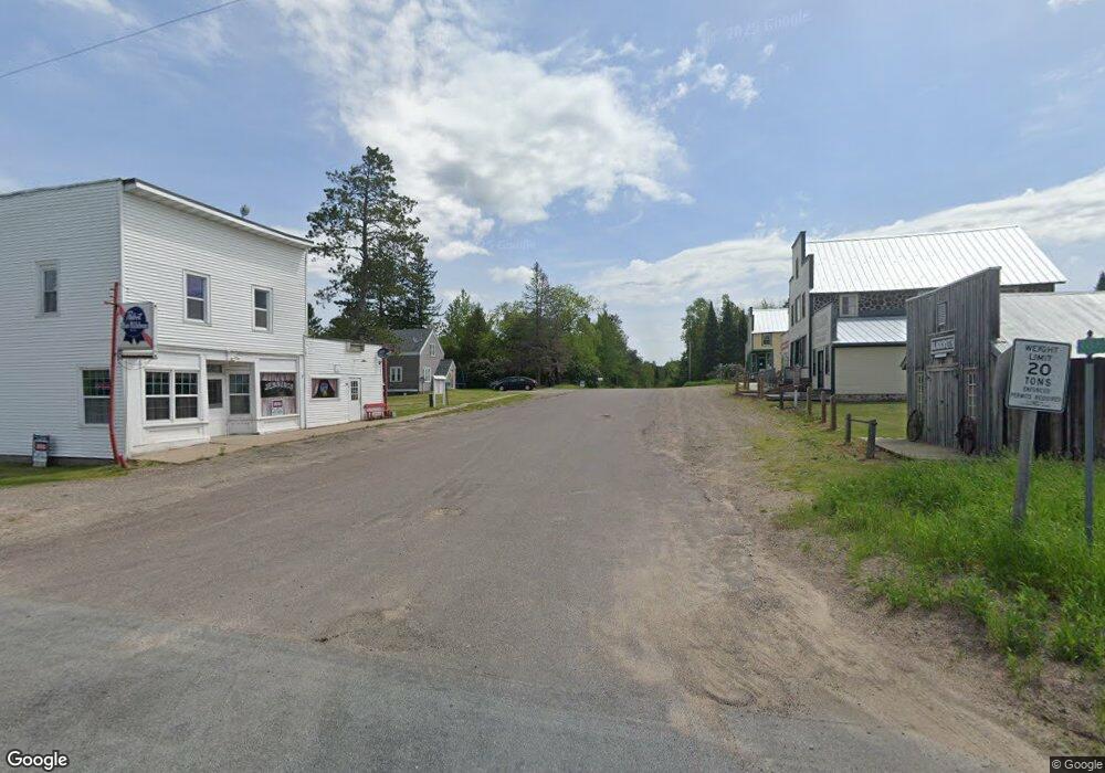
N10065 Cty B Summit Lake, WI 54485
Estimated Value: $303,000 - $535,000
--
Bed
--
Bath
--
Sq Ft
8
Acres
About This Home
This home is located at N10065 Cty B, Summit Lake, WI 54485 and is currently estimated at $403,200. N10065 Cty B is a home.
Ownership History
Date
Name
Owned For
Owner Type
Purchase Details
Closed on
Jun 29, 2015
Sold by
Cayla M Cayla M and Short Cayla
Bought by
Dettman Herbert W and Dettman Amanda L
Current Estimated Value
Home Financials for this Owner
Home Financials are based on the most recent Mortgage that was taken out on this home.
Original Mortgage
$135,714
Outstanding Balance
$105,674
Interest Rate
3.82%
Mortgage Type
Purchase Money Mortgage
Estimated Equity
$297,526
Purchase Details
Closed on
Jul 13, 2012
Sold by
Kautza Kevin J and Kautza Sue A
Bought by
Thunder Cayla M and Short Cayla
Home Financials for this Owner
Home Financials are based on the most recent Mortgage that was taken out on this home.
Original Mortgage
$117,520
Interest Rate
3.77%
Purchase Details
Closed on
Aug 28, 2006
Sold by
Mccabe Elijah and Schuett Charles
Bought by
Albert Rachelle Lynn
Create a Home Valuation Report for This Property
The Home Valuation Report is an in-depth analysis detailing your home's value as well as a comparison with similar homes in the area
Home Values in the Area
Average Home Value in this Area
Purchase History
| Date | Buyer | Sale Price | Title Company |
|---|---|---|---|
| Dettman Herbert W | -- | Langlade Abstract & Title Co | |
| Thunder Cayla M | -- | Quality Title, Inc., Po Box | |
| Albert Rachelle Lynn | -- | Amerititle & Abstract Inc, 8 |
Source: Public Records
Mortgage History
| Date | Status | Borrower | Loan Amount |
|---|---|---|---|
| Open | Dettman Herbert W | $135,714 | |
| Closed | Thunder Cayla M | $117,520 |
Source: Public Records
Tax History Compared to Growth
Tax History
| Year | Tax Paid | Tax Assessment Tax Assessment Total Assessment is a certain percentage of the fair market value that is determined by local assessors to be the total taxable value of land and additions on the property. | Land | Improvement |
|---|---|---|---|---|
| 2024 | $2,352 | $256,000 | $33,500 | $222,500 |
| 2023 | $2,490 | $188,100 | $27,000 | $161,100 |
| 2022 | $2,517 | $188,100 | $27,000 | $161,100 |
| 2021 | $2,257 | $188,100 | $27,000 | $161,100 |
| 2020 | $2,451 | $188,100 | $27,000 | $161,100 |
| 2019 | $2,416 | $188,100 | $27,000 | $161,100 |
| 2018 | $2,403 | $188,100 | $27,000 | $161,100 |
| 2017 | $2,442 | $188,100 | $27,000 | $161,100 |
| 2016 | $2,288 | $188,100 | $27,000 | $161,100 |
| 2015 | $2,299 | $188,100 | $27,000 | $161,100 |
| 2014 | $2,382 | $188,100 | $27,000 | $161,100 |
| 2013 | -- | $188,100 | $27,000 | $161,100 |
Source: Public Records
Map
Nearby Homes
- N10311 Hemlock Rd
- W10774 Summit Lake Rd
- 10774 Summit Lake Rd
- Near Brady Ln Unit LotWP001
- N10074 Airhole Lake Ln
- ON County Highway B Unit 2 Acres
- 0 Winter Rd Unit 201923
- 0 Winter Rd Unit 50276035
- W10212 Cth T
- N8960 Forest Rd
- N11347 Flower Ln
- W10604 Sunset Rd
- 28acres Sunset Rd
- 28 acres Sunset Rd
- W10402 Sunset Rd
- W11230 Horseshoe Bend Rd
- W11751 Outlet Dr
- N10884 Circle Dr Unit N10888
- N7791 Pence Lake Rd
- 261 U S 45
- N10065 County Road B
- N10090 Cty B
- N10065 Cth B
- N10130 Cty B
- N9976 County Road B
- N10139 County Road B
- N10033 Loon Lake Ln
- N10159 County Road B
- N9964 Cty B
- N9925 Cty B
- N9955 Us Highway 45
- N10159 Cth B
- N9960 Us Highway 45
- N9958 Us Highway 45
- N9911 County Road B
- N9944 Us Highway 45
- N10285 Us Highway 45
- N10274 Cty B
- n10284 U S 45
- N10284 Hwy 45
