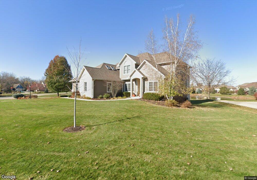
N27W24340 Single Tree Dr Pewaukee, WI 53072
Estimated Value: $654,671 - $824,000
--
Bed
--
Bath
--
Sq Ft
0.35
Acres
About This Home
This home is located at N27W24340 Single Tree Dr, Pewaukee, WI 53072 and is currently estimated at $743,224. N27W24340 Single Tree Dr is a home located in Waukesha County with nearby schools including Pewaukee Lake Elementary School, Asa Clark Middle School, and Pewaukee High School.
Ownership History
Date
Name
Owned For
Owner Type
Purchase Details
Closed on
Apr 20, 2007
Sold by
Bergman Brandon V
Bought by
Westerman James and Westerman Marieke
Current Estimated Value
Home Financials for this Owner
Home Financials are based on the most recent Mortgage that was taken out on this home.
Original Mortgage
$376,200
Outstanding Balance
$227,836
Interest Rate
6.18%
Mortgage Type
Construction
Estimated Equity
$515,388
Purchase Details
Closed on
Dec 12, 2005
Sold by
Creekside Preserve Llc
Bought by
Bergman Brandon V
Create a Home Valuation Report for This Property
The Home Valuation Report is an in-depth analysis detailing your home's value as well as a comparison with similar homes in the area
Home Values in the Area
Average Home Value in this Area
Purchase History
| Date | Buyer | Sale Price | Title Company |
|---|---|---|---|
| Westerman James | $127,000 | None Available | |
| Bergman Brandon V | -- | None Available |
Source: Public Records
Mortgage History
| Date | Status | Borrower | Loan Amount |
|---|---|---|---|
| Open | Westerman James | $376,200 |
Source: Public Records
Tax History Compared to Growth
Tax History
| Year | Tax Paid | Tax Assessment Tax Assessment Total Assessment is a certain percentage of the fair market value that is determined by local assessors to be the total taxable value of land and additions on the property. | Land | Improvement |
|---|---|---|---|---|
| 2024 | $5,442 | $457,400 | $161,700 | $295,700 |
| 2023 | $5,793 | $457,400 | $161,700 | $295,700 |
| 2022 | $5,645 | $457,400 | $161,700 | $295,700 |
| 2021 | $5,932 | $457,400 | $161,700 | $295,700 |
| 2020 | $6,247 | $411,400 | $115,200 | $296,200 |
| 2019 | $6,116 | $411,400 | $115,200 | $296,200 |
| 2018 | $5,871 | $411,400 | $115,200 | $296,200 |
| 2017 | $5,943 | $411,400 | $115,200 | $296,200 |
| 2016 | $6,031 | $411,400 | $115,200 | $296,200 |
| 2015 | $6,088 | $411,400 | $115,200 | $296,200 |
| 2014 | $6,656 | $411,400 | $115,200 | $296,200 |
| 2013 | $6,656 | $411,400 | $115,200 | $296,200 |
Source: Public Records
Map
Nearby Homes
- W241N2573 E Parkway Meadow Cir Unit 3
- N25W24117 River Park Dr Unit 2
- W241N2545 E Parkway Meadow Cir Unit 7
- W240N2532 E Parkway Meadow Cir Unit 4
- N24W24030 Brandon Oaks Dr Unit A
- W240N2500 E Parkway Meadow Cir Unit 8
- N24W24041 Stillwater Ln Unit A
- N22W24144 Cloister Cir Unit 6C
- 1136 Oxbow Ct
- 1343 Meadowcreek Dr Unit B
- N21W24352 Cumberland Dr Unit 31I
- N21W24090 Garden Cir Unit 3E
- 1019 Waterstone Ct
- 377 Briar Ct
- 1039 Waterstone Ct
- N21W24305 Cumberland Dr Unit 38 N
- N21W24248 Cumberland Dr Unit 26 I
- N21W24191 Dorchester Dr Unit 22C
- N28W25285 Parkway Ridge Cir Unit C Bldg 14 Unit 49
- N28W25285 Parkway Ridge Cir Unit D Bldg 14 Unit 50
- W243N2732 Single Tree Dr
- W243N2725 Creekside Dr
- W243N2736 Single Tree Dr
- W243N2719 Creekside Ct
- W243N2727 Creekside Dr
- W243N2720 Creekside Ct
- W242N2731 N Single Tree Dr
- W243N2731 Single Tree Dr
- W244N2748 Single Tree Dr
- W243N2728 Creekside Dr
- W243N2716 Creekside Ct
- W243N2715 Creekside Ct
- W244N2733 Single Tree Dr
- W244N2750 Single Tree Dr
- W243N2730 Creekside Dr
- W243N2735 Creekside Dr
- W244N2737 Single Tree Dr
- W244N2739 Single Tree Dr
- W243N2712 Creekside Ct
- W243N2711 Creekside Ct