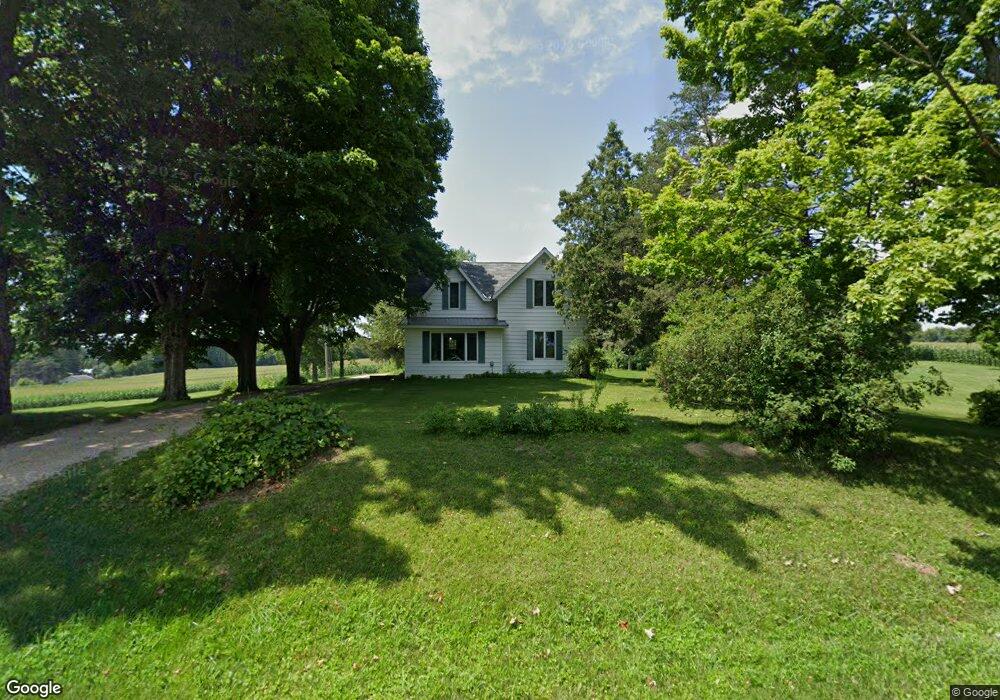
N5831 670th St Ellsworth, WI 54011
Estimated Value: $255,000 - $339,000
4
Beds
1
Bath
1,331
Sq Ft
$226/Sq Ft
Est. Value
About This Home
This home is located at N5831 670th St, Ellsworth, WI 54011 and is currently estimated at $300,970, approximately $226 per square foot. N5831 670th St is a home located in Pierce County with nearby schools including Ellsworth High School.
Ownership History
Date
Name
Owned For
Owner Type
Purchase Details
Closed on
Jul 28, 2005
Sold by
Schuster Randy J and Schuster Brenda L
Bought by
Forsman Scott
Current Estimated Value
Home Financials for this Owner
Home Financials are based on the most recent Mortgage that was taken out on this home.
Original Mortgage
$145,600
Outstanding Balance
$77,499
Interest Rate
6.37%
Mortgage Type
Adjustable Rate Mortgage/ARM
Estimated Equity
$223,471
Create a Home Valuation Report for This Property
The Home Valuation Report is an in-depth analysis detailing your home's value as well as a comparison with similar homes in the area
Home Values in the Area
Average Home Value in this Area
Purchase History
| Date | Buyer | Sale Price | Title Company |
|---|---|---|---|
| Forsman Scott | $182,000 | None Available |
Source: Public Records
Mortgage History
| Date | Status | Borrower | Loan Amount |
|---|---|---|---|
| Open | Forsman Scott | $145,600 |
Source: Public Records
Tax History
| Year | Tax Paid | Tax Assessment Tax Assessment Total Assessment is a certain percentage of the fair market value that is determined by local assessors to be the total taxable value of land and additions on the property. | Land | Improvement |
|---|---|---|---|---|
| 2025 | $4,569 | $249,400 | $35,000 | $214,400 |
| 2024 | $3,339 | $185,600 | $35,000 | $150,600 |
| 2023 | $3,039 | $185,600 | $35,000 | $150,600 |
| 2022 | $2,303 | $185,600 | $35,000 | $150,600 |
| 2021 | $2,662 | $185,600 | $35,000 | $150,600 |
| 2020 | $2,710 | $125,400 | $24,200 | $101,200 |
| 2019 | $2,621 | $125,400 | $24,200 | $101,200 |
| 2018 | $2,530 | $125,400 | $24,200 | $101,200 |
| 2017 | $2,537 | $125,400 | $24,200 | $101,200 |
| 2016 | $2,616 | $125,400 | $24,200 | $101,200 |
| 2015 | $2,464 | $125,400 | $24,200 | $101,200 |
| 2014 | $2,324 | $125,400 | $24,200 | $101,200 |
| 2013 | $2,824 | $151,600 | $24,200 | $127,400 |
Source: Public Records
Map
Nearby Homes
- 883 N Grant St
- 871 N Grant St
- 873 Hills Ln
- 332 Pleasant Ave
- 195 W Grove St
- 146 E Main St
- 314 N Maple St
- 375A W Kinne St
- 137 N Oak St
- 230 S Chestnut St
- 232 S Chestnut St
- 234 S Chestnut St
- 236 S Chestnut St
- 641 W Main St
- 770 W Hill St
- 638 W Dale St
- N5200 732nd St
- N5190 732nd St
- N5170 732nd St
- 808 S Piety St
- W6740 580th Ave
- N5834 670th St
- 325 W Crosstown Rd
- 325 W Cross Town Rd
- 325 E Crosstown Rd
- W6780 580th Ave
- Lot 1 Crosstown Rd
- xxx 670th St
- 205 E Crosstown Rd
- W6820 580th Ave
- 10A 670th St
- W6668 570th Ave
- W6661 570th Ave
- 6570 570th Ave
- 127 E Crosstown Rd
- Lot 3 670th St
- Lot 1 670th St
- 0 670th St
- 127E 127e Crosstown Rd
- 127E W Crosstown Rd
Your Personal Tour Guide
Ask me questions while you tour the home.