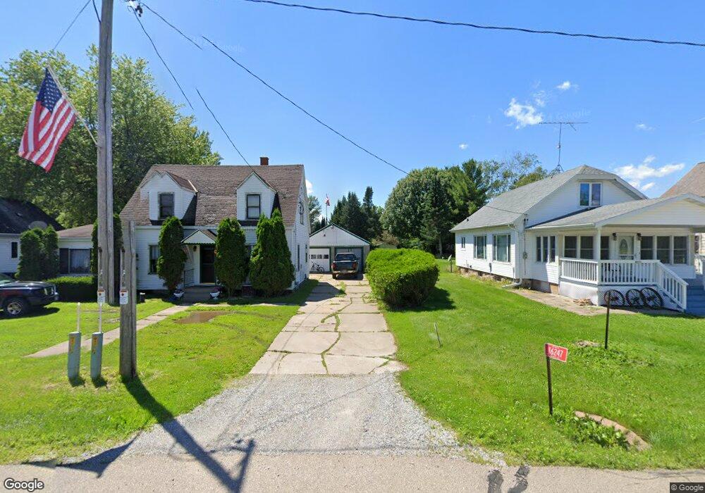
N6247 Airport Rd Bowler, WI 54416
Estimated Value: $197,428 - $385,000
4
Beds
2
Baths
2,415
Sq Ft
$105/Sq Ft
Est. Value
About This Home
This home is located at N6247 Airport Rd, Bowler, WI 54416 and is currently estimated at $253,607, approximately $105 per square foot. N6247 Airport Rd is a home located in Shawano County with nearby schools including Bowler Elementary School and Bowler High School.
Ownership History
Date
Name
Owned For
Owner Type
Purchase Details
Closed on
May 27, 2022
Sold by
Todd Wildenberg
Bought by
Wildenberg and Laura
Current Estimated Value
Purchase Details
Closed on
Sep 24, 2009
Sold by
Koester Lance
Bought by
Wildenberg Todd
Home Financials for this Owner
Home Financials are based on the most recent Mortgage that was taken out on this home.
Original Mortgage
$90,780
Interest Rate
5.19%
Purchase Details
Closed on
Aug 28, 2006
Sold by
Maahs I Gladys and Maahs Claude R
Bought by
Koester Lance
Purchase Details
Closed on
Apr 27, 2006
Sold by
Maahs Claude R
Bought by
Maahs I Gladys
Create a Home Valuation Report for This Property
The Home Valuation Report is an in-depth analysis detailing your home's value as well as a comparison with similar homes in the area
Home Values in the Area
Average Home Value in this Area
Purchase History
| Date | Buyer | Sale Price | Title Company |
|---|---|---|---|
| Wildenberg | $87,800 | Rl Hall Title | |
| Wildenberg Todd | $87,500 | Bay Title & Abstract Inc | |
| Koester Lance | $75,000 | -- | |
| Maahs I Gladys | $71,800 | -- |
Source: Public Records
Mortgage History
| Date | Status | Borrower | Loan Amount |
|---|---|---|---|
| Previous Owner | Wildenberg Todd | $90,780 | |
| Closed | Maahs I Gladys | $0 |
Source: Public Records
Tax History Compared to Growth
Tax History
| Year | Tax Paid | Tax Assessment Tax Assessment Total Assessment is a certain percentage of the fair market value that is determined by local assessors to be the total taxable value of land and additions on the property. | Land | Improvement |
|---|---|---|---|---|
| 2024 | $1,340 | $87,800 | $10,000 | $77,800 |
| 2023 | $1,209 | $87,800 | $10,000 | $77,800 |
| 2022 | $1,188 | $87,800 | $10,000 | $77,800 |
| 2021 | $1,183 | $87,800 | $10,000 | $77,800 |
| 2020 | $1,389 | $75,000 | $5,500 | $69,500 |
| 2019 | $1,473 | $75,000 | $5,500 | $69,500 |
| 2018 | $1,353 | $75,000 | $5,500 | $69,500 |
| 2017 | $1,293 | $75,000 | $5,500 | $69,500 |
| 2016 | $1,322 | $75,000 | $5,500 | $69,500 |
| 2015 | $1,240 | $75,000 | $5,500 | $69,500 |
| 2014 | $136,839 | $75,000 | $5,500 | $69,500 |
| 2013 | $1,683 | $75,000 | $5,500 | $69,500 |
Source: Public Records
Map
Nearby Homes
- 0 County Road D
- N7961 Moh He Con Nuc Rd
- N7961 Moh Hecon Nuck Rd
- 11100 Grandt Rd
- N4889 County Road D
- W11218 Grunewald St
- W15168 Rosenow Ln
- N4615 County Road D
- 1150 Schabow St
- 0 Knoke St Unit 50316989
- 0 Knoke St Unit 50304853
- 0 Mader St
- 931 Main St
- N3755 Netzel St
- W12796 Elm St
- W12799 County Road M
- 0 Lake Dr Unit 50315686
- 0 Lake Dr Unit 50315684
- 41 Lake Dr
- N8359 Regina Rd
- N6251 Airport Rd
- N6241 Airport Rd
- N6255 Airport Rd
- N6236 Airport Rd
- n 6236 Airport Rd
- N6263 Airport Rd
- n 6263 Airport Rd
- N6275 Airport Rd
- N6212 Airport Rd
- W13120 County Road D
- N6206 Airport Rd
- W13132 County Road D
- W13126 Cty D Rd
- W13115 County Road D
- W13115 County Road D
- N6193 County Road D
- W13139 County Road D
- W13143 Cth D
- N6185 Cty D Rd
- N6185 Cty D Rd