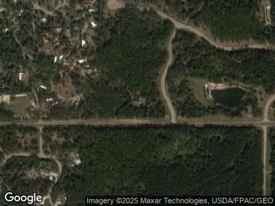
N7011 High Ridge Rd Mauston, WI 53948
Estimated Value: $538,000 - $698,000
3
Beds
4
Baths
3,424
Sq Ft
$181/Sq Ft
Est. Value
About This Home
This home is located at N7011 High Ridge Rd, Mauston, WI 53948 and is currently estimated at $618,131, approximately $180 per square foot. N7011 High Ridge Rd is a home located in Juneau County with nearby schools including West Side Elementary School, Lyndon Station Elementary School, and Grayside Elementary School.
Ownership History
Date
Name
Owned For
Owner Type
Purchase Details
Closed on
Aug 20, 2024
Sold by
Kristine J. Polsen and Kristine Dennis R. Polsen
Bought by
Conrardy Robert T
Current Estimated Value
Purchase Details
Closed on
Jun 28, 2024
Sold by
Dennis R Polsen 2006 Declaration Of Tru
Bought by
Sandstone Recreational Park Llc
Purchase Details
Closed on
Mar 18, 2005
Sold by
Golden Eagle Log Homes Inc
Bought by
Polsen Dennis R
Create a Home Valuation Report for This Property
The Home Valuation Report is an in-depth analysis detailing your home's value as well as a comparison with similar homes in the area
Home Values in the Area
Average Home Value in this Area
Purchase History
| Date | Buyer | Sale Price | Title Company |
|---|---|---|---|
| Conrardy Robert T | $54,000 | Richards-Bria Law Office | |
| Sandstone Recreational Park Llc | $100 | Richards-Bria Law Office | |
| Polsen Dennis R | $322,000 | -- |
Source: Public Records
Tax History Compared to Growth
Tax History
| Year | Tax Paid | Tax Assessment Tax Assessment Total Assessment is a certain percentage of the fair market value that is determined by local assessors to be the total taxable value of land and additions on the property. | Land | Improvement |
|---|---|---|---|---|
| 2024 | $6,752 | $437,700 | $23,800 | $413,900 |
| 2023 | $6,971 | $459,500 | $45,600 | $413,900 |
| 2022 | $7,306 | $459,500 | $45,600 | $413,900 |
| 2021 | $6,828 | $349,800 | $45,600 | $304,200 |
| 2020 | $7,221 | $349,800 | $45,600 | $304,200 |
| 2019 | $6,902 | $349,800 | $45,600 | $304,200 |
| 2018 | $6,696 | $349,800 | $45,600 | $304,200 |
| 2017 | $6,623 | $349,800 | $45,600 | $304,200 |
| 2016 | $7,783 | $349,800 | $45,600 | $304,200 |
| 2015 | $7,783 | $349,800 | $45,600 | $304,200 |
| 2014 | $6,201 | $355,200 | $71,100 | $284,100 |
| 2013 | $7,017 | $355,200 | $71,100 | $284,100 |
Source: Public Records
Map
Nearby Homes
- 9 Raccoon Ct
- N6893 Sandstone Dr
- N7108 Timber Ridge Ln
- N7122 Timber Ridge Ln
- N7088 Timber Ridge Ln
- N7109 Timber Ridge Ln
- N7123 Timber Ridge Ln
- N7137 Timber Ridge Ln
- N7151 Timber Ridge Ln
- N7165 Timber Ridge Ln
- N7179 Timber Ridge Ln
- Lot 22 Castle Ct
- W5120 County Road G
- W4150 Big Oak Dr
- N6613 20th Ave
- W4652 Crane Ln
- W4225 Vista Cir Unit 26
- W4134 Vista Dr
- W4248 Wildwood Dr
- W4197 41st St
- N7011 High Ridge Rd
- lot 30 High Ridge
- Lot 32 High Ridge
- Lot 4 High Ridge Rd
- L4 High Ridge Rd
- Lot 5 High Ridge Rd
- Lot 3 High Ridge Rd
- Lot 20 High Ridge Rd
- Lot 16 Raccoon Dr
- Lot 16 Racoon Dr
- N6982 N Sandstone Dr
- n 6982 Sandstone Dr
- N6953 Sandstone Dr
- 17 Raccoon Ct
- 17 Racoon Ct
- W4656 South Shore Rd
- Lot 31 Deer Run
- L22 Sandstone Dr
- L13 S Shore Rd
- Lot 13 S Shore Rd
