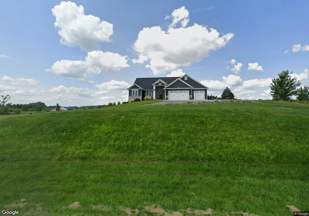
N7059 Fabisch Rd Beaver Dam, WI 53916
Estimated Value: $531,000 - $655,000
--
Bed
--
Bath
--
Sq Ft
1.4
Acres
About This Home
This home is located at N7059 Fabisch Rd, Beaver Dam, WI 53916 and is currently estimated at $582,898. N7059 Fabisch Rd is a home with nearby schools including Beaver Dam High School, St. Katharine Drexel School, and St. Stephen's Lutheran School.
Ownership History
Date
Name
Owned For
Owner Type
Purchase Details
Closed on
Aug 14, 2023
Sold by
Sutton Michael J
Bought by
Sutton Michael J and Mccormick Monica J
Current Estimated Value
Purchase Details
Closed on
Jul 3, 2020
Sold by
Hughes Cara H
Bought by
Sutton Michael J
Home Financials for this Owner
Home Financials are based on the most recent Mortgage that was taken out on this home.
Original Mortgage
$338,900
Interest Rate
2.9%
Mortgage Type
New Conventional
Purchase Details
Closed on
Aug 31, 2017
Sold by
T Fletcher & Sons Inc
Bought by
Sutton Michael J and Hughes Cara H
Home Financials for this Owner
Home Financials are based on the most recent Mortgage that was taken out on this home.
Original Mortgage
$15,000
Interest Rate
3.93%
Mortgage Type
Closed End Mortgage
Create a Home Valuation Report for This Property
The Home Valuation Report is an in-depth analysis detailing your home's value as well as a comparison with similar homes in the area
Home Values in the Area
Average Home Value in this Area
Purchase History
| Date | Buyer | Sale Price | Title Company |
|---|---|---|---|
| Sutton Michael J | $239,500 | Title Consultants | |
| Sutton Michael J | $226,000 | None Available | |
| Sutton Michael J | $40,000 | None Available |
Source: Public Records
Mortgage History
| Date | Status | Borrower | Loan Amount |
|---|---|---|---|
| Previous Owner | Sutton Michael J | $1,215 | |
| Previous Owner | Sutton Michael J | $338,900 | |
| Previous Owner | Sutton Michael J | $15,000 |
Source: Public Records
Tax History Compared to Growth
Tax History
| Year | Tax Paid | Tax Assessment Tax Assessment Total Assessment is a certain percentage of the fair market value that is determined by local assessors to be the total taxable value of land and additions on the property. | Land | Improvement |
|---|---|---|---|---|
| 2024 | $5,976 | $478,900 | $37,900 | $441,000 |
| 2023 | $6,211 | $478,900 | $37,900 | $441,000 |
| 2022 | $6,173 | $478,900 | $37,900 | $441,000 |
| 2021 | $4,835 | $284,500 | $32,000 | $252,500 |
| 2020 | $5,264 | $284,500 | $32,000 | $252,500 |
| 2019 | $4,432 | $259,500 | $32,000 | $227,500 |
| 2018 | $548 | $32,000 | $32,000 | $0 |
| 2017 | $7 | $400 | $400 | $0 |
| 2016 | $6 | $400 | $400 | $0 |
| 2015 | $6 | $400 | $400 | $0 |
| 2014 | $6 | $400 | $400 | $0 |
Source: Public Records
Map
Nearby Homes
- Lot 2 Hidden Valley Dr
- N6710 High Point Rd
- N7427 Hillendale Pkwy
- N7245 County Road I
- W7170 E Fir Rd
- 129 Acre S Crystal Lake Rd
- 305 Morgan Ln
- L5 Woodridge Ln
- 116 Prairie View Dr
- 121 Prairie View Dr
- 8246 N Crystal Lake Rd
- 314 Hillcrest Dr
- The Harrington Plan at Stoney Ridge
- The Dover Plan at Stoney Ridge
- The Bridgeport Plan at Stoney Ridge
- The Caspian Plan at Stoney Ridge
- The Conway Plan at Stoney Ridge
- The Saybrook Plan at Stoney Ridge
- The Charleston Plan at Stoney Ridge
- The Wingra Plan at Stoney Ridge