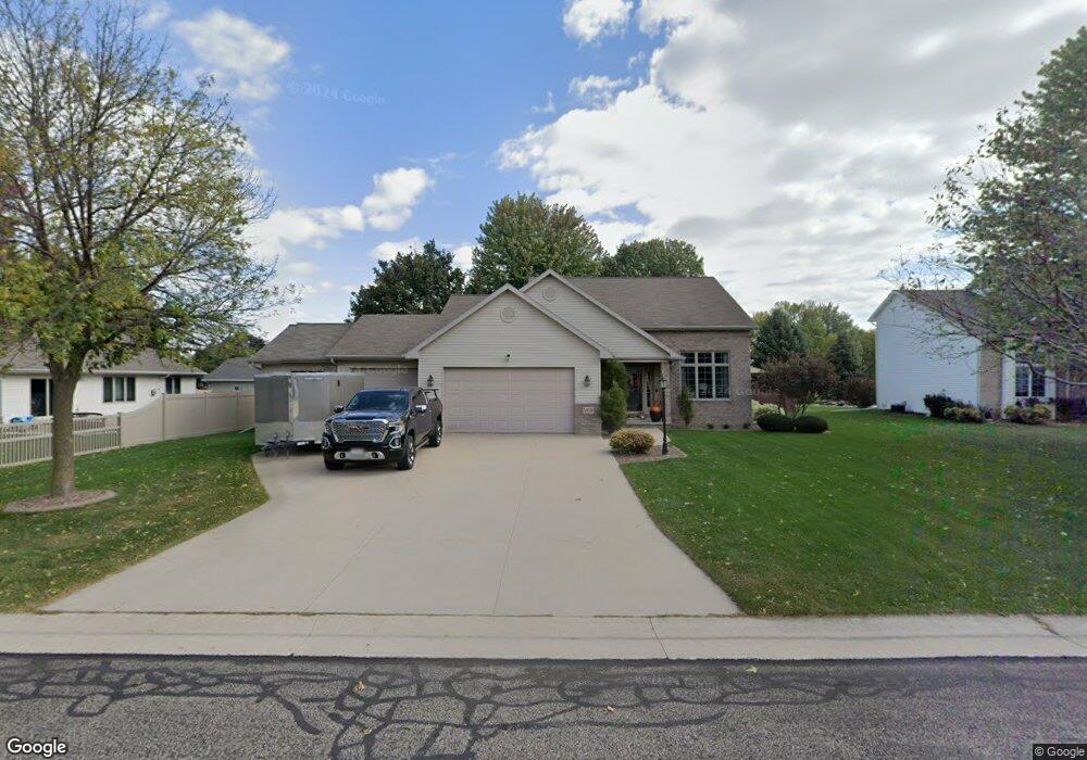
N9374 Snapdragon Ln Appleton, WI 54915
Estimated Value: $425,429 - $444,000
3
Beds
3
Baths
1,716
Sq Ft
$251/Sq Ft
Est. Value
About This Home
This home is located at N9374 Snapdragon Ln, Appleton, WI 54915 and is currently estimated at $430,607, approximately $250 per square foot. N9374 Snapdragon Ln is a home located in Calumet County with nearby schools including Sunrise Elementary School, J.R. Gerritts Middle School, and Mapleview Intermediate School.
Ownership History
Date
Name
Owned For
Owner Type
Purchase Details
Closed on
Apr 22, 2009
Sold by
Murphy Todd M and Murphy Tina M
Bought by
Goodsett Thomas F and Hanzel Jill A
Current Estimated Value
Home Financials for this Owner
Home Financials are based on the most recent Mortgage that was taken out on this home.
Original Mortgage
$163,100
Outstanding Balance
$103,713
Interest Rate
5.05%
Mortgage Type
New Conventional
Estimated Equity
$326,894
Purchase Details
Closed on
Jun 6, 2006
Sold by
Rosin Brian D and Rosin Anne C
Bought by
Murphy Todd M
Home Financials for this Owner
Home Financials are based on the most recent Mortgage that was taken out on this home.
Original Mortgage
$20,500
Interest Rate
6.66%
Mortgage Type
Credit Line Revolving
Create a Home Valuation Report for This Property
The Home Valuation Report is an in-depth analysis detailing your home's value as well as a comparison with similar homes in the area
Home Values in the Area
Average Home Value in this Area
Purchase History
| Date | Buyer | Sale Price | Title Company |
|---|---|---|---|
| Goodsett Thomas F | $203,900 | None Available | |
| Murphy Todd M | $205,000 | None Available |
Source: Public Records
Mortgage History
| Date | Status | Borrower | Loan Amount |
|---|---|---|---|
| Open | Goodsett Thomas F | $163,100 | |
| Previous Owner | Murphy Todd M | $20,500 |
Source: Public Records
Tax History
| Year | Tax Paid | Tax Assessment Tax Assessment Total Assessment is a certain percentage of the fair market value that is determined by local assessors to be the total taxable value of land and additions on the property. | Land | Improvement |
|---|---|---|---|---|
| 2024 | $4,203 | $247,900 | $43,200 | $204,700 |
| 2023 | $4,174 | $247,900 | $43,200 | $204,700 |
| 2022 | $3,933 | $247,900 | $43,200 | $204,700 |
| 2021 | $3,811 | $247,900 | $43,200 | $204,700 |
| 2020 | $4,086 | $247,900 | $43,200 | $204,700 |
| 2019 | $4,148 | $247,900 | $43,200 | $204,700 |
| 2018 | $4,154 | $211,000 | $43,200 | $167,800 |
| 2017 | $3,925 | $211,000 | $43,200 | $167,800 |
| 2016 | $4,082 | $211,000 | $43,200 | $167,800 |
| 2015 | $4,036 | $211,000 | $43,200 | $167,800 |
| 2013 | -- | $0 | $0 | $0 |
Source: Public Records
Map
Nearby Homes
- W6074 Strawflower Dr
- W6082 Hearthstone Dr
- N9221 Phlox Dr
- N9185 Jonsch Dr
- W5981 Woodsedge Ct
- N9036 Cedar Ct
- N9035 Cedar Ct
- N9050 Spring Valley Rd
- N9039 Spring Valley Rd
- N9337 Rosella Dr
- N9650 Darboy Dr
- N9562 Otte Ct
- 0 Otte Ct
- W5658 Tonys Way
- N9046 Southtowne Dr
- W6341 Kimberly Trail
- N9053 Southtowne Dr
- N9246 Homestead Ln
- N9240 Homestead Ln
- N9269 Breezy Way
- N9366 Snapdragon Ln
- W6075 Blazing Star Dr
- W6057 Blazing Star Dr
- W6061 Blazing Star Dr
- N9360 Snapdragon Ln
- N9371 Snapdragon Ln
- W6053 Blazing Star Dr
- N9379 Snapdragon Ln
- N9363 Snapdragon Ln
- N9352 Snapdragon Ln
- W6066 Moonflower Dr
- N9357 Snapdragon Ln
- W6066 Blazing Star Dr
- W6049 Blazing Star Dr
- N9393 Snapdragon Ln
- W6060 Moonflower Dr
- N9349 Snapdragon Ln
- W6058 Blazing Star Dr
- W6073 Jessica Ln
- W6065 Jessica Ln
Your Personal Tour Guide
Ask me questions while you tour the home.