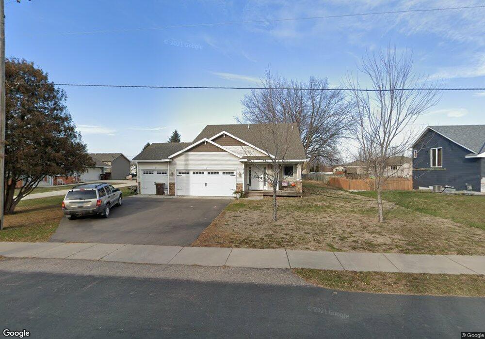
TBB 413 1st St N Montrose, MN 55363
Estimated Value: $304,321 - $320,000
2
Beds
1
Bath
1,005
Sq Ft
$311/Sq Ft
Est. Value
About This Home
This home is located at TBB 413 1st St N, Montrose, MN 55363 and is currently estimated at $312,580, approximately $311 per square foot. TBB 413 1st St N is a home located in Wright County with nearby schools including Montrose Elementary School, Buffalo Community Middle School, and Buffalo Senior High School.
Ownership History
Date
Name
Owned For
Owner Type
Purchase Details
Closed on
May 16, 2019
Sold by
Hpa Us1 Llc
Bought by
Hpa Jv Borrower 2019 1 Ath Llc
Current Estimated Value
Purchase Details
Closed on
Apr 26, 2019
Sold by
Hp Minnesota I Llc
Bought by
Hpa Us1 Llc
Purchase Details
Closed on
Oct 29, 2018
Sold by
Ford Trevor and Ford Shelby
Bought by
Hp Minnesota I Llc
Purchase Details
Closed on
Mar 29, 2016
Sold by
Progressive Builders Inc
Bought by
Ford Trevor
Create a Home Valuation Report for This Property
The Home Valuation Report is an in-depth analysis detailing your home's value as well as a comparison with similar homes in the area
Home Values in the Area
Average Home Value in this Area
Purchase History
| Date | Buyer | Sale Price | Title Company |
|---|---|---|---|
| Hpa Jv Borrower 2019 1 Ath Llc | -- | Stewart Ttl Guaranty Com Svc | |
| Hpa Us1 Llc | -- | Stewart Ttl Guaranty Com Svc | |
| Hp Minnesota I Llc | $225,000 | Burnet Title | |
| Ford Trevor | $174,900 | Minnesota Title | |
| Progressive Builders Inc | $14,000 | Minnesota Title |
Source: Public Records
Tax History Compared to Growth
Tax History
| Year | Tax Paid | Tax Assessment Tax Assessment Total Assessment is a certain percentage of the fair market value that is determined by local assessors to be the total taxable value of land and additions on the property. | Land | Improvement |
|---|---|---|---|---|
| 2025 | $3,860 | $290,900 | $50,000 | $240,900 |
| 2024 | $3,652 | $295,100 | $65,000 | $230,100 |
| 2023 | $3,652 | $319,500 | $81,000 | $238,500 |
| 2022 | $3,606 | $288,600 | $72,000 | $216,600 |
| 2021 | $3,504 | $242,900 | $40,000 | $202,900 |
| 2020 | $3,268 | $230,200 | $35,000 | $195,200 |
| 2019 | $2,640 | $209,600 | $0 | $0 |
| 2018 | $2,174 | $170,700 | $0 | $0 |
| 2017 | $1,914 | $140,100 | $0 | $0 |
| 2016 | $384 | $0 | $0 | $0 |
| 2015 | $372 | $0 | $0 | $0 |
| 2014 | -- | $0 | $0 | $0 |
Source: Public Records
Map
Nearby Homes
- 517 2nd St S
- 282 Fieldcrest Ave
- 305 Garfield Ave S
- 161 Mindy Ln Unit 9
- 136 Garner Cir
- 426 Dillon Ave N
- 1766 US Highway 12 SW
- 608 1st St N
- 683 Aspen Ln
- 610 Emerson Ave N
- 684 Aspen Ln
- 685 Aspen Ln
- 687 Aspen Ln
- 137 Pheasant Ridge Dr
- 689 Aspen Ln
- 150 Pheasant Ridge Dr
- 690 Aspen Ln
- 691 Aspen Ln
- 692 Aspen Ln
- 693 Aspen Ln
- 413 1st St N
- 415 1st St N
- 415 415 1st-Street-n
- 144 Crystal Cir
- 144 Crystal Cir
- 146 Crystal Ct
- 146 Crystal Cir
- 409 1st St N
- 417 1st St N
- xxxx 1st St
- xxx 1st St
- 108 Charity Cir
- 407 1st St N
- 148 Crystal Cir
- 106 Charity Cir
- xxxxx Crystal Cir
- 148 Crystal Cir
- xxx Crystal Cir
- 125 Crystal Cir
- 125 Crystal Cir