
TBD S Main St Cambridge, MN 55008
Estimated payment $23,389/month
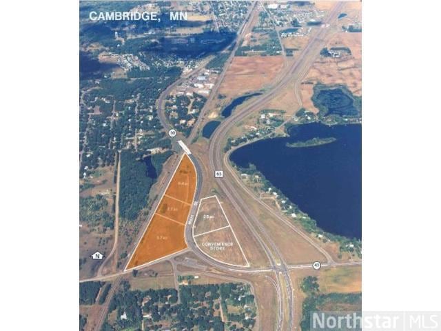
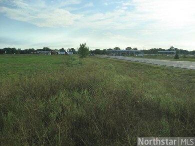
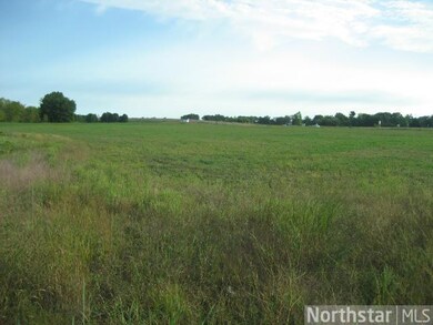
About This Lot
Highly visible to Hwy 65. Natural traffic split between Old Main St. and new Hwy 65 bypass. Price may be subject to change depending on use and size of split
Property Details
Property Type
- Land
Est. Annual Taxes
- $1,998
Lot Details
- Lot Dimensions are 1159x602x1853x243
- Additional Parcels
- Zoning described as Business/Commercial
Community Details
- No Home Owners Association
Listing and Financial Details
- Assessor Parcel Number 150080601
Map
Home Values in the Area
Average Home Value in this Area
Property History
| Date | Event | Price | List to Sale | Price per Sq Ft |
|---|---|---|---|---|
| 02/04/2022 02/04/22 | Price Changed | $4,406,094 | +42.9% | -- |
| 02/01/2013 02/01/13 | For Sale | $3,084,263 | -- | -- |
Source: NorthstarMLS
MLS Number: 4333091
Disclaimer: Certain information contained herein is derived from information provided by parties other than Homes.com. All information provided is deemed reliable, but is not guaranteed to be accurate and should be independently verified.
![]() Based on information submitted to the MLS GRID. All data is obtained from various sources and may not have been verified by broker or MLS GRID. Supplied Open House Information is subject to change without notice. All information should be independently reviewed and verified for accuracy. Properties may or may not be listed by the office/agent presenting the information. Some IDX listings have been excluded from this website.
Based on information submitted to the MLS GRID. All data is obtained from various sources and may not have been verified by broker or MLS GRID. Supplied Open House Information is subject to change without notice. All information should be independently reviewed and verified for accuracy. Properties may or may not be listed by the office/agent presenting the information. Some IDX listings have been excluded from this website.
The Digital Millennium Copyright Act of 1998, 17 U.S.C. § 512 (the “DMCA”) provides recourse for copyright owners who believe that material appearing on the Internet infringes their rights under U.S. copyright law. If you believe in good faith that any content or material made available in connection with our website or services infringes your copyright, you (or your agent) may send us a notice requesting that the content or material be removed, or access to it blocked.
Notices must be sent in writing by email to DMCAnotice@MLSGrid.com.
The DMCA requires that your notice of alleged copyright infringement include the following information:
(1) description of the copyrighted work that is the subject of claimed infringement;
(2) description of the alleged infringing content and information sufficient to permit us to locate the content;
(3) contact information for you, including your address, telephone number and email address;
(4) a statement by you that you have a good faith belief that the content in the manner complained of is not authorized by the copyright owner, or its agent, or by the operation of any law;
(5) a statement by you, signed under penalty of perjury, that the information in the notification is accurate and that you have the authority to enforce the copyrights that are claimed to be infringed; and
(6) a physical or electronic signature of the copyright owner or a person authorized to act on the copyright owner’s behalf. Failure to include all of the above information may result in the delay of the processing of your complaint.
- 51352 113th Ave
- 49404 109th Ave
- 128 Spruce Ave
- 48111 E Pine Lake Rd
- 39309 350th St SE
- 47911 Taflin Lake Rd
- TBD 460th St
- 0 Tbd 460th St Unit LotWP001
- 46496 County 7
- 37616 390th Ave SE
- TBD Lot 1&2 390th Ave SE
- 315 3rd Ave SW
- 29211 305th Ave SE
- 405 County Road 5
- 302 Elm St
- 311 3rd Ave
- 411 Governor St
- 34774 400th St SE
- 411 8th St NE
- 46813 209th Ave
