

Estimated payment $484/month
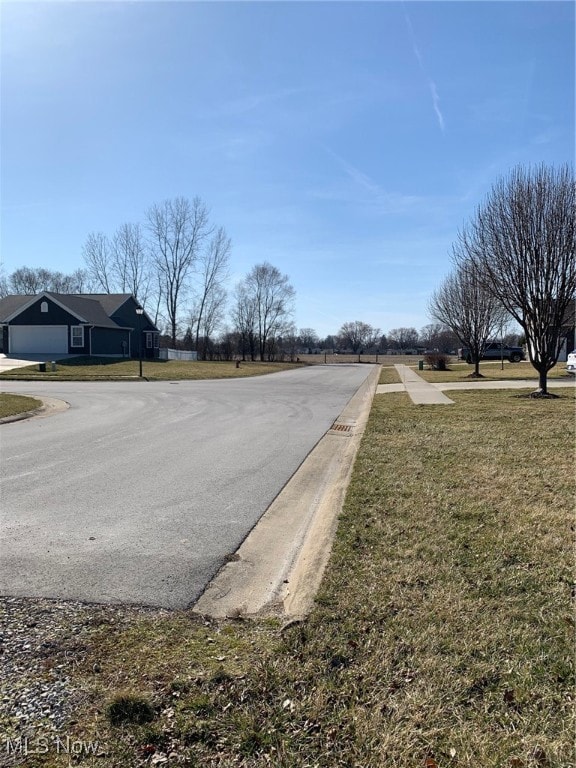
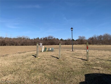
About This Lot
This home is located at V/L- Lake Breeze Dr, Huron, OH 44839 and is currently priced at $69,900. V/L- Lake Breeze Dr is a home located in Erie County with nearby schools including Furry Elementary School, Meadowlawn Elementary School, and Briar Middle School.
Listing Agent
Century 21 DeAnna Realty Brokerage Email: jim@century21deanna.com, 330-323-3356 License #2006003572 Listed on: 07/15/2025

Property Details
Property Type
- Land
Est. Annual Taxes
- $1,161
Lot Details
- 0.69 Acre Lot
- Lot Dimensions are 220x150
- 41-00014-024
Parking
- On-Street Parking
Property Views
- Neighborhood Views
Utilities
- Phone Available
- Cable TV Available
Community Details
- Property has a Home Owners Association
- Willow Lake Association
- Willow Lake Subdivision
Listing and Financial Details
- Assessor Parcel Number 41-00014-023
Map
Home Values in the Area
Average Home Value in this Area
Tax History
| Year | Tax Paid | Tax Assessment Tax Assessment Total Assessment is a certain percentage of the fair market value that is determined by local assessors to be the total taxable value of land and additions on the property. | Land | Improvement |
|---|---|---|---|---|
| 2024 | $582 | $12,530 | $12,530 | $0 |
| 2023 | $582 | $8,284 | $8,284 | $0 |
| 2022 | $486 | $8,281 | $8,281 | $0 |
| 2021 | $484 | $8,280 | $8,280 | $0 |
| 2020 | $512 | $8,280 | $8,280 | $0 |
| 2019 | $525 | $8,280 | $8,280 | $0 |
| 2018 | $525 | $8,280 | $8,280 | $0 |
| 2017 | $786 | $13,840 | $13,840 | $0 |
| 2016 | $684 | $13,840 | $13,840 | $0 |
| 2015 | $663 | $13,840 | $13,840 | $0 |
| 2014 | $670 | $13,840 | $13,840 | $0 |
| 2013 | $638 | $13,840 | $13,840 | $0 |
Property History
| Date | Event | Price | Change | Sq Ft Price |
|---|---|---|---|---|
| 07/15/2025 07/15/25 | For Sale | $69,900 | -- | -- |
Purchase History
| Date | Type | Sale Price | Title Company |
|---|---|---|---|
| Warranty Deed | $92,542 | Frankel John D |
Source: MLS Now
MLS Number: 5140496
APN: 41-00014-023
Disclaimer: Certain information contained herein is derived from information provided by parties other than Homes.com. All information provided is deemed reliable, but is not guaranteed to be accurate and should be independently verified.
![]() IDX information is provided exclusively for personal, non-commercial use, and may not be used for any purpose other than to identify prospective properties consumers may be interested in purchasing. Information is deemed reliable but not guaranteed.
IDX information is provided exclusively for personal, non-commercial use, and may not be used for any purpose other than to identify prospective properties consumers may be interested in purchasing. Information is deemed reliable but not guaranteed.
- 3501 Cleveland Rd W
- 3010 E Bayview Ln
- 3050 E Perkins Ave
- 2834 Hinde Ave
- 2822 Sunset Ln
- 2906 E Perkins Ave
- 3224 Angels Way
- 0 Lauras Ln
- 3135 Lauras Ln
- 3033 Lauras Ln
- 3037 Lauras Ln
- 3123 Alexandrias Dr
- 3127 Alexandrias Dr
- 2712 N Bayview Ln
- 2501 E Perkins Ave
- 3125 Michaels Cir
- 0 Galloway Rd Unit 20243994
- 1640 Cleveland Rd W
- 3509 Jeanette Dr
- 3616 Turfside Cir Unit B
- 2800 Mall Dr N
- 122 Redwood Dr
- 100 Brook Blvd
- 1600 Pelton Park Dr
- 3837 Windsor Bridge Cir
- 2613 Pioneer Trail
- 2070 Heritage Dr
- 804 Force Ave
- 1937 4th St
- 3307 Columbus Ave
- 1528 5th St Unit Purple
- 1528 5th St Unit Blue
- 1528 5th St Unit Green
- 1528 5th St Unit Rose
- 2615 Columbus Ave
- 1227 Avondale St
- 201 Rye Beach Rd
- 1107 1st St Unit ID1061069P
- 122 Overlook Rd Unit ID1061029P
- 208-214 Perry St