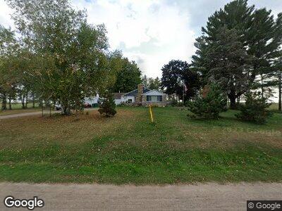
w 1535 Us Highway 10 Unit 69 Acres MOL Granton, WI 54436
Estimated Value: $149,000 - $320,000
--
Bed
--
Bath
--
Sq Ft
69
Acres
About This Home
This home is located at w 1535 Us Highway 10 Unit 69 Acres MOL, Granton, WI 54436 and is currently estimated at $222,925. w 1535 Us Highway 10 Unit 69 Acres MOL is a home located in Clark County with nearby schools including Granton Elementary School and Granton High School.
Ownership History
Date
Name
Owned For
Owner Type
Purchase Details
Closed on
Oct 18, 2011
Sold by
Noel Carol
Bought by
Selves Troy S
Current Estimated Value
Purchase Details
Closed on
Jul 22, 2010
Sold by
Noel Carol
Bought by
Schmitz Farms Llc
Create a Home Valuation Report for This Property
The Home Valuation Report is an in-depth analysis detailing your home's value as well as a comparison with similar homes in the area
Home Values in the Area
Average Home Value in this Area
Purchase History
| Date | Buyer | Sale Price | Title Company |
|---|---|---|---|
| Selves Troy S | -- | Title Experts Of Wisconsin L | |
| Selves Troy S | $54,000 | Title Experts Of Wisconsin L | |
| Schmitz Farms Llc | $202,900 | Schuster Campman Abstract & |
Source: Public Records
Mortgage History
| Date | Status | Borrower | Loan Amount |
|---|---|---|---|
| Open | Selves Troy | $23,000 |
Source: Public Records
Tax History Compared to Growth
Tax History
| Year | Tax Paid | Tax Assessment Tax Assessment Total Assessment is a certain percentage of the fair market value that is determined by local assessors to be the total taxable value of land and additions on the property. | Land | Improvement |
|---|---|---|---|---|
| 2024 | $1,145 | $82,000 | $8,200 | $73,800 |
| 2023 | $1,023 | $82,000 | $8,200 | $73,800 |
| 2022 | $1,082 | $82,000 | $8,200 | $73,800 |
| 2021 | $1,083 | $62,100 | $5,600 | $56,500 |
| 2020 | $1,257 | $62,100 | $5,600 | $56,500 |
| 2019 | $1,204 | $62,100 | $5,600 | $56,500 |
| 2018 | $1,275 | $62,100 | $5,600 | $56,500 |
| 2017 | $115 | $62,100 | $5,600 | $56,500 |
| 2016 | $1,187 | $62,100 | $5,600 | $56,500 |
| 2015 | -- | $62,100 | $5,600 | $56,500 |
| 2014 | -- | $62,100 | $5,600 | $56,500 |
| 2013 | -- | $62,100 | $5,600 | $56,500 |
| 2011 | -- | $100,100 | $5,600 | $94,500 |
Source: Public Records
Map
Nearby Homes
- W1802 Maple Rd
- 00 Badger Ave
- W1066 Sand Rd
- N7066 County Road Y Unit Lot 2
- 8454 County Road V
- W320 Tree Rd
- N6791 Sandhill Ave
- W839 W Rosewood Dr Unit Lot 4
- W887 W Rosewood Dr Unit Lot 1
- 10596 Macarthur Dr
- N6695 Pelsdorf Ave
- N6479 County Road K
- 8249 Robin Rd
- 11651 Eagle Rd
- Lot 8 Riveredge Ln
- 9897 Riveredge Dr
- 0 Granton Rd Unit 1588263
- N1040 County Road z
- 9878 Clark Dr
- 10112 County Road Bb