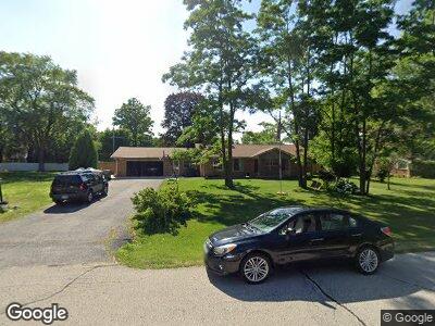
W124S6491 Hawthorne Rd Muskego, WI 53150
Estimated Value: $387,000 - $442,000
3
Beds
2
Baths
1,755
Sq Ft
$241/Sq Ft
Est. Value
About This Home
This home is located at W124S6491 Hawthorne Rd, Muskego, WI 53150 and is currently estimated at $422,901, approximately $240 per square foot. W124S6491 Hawthorne Rd is a home located in Waukesha County with nearby schools including Bay Lane Elementary School, Lake Denoon Middle School, and Muskego High School.
Ownership History
Date
Name
Owned For
Owner Type
Purchase Details
Closed on
Jul 30, 2009
Sold by
Popp Richard L and Popp Denise K
Bought by
Bush Jeffrey A and Bush Susan A
Current Estimated Value
Home Financials for this Owner
Home Financials are based on the most recent Mortgage that was taken out on this home.
Original Mortgage
$182,631
Interest Rate
5.49%
Mortgage Type
FHA
Purchase Details
Closed on
Oct 29, 1999
Sold by
Haverlock James C
Bought by
Wink Denise K and Popp Richard
Home Financials for this Owner
Home Financials are based on the most recent Mortgage that was taken out on this home.
Original Mortgage
$130,000
Interest Rate
7.88%
Create a Home Valuation Report for This Property
The Home Valuation Report is an in-depth analysis detailing your home's value as well as a comparison with similar homes in the area
Home Values in the Area
Average Home Value in this Area
Purchase History
| Date | Buyer | Sale Price | Title Company |
|---|---|---|---|
| Bush Jeffrey A | $186,000 | None Available | |
| Wink Denise K | $150,000 | -- |
Source: Public Records
Mortgage History
| Date | Status | Borrower | Loan Amount |
|---|---|---|---|
| Open | Bush Jeffrey A | $157,000 | |
| Closed | Bush Jeffrey A | $20,000 | |
| Closed | Bush Jeffrey A | $179,346 | |
| Closed | Bush Jeffrey A | $182,631 | |
| Previous Owner | Wink Denise K | $130,000 |
Source: Public Records
Tax History Compared to Growth
Tax History
| Year | Tax Paid | Tax Assessment Tax Assessment Total Assessment is a certain percentage of the fair market value that is determined by local assessors to be the total taxable value of land and additions on the property. | Land | Improvement |
|---|---|---|---|---|
| 2024 | $3,157 | $280,600 | $69,500 | $211,100 |
| 2023 | $3,110 | $280,600 | $69,500 | $211,100 |
| 2022 | $3,042 | $280,600 | $69,500 | $211,100 |
| 2021 | $3,012 | $280,600 | $69,500 | $211,100 |
| 2020 | $3,243 | $236,200 | $60,800 | $175,400 |
| 2019 | $3,212 | $236,200 | $60,800 | $175,400 |
| 2018 | $3,251 | $236,200 | $60,800 | $175,400 |
| 2017 | $3,251 | $236,200 | $60,800 | $175,400 |
| 2016 | $3,360 | $216,900 | $58,200 | $158,700 |
| 2015 | $3,396 | $216,900 | $58,200 | $158,700 |
| 2014 | $3,697 | $216,900 | $58,200 | $158,700 |
| 2013 | $3,697 | $216,900 | $58,200 | $158,700 |
Source: Public Records
Map
Nearby Homes
- 12012 W James Ave
- 12001 Parkview Ln
- Lt2 Windsor Rd
- 12113 N Ridge Trail
- 11560 W James Ave
- 6872 S 117th St
- 13645 W Sunbury Rd
- 6590 S Carroll Cir
- S69W13488 Hale Park Ct
- 11230 W Belmar Dr
- Lt1 W Forest Home Ave
- S67W13779 Hardwicke Place
- S70W13426 Fennimore Ln
- 5910 S Conservancy Dr
- 11385 W Rawson Ave
- Lt17 W Old Farm Rd
- 11260 Bridget Ln
- Lt8 Twin Silos Ct
- Lt1 Twin Silos Ct
- Lt2 Twin Silos Ct
- W124S6491 Hawthorne Rd
- W124S6519 Hawthorne Rd
- W124S6465 Hawthorne Rd
- W125S6490 Whittier Terrace
- W124S6488 Hawthorne Rd
- W124S6541 Hawthorne Rd
- W124S6516 Hawthorne Rd
- W125S6464 Whittier Terrace
- W125S6518 Whittier Terrace
- W124S6462 Hawthorne Rd
- W124S6439 Hawthorne Rd
- W124S6540 Hawthorne Rd
- W125S6538 Whittier Terrace
- S64W12563 Tennyson Ln
- W124S6438 Hawthorne Rd
- W125S6521 Whittier Terrace
- W124S6566 Hawthorne Rd
- W125S6493 Whittier Terrace
- S64W12615 Tennyson Ln
- S63W12525 Tennyson Ln