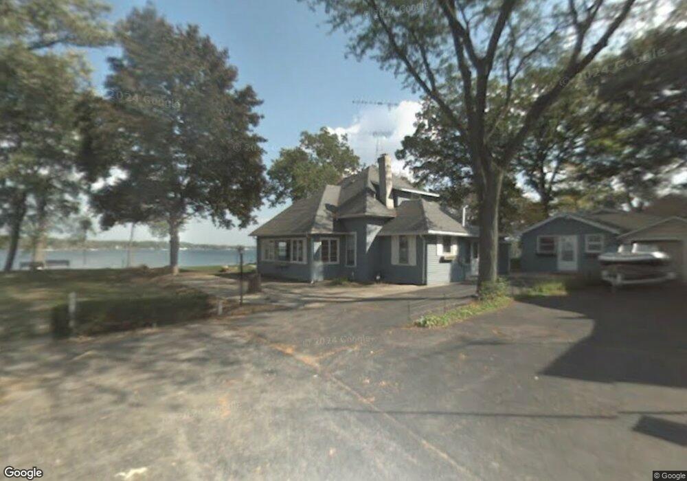
W192 Nippersink Rd Genoa City, WI 53128
Estimated Value: $630,000 - $2,163,866
--
Bed
--
Bath
--
Sq Ft
0.27
Acres
About This Home
This home is located at W192 Nippersink Rd, Genoa City, WI 53128 and is currently estimated at $1,634,622. W192 Nippersink Rd is a home with nearby schools including Brookwood Elementary School, Brookwood Middle School, and Badger High School.
Ownership History
Date
Name
Owned For
Owner Type
Purchase Details
Closed on
Oct 22, 2019
Sold by
Puder John G and John G Puder Trust
Bought by
Grossman David R and Files Steven P
Current Estimated Value
Home Financials for this Owner
Home Financials are based on the most recent Mortgage that was taken out on this home.
Original Mortgage
$1,012,500
Outstanding Balance
$890,597
Interest Rate
3.7%
Mortgage Type
New Conventional
Estimated Equity
$744,025
Create a Home Valuation Report for This Property
The Home Valuation Report is an in-depth analysis detailing your home's value as well as a comparison with similar homes in the area
Home Values in the Area
Average Home Value in this Area
Purchase History
| Date | Buyer | Sale Price | Title Company |
|---|---|---|---|
| Grossman David R | $1,350,000 | None Available |
Source: Public Records
Mortgage History
| Date | Status | Borrower | Loan Amount |
|---|---|---|---|
| Open | Grossman David R | $1,012,500 |
Source: Public Records
Tax History Compared to Growth
Tax History
| Year | Tax Paid | Tax Assessment Tax Assessment Total Assessment is a certain percentage of the fair market value that is determined by local assessors to be the total taxable value of land and additions on the property. | Land | Improvement |
|---|---|---|---|---|
| 2024 | $19,551 | $1,324,200 | $618,500 | $705,700 |
| 2023 | $19,727 | $1,324,200 | $618,500 | $705,700 |
| 2022 | $20,341 | $917,100 | $499,200 | $417,900 |
| 2021 | $20,322 | $917,100 | $499,200 | $417,900 |
| 2020 | $19,709 | $917,100 | $499,200 | $417,900 |
| 2019 | $19,379 | $917,100 | $499,200 | $417,900 |
| 2018 | $18,264 | $917,100 | $499,200 | $417,900 |
| 2017 | $18,633 | $917,100 | $499,200 | $417,900 |
| 2016 | $17,384 | $873,900 | $479,900 | $394,000 |
| 2015 | $17,288 | $873,900 | $479,900 | $394,000 |
| 2014 | -- | $873,900 | $479,900 | $394,000 |
| 2013 | -- | $848,600 | $479,900 | $368,700 |
Source: Public Records
Map
Nearby Homes
- 40724 93rd St
- N1189 Tombeau Rd
- 8823 406th Ave
- 9499 402nd Ave
- 39918 93rd St
- Lt9 95th St
- Lt10 95th St
- 9631 400th Ave
- W105 Tombeau Blvd
- 10244 406th Ave
- 9244 391st Ave
- 8627 392nd Ave
- 39740 Bloomfield Rd
- 9020 388th Ave
- 10536 401st Ave
- N1548 N Daisy Dr
- Lt249-264 Hyacinth Rd
- 1400 Hunters Ridge Dr Unit 20
- 1400 Hunters Ridge Dr Unit 103
- W941 Hyacinth Rd
- W190 Nippersink Rd
- W146 92nd St
- W188 Nippersink Rd
- W186 Nippersink Rd
- W144 92nd St
- W184 Nippersink Rd
- W142 92nd St
- W180 Nippersink Rd
- W182 Nippersink Rd
- W138 92nd St
- W178 Nippersink Rd
- W134 92nd St
- N1353 Tombeau Rd
- W135 92nd St
- W174 Nippersink Rd
- W202 Nippersink Rd
- W168 Nippersink Rd
- W128 92nd St
- N1346 Tombeau Rd
- W127 92nd St