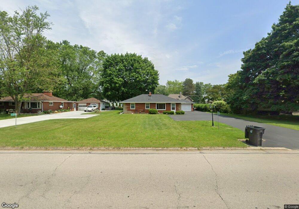
W229S8450 Big Bend Dr Big Bend, WI 53103
Estimated Value: $349,000 - $419,000
--
Bed
--
Bath
--
Sq Ft
0.36
Acres
About This Home
This home is located at W229S8450 Big Bend Dr, Big Bend, WI 53103 and is currently estimated at $376,773. W229S8450 Big Bend Dr is a home located in Waukesha County with nearby schools including Big Bend Elementary School, Park View Middle School, and Mukwonago High School.
Ownership History
Date
Name
Owned For
Owner Type
Purchase Details
Closed on
Jul 31, 2017
Sold by
Badertscher Ronald
Bought by
Arrowood Daniel and Adkins Lanette
Current Estimated Value
Home Financials for this Owner
Home Financials are based on the most recent Mortgage that was taken out on this home.
Original Mortgage
$199,025
Interest Rate
3.88%
Mortgage Type
New Conventional
Purchase Details
Closed on
Jul 15, 2010
Sold by
Rosenthal Michael J
Bought by
Badertscher Ronald and Badertscher Sandra
Purchase Details
Closed on
Oct 15, 2009
Sold by
Bauman Joan L
Bought by
Rosenthal Michael J
Home Financials for this Owner
Home Financials are based on the most recent Mortgage that was taken out on this home.
Original Mortgage
$157,102
Interest Rate
5.1%
Mortgage Type
FHA
Create a Home Valuation Report for This Property
The Home Valuation Report is an in-depth analysis detailing your home's value as well as a comparison with similar homes in the area
Home Values in the Area
Average Home Value in this Area
Purchase History
| Date | Buyer | Sale Price | Title Company |
|---|---|---|---|
| Arrowood Daniel | $209,500 | Frontier Title & Closing Svc | |
| Badertscher Ronald | $168,000 | None Available | |
| Rosenthal Michael J | $160,000 | None Available |
Source: Public Records
Mortgage History
| Date | Status | Borrower | Loan Amount |
|---|---|---|---|
| Open | Arrowood Daniel T | $232,100 | |
| Closed | Arrowood Daniel T | $198,600 | |
| Closed | Arrowood Daniel | $199,025 | |
| Previous Owner | Rosenthal Michael J | $157,102 |
Source: Public Records
Tax History Compared to Growth
Tax History
| Year | Tax Paid | Tax Assessment Tax Assessment Total Assessment is a certain percentage of the fair market value that is determined by local assessors to be the total taxable value of land and additions on the property. | Land | Improvement |
|---|---|---|---|---|
| 2024 | $2,348 | $290,600 | $82,000 | $208,600 |
| 2023 | $2,264 | $290,600 | $82,000 | $208,600 |
| 2022 | $2,394 | $218,800 | $60,400 | $158,400 |
| 2021 | $2,354 | $218,800 | $60,400 | $158,400 |
| 2020 | $2,412 | $218,800 | $60,400 | $158,400 |
| 2019 | $2,079 | $169,900 | $52,500 | $117,400 |
| 2018 | $2,098 | $169,900 | $52,500 | $117,400 |
| 2017 | $2,093 | $169,900 | $52,500 | $117,400 |
| 2016 | $2,078 | $169,900 | $52,500 | $117,400 |
| 2015 | $2,052 | $169,900 | $52,500 | $117,400 |
| 2014 | $2,149 | $0 | $0 | $0 |
| 2013 | $2,149 | $171,800 | $54,000 | $117,800 |
Source: Public Records
Map
Nearby Homes
- S83W23145 Artesian Ave
- W232S8430 Rosemary Dr
- W232S8755 Edgewood Ct
- Lt2 Marianne Ave
- Pcl0 Clark St
- S80W23790 Parkview Dr
- S95W23000 River Oaks Dr
- S94W23620 Kunzendorf Ct
- S96W22870 River Oaks Dr
- S71W23350 National Ave
- W247S7405 Scotland Dr
- W237S6815 Fernwood Dr
- W240S10240 Castle Rd
- W255S8545 Hi lo Dr
- Lt3 Madyson Ct
- Lt2 Madyson Ct
- Lt1 Madyson Ct
- Lt1 Parker Dr
- Lt3 Parker Dr
- W247S6795 Sugar Maple Dr
- W229S8440 Big Bend Dr
- W229S8460 Big Bend Dr
- W229S8430 Big Bend Dr
- W229S8480 Big Bend Dr
- W229S8475 Mardith Ave
- W229S8455 Mardith Ave
- W229S8420 Big Bend Dr
- W229S8520 Big Bend Dr
- W229S8435 Mardith Ave
- W229S8505 Mardith Ave
- W228S8440 Mardith Ave
- S85W23000 Villa Dr
- W228S8460 Mardith Ave
- W228S8470 Mardith Ave
- W229S8400 Big Bend Dr
- W228S8430 Mardith Ave
- W229S8530 Big Bend Dr
- W229S8405 Mardith Ave
- W228S8510 Mardith Ave
- S85W23030 Villa Dr