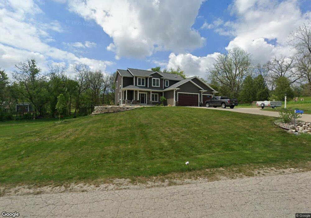
W233S8415 Robert Way Big Bend, WI 53103
Estimated Value: $666,204 - $758,000
--
Bed
--
Bath
--
Sq Ft
1.08
Acres
About This Home
This home is located at W233S8415 Robert Way, Big Bend, WI 53103 and is currently estimated at $708,051. W233S8415 Robert Way is a home located in Waukesha County with nearby schools including Big Bend Elementary School, Park View Middle School, and Mukwonago High School.
Ownership History
Date
Name
Owned For
Owner Type
Purchase Details
Closed on
Dec 14, 2016
Sold by
Bird Timothy and Bird Rozanne
Bought by
Schoeneck Christopher
Current Estimated Value
Home Financials for this Owner
Home Financials are based on the most recent Mortgage that was taken out on this home.
Original Mortgage
$346,275
Outstanding Balance
$279,783
Interest Rate
3.54%
Mortgage Type
New Conventional
Estimated Equity
$428,268
Purchase Details
Closed on
May 28, 2015
Sold by
Waterstone Bank Ssb
Bought by
Bird Timothy and Bird Rozanne
Home Financials for this Owner
Home Financials are based on the most recent Mortgage that was taken out on this home.
Original Mortgage
$42,000
Interest Rate
0.78%
Mortgage Type
Construction
Purchase Details
Closed on
May 18, 2012
Sold by
Wind Walker Highlands Inc
Bought by
Waterstone Bank Ssb and Wauwatosa Savings Bank
Create a Home Valuation Report for This Property
The Home Valuation Report is an in-depth analysis detailing your home's value as well as a comparison with similar homes in the area
Home Values in the Area
Average Home Value in this Area
Purchase History
| Date | Buyer | Sale Price | Title Company |
|---|---|---|---|
| Schoeneck Christopher | $364,500 | None Available | |
| Bird Timothy | $52,500 | None Available | |
| Waterstone Bank Ssb | $590,000 | None Available |
Source: Public Records
Mortgage History
| Date | Status | Borrower | Loan Amount |
|---|---|---|---|
| Open | Schoeneck Christopher | $346,275 | |
| Previous Owner | Bird Timothy | $42,000 |
Source: Public Records
Tax History Compared to Growth
Tax History
| Year | Tax Paid | Tax Assessment Tax Assessment Total Assessment is a certain percentage of the fair market value that is determined by local assessors to be the total taxable value of land and additions on the property. | Land | Improvement |
|---|---|---|---|---|
| 2024 | $7,424 | $608,900 | $80,800 | $528,100 |
| 2023 | $6,843 | $574,200 | $80,800 | $493,400 |
| 2022 | $5,209 | $310,900 | $70,500 | $240,400 |
| 2021 | $5,324 | $310,900 | $70,500 | $240,400 |
| 2020 | $5,420 | $310,900 | $70,500 | $240,400 |
| 2019 | $5,210 | $310,900 | $70,500 | $240,400 |
| 2018 | $5,443 | $310,900 | $70,500 | $240,400 |
| 2017 | $5,339 | $310,900 | $70,500 | $240,400 |
| 2016 | $1,202 | $70,500 | $70,500 | $0 |
| 2015 | $1,122 | $70,500 | $70,500 | $0 |
| 2014 | $1,214 | $70,500 | $70,500 | $0 |
| 2013 | $1,214 | $70,500 | $70,500 | $0 |
Source: Public Records
Map
Nearby Homes
- W232S8430 Rosemary Dr
- S80W23790 Parkview Dr
- W232S8755 Edgewood Ct
- S88W23155 Wynn Dr
- Lt0-Lt1 Wisconsin 164
- Pcl0 Clark St
- S94W23620 Kunzendorf Ct
- S95W23000 River Oaks Dr
- S71W23350 National Ave
- S96W22870 River Oaks Dr
- W247S7405 Scotland Dr
- W237S6815 Fernwood Dr
- W255S8545 Hi lo Dr
- W247S6795 Sugar Maple Dr
- W240S10240 Castle Rd
- S76W25745 Prairieside Dr
- S64W22000 National Ave
- Lt3 Madyson Ct
- Lt2 Madyson Ct
- Lt1 Madyson Ct
- W233S8422 Robert Way
- W233S8427 Robert Way
- S83W23325 Artesian Ave
- S83W23295 Artesian Ave
- W232S8465 Rosemary Dr
- W232S8448 Rosemary Dr
- W233S8453 Robert Way
- S83W23255 Artesian Ave
- S82W23310 Artesian Ave
- W233S8474 Robert Way
- W232S8491 Rosemary Dr
- W232S8482 Rosemary Dr
- S83W23225 Artesian Ave
- S84W23478 Sherman Ln
- Lt15 Sherman Ln
- S83W23175 Artesian Ave
- S84W23265 Sherman Ln
- S84W23485 Sherman Ln
- S84W23335 Sherman Ln
- S84W23413 Sherman Ln