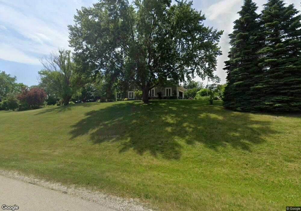
W243S10085 Lea Dr Big Bend, WI 53103
Estimated Value: $538,000 - $617,000
--
Bed
--
Bath
--
Sq Ft
1.55
Acres
About This Home
This home is located at W243S10085 Lea Dr, Big Bend, WI 53103 and is currently estimated at $576,679. W243S10085 Lea Dr is a home located in Waukesha County with nearby schools including Big Bend Elementary School, Park View Middle School, and Mukwonago High School.
Ownership History
Date
Name
Owned For
Owner Type
Purchase Details
Closed on
Dec 30, 2019
Sold by
Cornell Deborah R and Lech Deborah
Bought by
Cornell Patrick D and Cornell Deborah R
Current Estimated Value
Home Financials for this Owner
Home Financials are based on the most recent Mortgage that was taken out on this home.
Original Mortgage
$100,000
Outstanding Balance
$88,354
Interest Rate
3.6%
Mortgage Type
Credit Line Revolving
Estimated Equity
$488,325
Purchase Details
Closed on
Mar 21, 2005
Sold by
Lech Robert
Bought by
Lech Deborah
Home Financials for this Owner
Home Financials are based on the most recent Mortgage that was taken out on this home.
Original Mortgage
$124,209
Interest Rate
5.68%
Mortgage Type
Fannie Mae Freddie Mac
Purchase Details
Closed on
Oct 5, 2000
Sold by
Hansen Timothy T and Hansen Maripat
Bought by
Hansen Revocable Trust
Create a Home Valuation Report for This Property
The Home Valuation Report is an in-depth analysis detailing your home's value as well as a comparison with similar homes in the area
Home Values in the Area
Average Home Value in this Area
Purchase History
| Date | Buyer | Sale Price | Title Company |
|---|---|---|---|
| Cornell Patrick D | -- | Prism Title | |
| Lech Deborah | -- | -- | |
| Hansen Revocable Trust | -- | -- |
Source: Public Records
Mortgage History
| Date | Status | Borrower | Loan Amount |
|---|---|---|---|
| Open | Cornell Patrick D | $100,000 | |
| Previous Owner | Lech Deborah | $124,209 |
Source: Public Records
Tax History Compared to Growth
Tax History
| Year | Tax Paid | Tax Assessment Tax Assessment Total Assessment is a certain percentage of the fair market value that is determined by local assessors to be the total taxable value of land and additions on the property. | Land | Improvement |
|---|---|---|---|---|
| 2024 | $4,114 | $507,100 | $118,200 | $388,900 |
| 2023 | $4,001 | $507,100 | $118,200 | $388,900 |
| 2022 | $4,030 | $365,500 | $73,600 | $291,900 |
| 2021 | $3,981 | $365,500 | $73,600 | $291,900 |
| 2020 | $4,040 | $365,500 | $73,600 | $291,900 |
| 2019 | $3,817 | $309,400 | $64,000 | $245,400 |
| 2018 | $3,841 | $309,400 | $64,000 | $245,400 |
| 2017 | $4,325 | $309,400 | $64,000 | $245,400 |
| 2016 | $3,799 | $309,400 | $64,000 | $245,400 |
| 2015 | $3,725 | $309,400 | $64,000 | $245,400 |
| 2014 | $4,081 | $0 | $0 | $0 |
| 2013 | $4,081 | $315,200 | $65,000 | $250,200 |
Source: Public Records
Map
Nearby Homes
- W240S10240 Castle Rd
- S94W23620 Kunzendorf Ct
- S96W22870 River Oaks Dr
- S95W23000 River Oaks Dr
- 8428 Fox River Rd
- Pcl0 Clark St
- W232S8755 Edgewood Ct
- Lt2 Marianne Ave
- 7908 Fox River Rd
- 7820 Fox River Rd
- W255S8545 Hi lo Dr
- W232S8430 Rosemary Dr
- 28645 Sunflower Ln
- S83W23145 Artesian Ave
- 28747 N Lake Dr
- S80W23790 Parkview Dr
- 28679 Driftwood Ct
- S81W26300 National Ave
- Lt3 Madyson Ct
- Lt2 Madyson Ct
- W243S10065 Lea Dr
- W243S10080 Lea Dr
- W243S10090 Lea Dr
- W243S10060 Lea Dr
- W243S10110 Lea Dr
- W243S10045 Lea Dr
- W243S10130 Lea Dr
- W242S10040 Lea Dr
- W242S10025 Lea Dr
- S100W24380 Forest Home Ave
- S100W24450 Forest Home Ave
- W242S10020 Lea Dr
- S100W24370 Forest Home Ave
- W242S9995 Lea Dr
- S99W24280 Forest Home Ave
- S100W24225 Meadow Cir
- W242S10185 Meadow Cir
- W242S10175 Meadow Cir
- W241S10135 Meadow Cir
- W242S10195 Meadow Cir