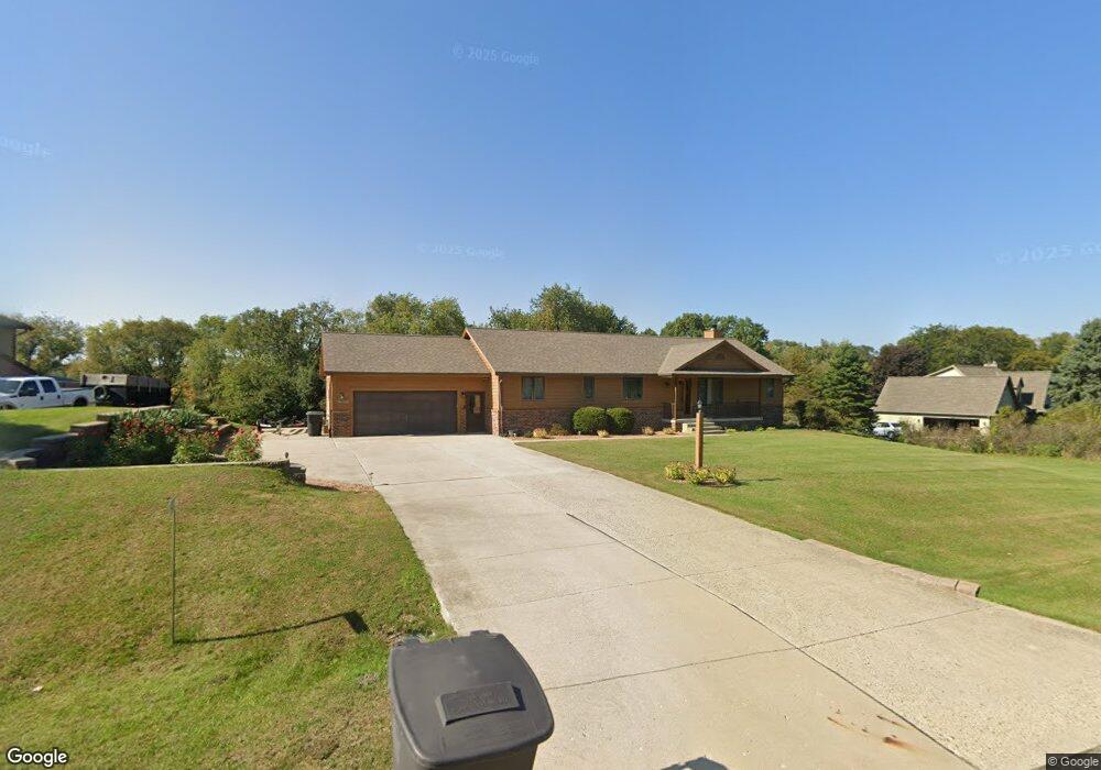
W323S7673 Paul Ln Mukwonago, WI 53149
Estimated Value: $421,831 - $601,000
Studio
--
Bath
--
Sq Ft
47,916
Sq Ft Lot
About This Home
This home is located at W323S7673 Paul Ln, Mukwonago, WI 53149 and is currently estimated at $498,958. W323S7673 Paul Ln is a home located in Waukesha County with nearby schools including Section Elementary School, Park View Middle School, and Mukwonago High School.
Ownership History
Date
Name
Owned For
Owner Type
Purchase Details
Closed on
Jan 11, 2019
Sold by
Jaskowiak Richard and Jaskowiak Janeen
Bought by
Jaskowiak Vincent
Current Estimated Value
Home Financials for this Owner
Home Financials are based on the most recent Mortgage that was taken out on this home.
Original Mortgage
$150,000
Outstanding Balance
$131,881
Interest Rate
4.6%
Mortgage Type
Purchase Money Mortgage
Estimated Equity
$367,077
Create a Home Valuation Report for This Property
The Home Valuation Report is an in-depth analysis detailing your home's value as well as a comparison with similar homes in the area
Home Values in the Area
Average Home Value in this Area
Purchase History
| Date | Buyer | Sale Price | Title Company |
|---|---|---|---|
| Jaskowiak Vincent | $300,000 | None Available |
Source: Public Records
Mortgage History
| Date | Status | Borrower | Loan Amount |
|---|---|---|---|
| Open | Jaskowiak Vincent | $150,000 |
Source: Public Records
Tax History
| Year | Tax Paid | Tax Assessment Tax Assessment Total Assessment is a certain percentage of the fair market value that is determined by local assessors to be the total taxable value of land and additions on the property. | Land | Improvement |
|---|---|---|---|---|
| 2024 | $3,564 | $383,500 | $103,000 | $280,500 |
| 2023 | $3,743 | $259,400 | $75,000 | $184,400 |
| 2022 | $3,688 | $259,400 | $75,000 | $184,400 |
| 2021 | $3,418 | $259,400 | $75,000 | $184,400 |
| 2020 | $3,403 | $259,400 | $75,000 | $184,400 |
| 2019 | $3,097 | $259,400 | $75,000 | $184,400 |
| 2018 | $3,218 | $259,400 | $75,000 | $184,400 |
| 2017 | $3,201 | $259,400 | $75,000 | $184,400 |
| 2016 | $3,261 | $259,400 | $75,000 | $184,400 |
| 2015 | $3,130 | $259,400 | $75,000 | $184,400 |
| 2014 | $3,473 | $259,400 | $75,000 | $184,400 |
| 2013 | $3,473 | $259,400 | $75,000 | $184,400 |
Source: Public Records
Map
Nearby Homes
- W322S7805 Claire Dr
- W327S8037 Memory Ln
- S83W32784 N Oak Tree Ct
- W330S7098 County Rd E
- 130 Chestnut Way
- W313S6637 Spring Dr
- 308 Prairie View Dr
- 365 Woods Edge Dr
- Lt24 Woods Edge Dr
- Lt26 Woods Edge Dr
- Lt25 Woods Edge Dr
- 380 Woods Edge Dr
- 364 Woods Edge Dr
- S88W34777 Nesting Ln
- 883 Medina Dr
- 881 Medina Dr
- 963 Medina Dr
- Lt19 Medina Dr
- 949 Medina Dr
- 937 Medina Dr
- W324S7701 Paul Ln
- W323S7651 Paul Ln
- W323S7690 Paul Ln
- S76W32295 Hawthorn Cir
- W324S7712 Paul Ln
- W324S7713 Paul Ln
- W323S7625 Paul Ln
- S76W32292 Hawthorn Cir
- W324S7734 Paul Ln
- W324S7727 Paul Ln
- W323S7733 Cherry Ln
- S76W32287 Hawthorn Cir
- W323S7591 Park Ridge Dr
- W323S7747 Cherry Ln
- W324S7760 Paul Ln
- W323S7736 Cherry Ln
- S76W32278 Hawthorn Cir
- S76W32272 Hawthorn Cir
- W324S7745 Paul Ln
- W323S7575 Park Ridge Dr
Your Personal Tour Guide
Ask me questions while you tour the home.