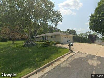
W4067 Will Rd Hustisford, WI 53034
Estimated Value: $256,647 - $349,000
--
Bed
--
Bath
--
Sq Ft
0.33
Acres
About This Home
This home is located at W4067 Will Rd, Hustisford, WI 53034 and is currently estimated at $323,412. W4067 Will Rd is a home located in Dodge County with nearby schools including John Hustis Elementary School, Hustisford High School, and Bethany Lutheran School.
Ownership History
Date
Name
Owned For
Owner Type
Purchase Details
Closed on
Oct 14, 2024
Sold by
Elvin E Will Revocable Trust and Will Douglas G
Bought by
Kramoris Mitchell T and Kramoris Macy
Current Estimated Value
Home Financials for this Owner
Home Financials are based on the most recent Mortgage that was taken out on this home.
Original Mortgage
$318,250
Outstanding Balance
$317,357
Interest Rate
6.35%
Mortgage Type
New Conventional
Estimated Equity
$4,393
Purchase Details
Closed on
Jul 31, 2024
Sold by
Will Louise D
Bought by
Will Douglas G and Will Elvin E
Purchase Details
Closed on
Jul 29, 2024
Sold by
Will Elvin E
Bought by
Elvin E Will Revocable Trust
Create a Home Valuation Report for This Property
The Home Valuation Report is an in-depth analysis detailing your home's value as well as a comparison with similar homes in the area
Home Values in the Area
Average Home Value in this Area
Purchase History
| Date | Buyer | Sale Price | Title Company |
|---|---|---|---|
| Kramoris Mitchell T | $335,000 | Worldwide Recording | |
| Elvin E Will Revocable Trust | -- | None Listed On Document |
Source: Public Records
Mortgage History
| Date | Status | Borrower | Loan Amount |
|---|---|---|---|
| Open | Kramoris Mitchell T | $318,250 |
Source: Public Records
Tax History Compared to Growth
Tax History
| Year | Tax Paid | Tax Assessment Tax Assessment Total Assessment is a certain percentage of the fair market value that is determined by local assessors to be the total taxable value of land and additions on the property. | Land | Improvement |
|---|---|---|---|---|
| 2024 | $2,936 | $164,500 | $28,700 | $135,800 |
| 2023 | $2,716 | $164,500 | $28,700 | $135,800 |
| 2022 | $2,887 | $164,500 | $28,700 | $135,800 |
| 2021 | $2,504 | $164,500 | $28,700 | $135,800 |
| 2020 | $2,703 | $164,500 | $28,700 | $135,800 |
| 2019 | $2,681 | $164,500 | $28,700 | $135,800 |
| 2018 | $2,519 | $151,700 | $28,700 | $123,000 |
| 2017 | $2,564 | $151,700 | $28,700 | $123,000 |
| 2016 | $2,610 | $151,700 | $28,700 | $123,000 |
| 2015 | $2,601 | $151,700 | $28,700 | $123,000 |
| 2014 | $2,811 | $151,700 | $28,700 | $123,000 |
Source: Public Records
Map
Nearby Homes
- .68 Acre Parcel Anthony Island
- N4510 & N4504 Anthony Island
- Lt51 Anthony Island -
- N4510 Anthony Island -
- N4621 Lake Dr
- N4610 Hickory Rd
- N4554 Lakeview Rd
- N5077 Lake Dr
- N4819 Sinissippi Point Rd
- N5094 Butternut Ct
- N5117 Sinissippi Point Rd
- N5529 Wisconsin 67
- N5413 County Rd S
- W4337 County Rd S Unit 73
- 0 Burkwald Ave
- 110 N Main St
- 140 East Ave
- W6140 County Road J
- 609 E Oak St
- Lt11 Cross St